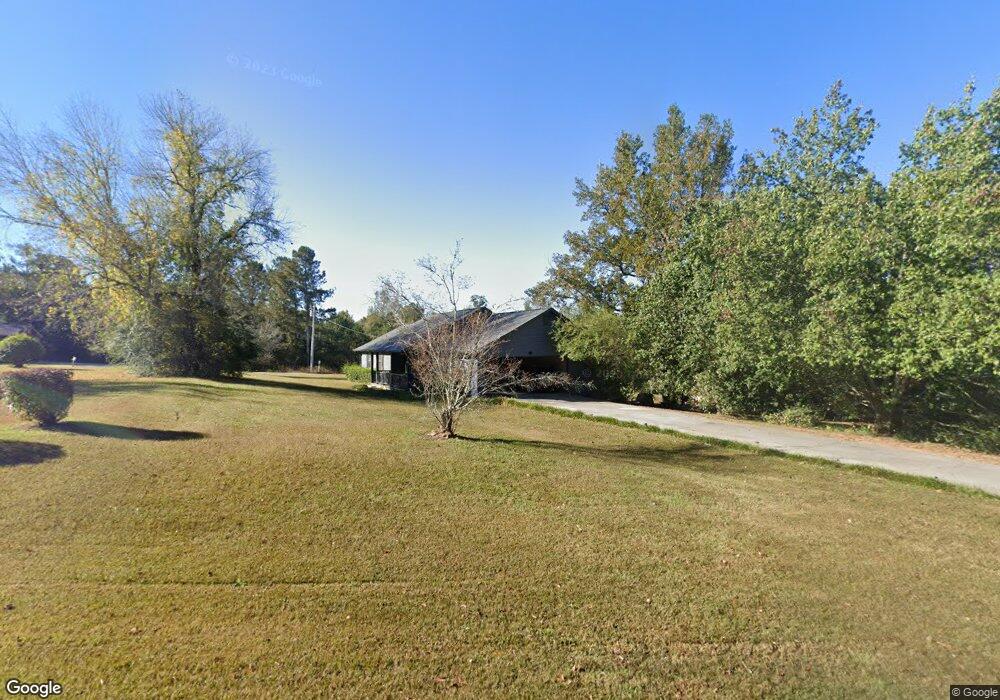
85 Salem Branch Rd Covington, GA 30016
Estimated Value: $236,818 - $253,000
--
Bed
2
Baths
1,654
Sq Ft
$147/Sq Ft
Est. Value
About This Home
This home is located at 85 Salem Branch Rd, Covington, GA 30016 and is currently estimated at $243,705, approximately $147 per square foot. 85 Salem Branch Rd is a home located in Newton County with nearby schools including West Newton Elementary School, Veterans Memorial Middle School, and Alcovy High School.
Ownership History
Date
Name
Owned For
Owner Type
Purchase Details
Closed on
Sep 24, 2010
Sold by
330 Riverbirch Lane Trust
Bought by
Walker William J
Current Estimated Value
Purchase Details
Closed on
Jul 15, 2010
Sold by
Walker William J
Bought by
330 Riverbirch Lane Trust
Purchase Details
Closed on
Dec 30, 2004
Sold by
Fuller Frank W and Fuller V
Bought by
Walker William J
Home Financials for this Owner
Home Financials are based on the most recent Mortgage that was taken out on this home.
Original Mortgage
$114,300
Interest Rate
7.75%
Mortgage Type
New Conventional
Purchase Details
Closed on
Feb 25, 1997
Sold by
Dial Carol
Bought by
Fuller Frank Susan
Create a Home Valuation Report for This Property
The Home Valuation Report is an in-depth analysis detailing your home's value as well as a comparison with similar homes in the area
Home Values in the Area
Average Home Value in this Area
Purchase History
| Date | Buyer | Sale Price | Title Company |
|---|---|---|---|
| Walker William J | -- | -- | |
| 330 Riverbirch Lane Trust | -- | -- | |
| Walker William J | $127,000 | -- | |
| Fuller Frank Susan | $85,000 | -- |
Source: Public Records
Mortgage History
| Date | Status | Borrower | Loan Amount |
|---|---|---|---|
| Previous Owner | Walker William J | $114,300 | |
| Closed | Fuller Frank Susan | $0 |
Source: Public Records
Tax History Compared to Growth
Tax History
| Year | Tax Paid | Tax Assessment Tax Assessment Total Assessment is a certain percentage of the fair market value that is determined by local assessors to be the total taxable value of land and additions on the property. | Land | Improvement |
|---|---|---|---|---|
| 2024 | $1,809 | $75,280 | $16,000 | $59,280 |
| 2023 | $1,884 | $73,320 | $10,800 | $62,520 |
| 2022 | $1,256 | $50,160 | $10,000 | $40,160 |
| 2021 | $1,223 | $44,200 | $10,000 | $34,200 |
| 2020 | $1,075 | $35,880 | $10,000 | $25,880 |
| 2019 | $1,087 | $35,760 | $10,000 | $25,760 |
| 2018 | $1,058 | $34,720 | $10,000 | $24,720 |
| 2017 | $987 | $32,640 | $10,000 | $22,640 |
| 2016 | $774 | $26,440 | $3,800 | $22,640 |
| 2015 | $626 | $22,120 | $3,400 | $18,720 |
| 2014 | $577 | $20,720 | $0 | $0 |
Source: Public Records
Map
Nearby Homes
- 345 Timberlake Terrace
- 145 Glynnshire Ct
- 175 Glynnshire Ct Unit 2
- 25 Franklin Way
- 190 Timberlake Terrace
- 55 Emerson Trail
- 13935 Brown Bridge Rd
- 217 Limestone Cir
- 330 Greenway Dr
- 130 Hazelhurst Dr
- 7 Glynnshire Ct
- 273 Lotus Ln Unit 20
- 115 Jericho Dr
- 193 Lotus Ln Unit 28
- 193 Lotus Ln
- Grandview Plan at Underwood Crossing
- Stanley Plan at Underwood Crossing
- Waverly Plan at Underwood Crossing
- Eliott Plan at Underwood Crossing
- 247 Lotus Ln
- 105 Salem Branch Rd
- 11 Salem Branch Rd
- 11 Salem Branch Dr
- 0 Salem Branch Dr Unit 8119918
- 25 Salem Branch Dr
- 65 Salem Branch Rd
- 55 Salem Branch Rd
- 40 Salem Branch Dr Unit 20
- 40 Salem Branch Dr
- 40 Salem Branch Rd
- 40 Salem Branch Rd
- 80 Salem Branch Rd
- 35 Salem Branch Dr
- 0 Salem Branch Rd Unit 7552037
- 0 Salem Branch Rd Unit 8916580
- 0 Salem Branch Rd
- 20 Salem Branch Ct
- 10 Salem Branch Ct
- 50 Salem Branch Rd
- 30 Salem Branch Ct