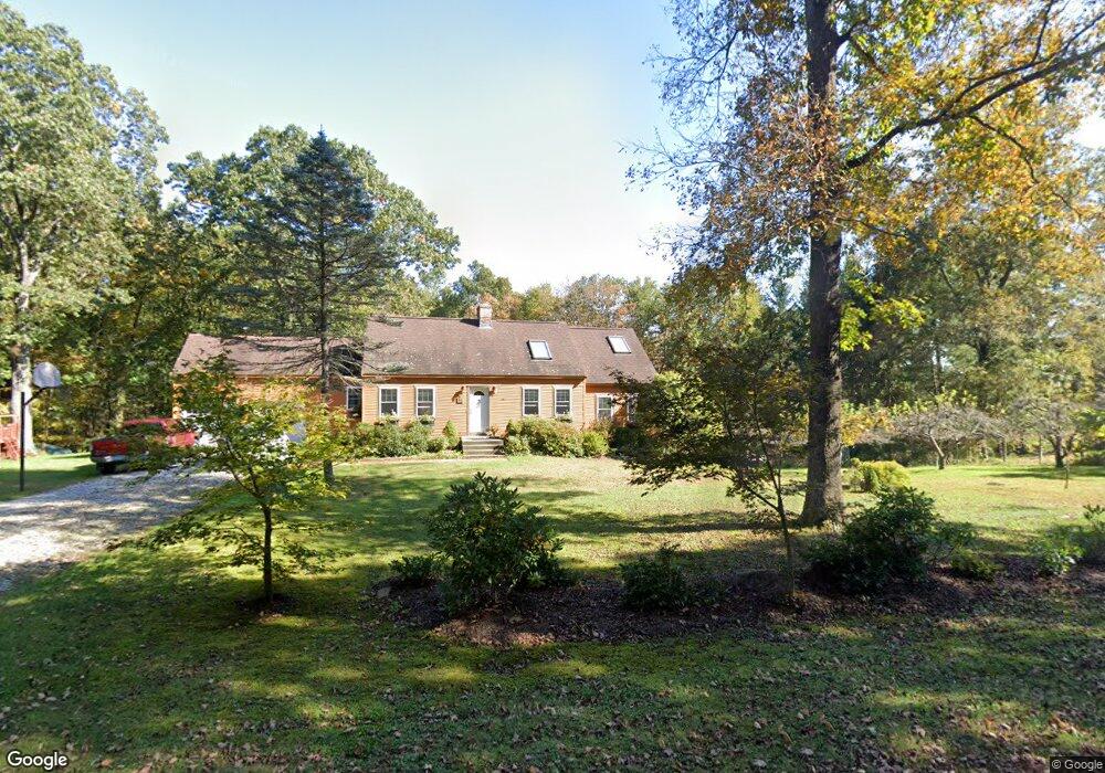
85 Seckar Rd Ashford, CT 06278
Estimated Value: $397,006 - $445,000
3
Beds
2
Baths
1,939
Sq Ft
$216/Sq Ft
Est. Value
About This Home
This home is located at 85 Seckar Rd, Ashford, CT 06278 and is currently estimated at $418,002, approximately $215 per square foot. 85 Seckar Rd is a home located in Windham County with nearby schools including Ashford School and E.O. Smith High School.
Ownership History
Date
Name
Owned For
Owner Type
Purchase Details
Closed on
Oct 2, 2017
Sold by
Renn Phillip A and Renn Janet L
Bought by
Renn Phillip A and Renn Janet L
Current Estimated Value
Purchase Details
Closed on
Dec 7, 1979
Bought by
Renn Phillip A and Renn Janet L
Create a Home Valuation Report for This Property
The Home Valuation Report is an in-depth analysis detailing your home's value as well as a comparison with similar homes in the area
Home Values in the Area
Average Home Value in this Area
Purchase History
| Date | Buyer | Sale Price | Title Company |
|---|---|---|---|
| Renn Phillip A | -- | -- | |
| Renn Phillip A | -- | -- | |
| Renn Phillip A | -- | -- |
Source: Public Records
Mortgage History
| Date | Status | Borrower | Loan Amount |
|---|---|---|---|
| Previous Owner | Renn Phillip A | $16,300 |
Source: Public Records
Tax History
| Year | Tax Paid | Tax Assessment Tax Assessment Total Assessment is a certain percentage of the fair market value that is determined by local assessors to be the total taxable value of land and additions on the property. | Land | Improvement |
|---|---|---|---|---|
| 2025 | $6,619 | $181,930 | $37,240 | $144,690 |
| 2024 | $6,251 | $181,930 | $37,240 | $144,690 |
| 2023 | $6,020 | $181,930 | $37,240 | $144,690 |
| 2022 | $5,871 | $181,930 | $37,240 | $144,690 |
| 2021 | $5,561 | $152,910 | $38,410 | $114,500 |
| 2020 | $5,633 | $152,910 | $38,410 | $114,500 |
| 2019 | $5,422 | $152,910 | $38,410 | $114,500 |
| 2018 | $8,872 | $152,910 | $38,410 | $114,500 |
| 2017 | $5,256 | $152,910 | $38,410 | $114,500 |
| 2016 | $4,599 | $142,090 | $44,490 | $97,600 |
| 2015 | $4,683 | $142,090 | $44,490 | $97,600 |
| 2014 | $4,570 | $142,090 | $44,490 | $97,600 |
Source: Public Records
Map
Nearby Homes
- 21 Fermier Rd
- 102 Krapf Rd
- 0 Jared Sparks Rd
- 292 Tolland Turnpike
- 167 Armitage Rd
- 228 Ruby Rd
- 144 Hnath Rd
- 0 Lohse Rd Unit map 42 block 21
- 483 North Rd
- 21 Ashley Ln
- 21 Westview Dr
- 0 River Rd Unit 24120753
- 44 Michalec Rd
- 133 Fitts Rd
- 113 Michelec Rd
- 66 Bebbington Rd
- 81 Floeting Rd
- 0 Summit Rd
- 69 Cisar Rd
- 28 Cemetery Rd
Your Personal Tour Guide
Ask me questions while you tour the home.