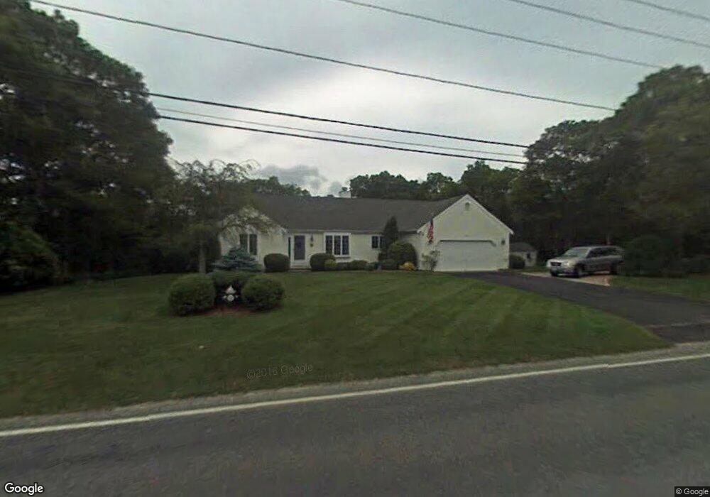
85 Setucket Rd Yarmouth Port, MA 02675
Yarmouth Port NeighborhoodEstimated Value: $726,000 - $839,000
3
Beds
2
Baths
1,698
Sq Ft
$449/Sq Ft
Est. Value
About This Home
This home is located at 85 Setucket Rd, Yarmouth Port, MA 02675 and is currently estimated at $762,288, approximately $448 per square foot. 85 Setucket Rd is a home located in Barnstable County with nearby schools including Dennis-Yarmouth Regional High School and St. Pius X. School.
Ownership History
Date
Name
Owned For
Owner Type
Purchase Details
Closed on
Nov 1, 2004
Sold by
Buchanan Adrianne M
Bought by
Cudmore Dianne M and Cudmore Thomas B
Current Estimated Value
Create a Home Valuation Report for This Property
The Home Valuation Report is an in-depth analysis detailing your home's value as well as a comparison with similar homes in the area
Home Values in the Area
Average Home Value in this Area
Purchase History
| Date | Buyer | Sale Price | Title Company |
|---|---|---|---|
| Cudmore Dianne M | $381,000 | -- |
Source: Public Records
Mortgage History
| Date | Status | Borrower | Loan Amount |
|---|---|---|---|
| Previous Owner | Cudmore Dianne M | $151,000 |
Source: Public Records
Tax History Compared to Growth
Tax History
| Year | Tax Paid | Tax Assessment Tax Assessment Total Assessment is a certain percentage of the fair market value that is determined by local assessors to be the total taxable value of land and additions on the property. | Land | Improvement |
|---|---|---|---|---|
| 2025 | $5,309 | $749,900 | $158,500 | $591,400 |
| 2024 | $5,241 | $710,200 | $167,000 | $543,200 |
| 2023 | $5,313 | $655,100 | $148,800 | $506,300 |
| 2022 | $4,926 | $536,600 | $133,800 | $402,800 |
| 2021 | $4,541 | $475,000 | $133,800 | $341,200 |
| 2020 | $4,379 | $437,900 | $133,700 | $304,200 |
| 2019 | $3,974 | $393,500 | $133,700 | $259,800 |
| 2018 | $3,795 | $368,800 | $109,000 | $259,800 |
| 2017 | $3,695 | $368,800 | $109,000 | $259,800 |
| 2016 | $3,582 | $358,900 | $99,100 | $259,800 |
| 2015 | $3,410 | $339,600 | $99,100 | $240,500 |
Source: Public Records
Map
Nearby Homes
- 6 Nimble Hill Dr
- 44 Stratford Ln
- 13 Covey Dr
- 59 Route 6a Unit 29-4
- 111 Merchant Ave
- 800 Route 6a
- 800 Route 6a
- 64 Kates Path
- 43 Canterbury Rd
- 15 Follins Pond Rd
- 17 Kates Path Unit A
- 228 Kates Path
- 19 John Halls Cartpath Village Unit E
- 42 John Hall Cartway Unit 42
- 19 John Hall Cartway Unit E
- 50 John Hall Cartway
- 50 John Hall Cartway Unit 50
- 21 Boxwood Cir
- 158 Kates Path
- 28 Oak Glen