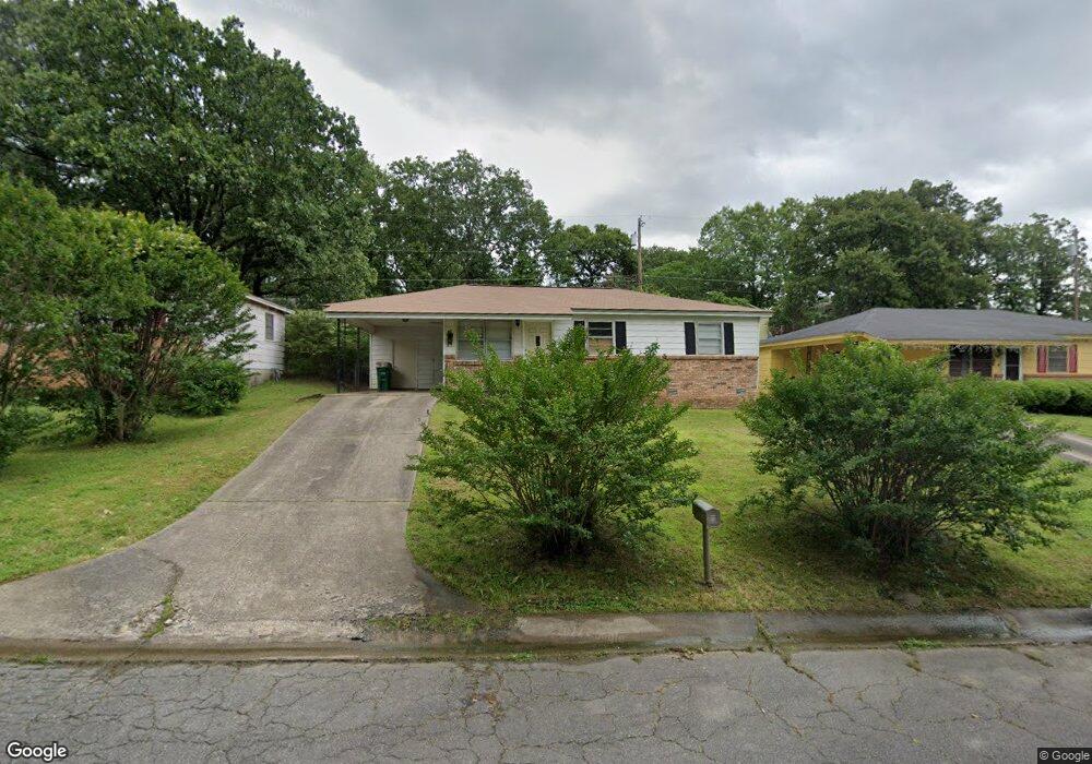
85 Somerset Dr North Little Rock, AR 72118
Amboy NeighborhoodEstimated Value: $81,146 - $110,000
--
Bed
1
Bath
910
Sq Ft
$108/Sq Ft
Est. Value
About This Home
This home is located at 85 Somerset Dr, North Little Rock, AR 72118 and is currently estimated at $98,037, approximately $107 per square foot. 85 Somerset Dr is a home located in Pulaski County with nearby schools including Indian Hills Elementary School, North Little Rock Middle School 6th Grade Campus, and North Little Rock High School.
Ownership History
Date
Name
Owned For
Owner Type
Purchase Details
Closed on
Jun 30, 2017
Sold by
Strnad Roman
Bought by
85 Somerset Trust
Current Estimated Value
Purchase Details
Closed on
Jan 10, 2014
Sold by
Eu Holdings Llc
Bought by
Strnad Roman
Home Financials for this Owner
Home Financials are based on the most recent Mortgage that was taken out on this home.
Original Mortgage
$37,150
Interest Rate
4.47%
Mortgage Type
New Conventional
Purchase Details
Closed on
Jun 12, 2008
Sold by
Tracy Peggy
Bought by
Strnad Roman
Home Financials for this Owner
Home Financials are based on the most recent Mortgage that was taken out on this home.
Original Mortgage
$49,500
Interest Rate
6.08%
Mortgage Type
Purchase Money Mortgage
Create a Home Valuation Report for This Property
The Home Valuation Report is an in-depth analysis detailing your home's value as well as a comparison with similar homes in the area
Home Values in the Area
Average Home Value in this Area
Purchase History
| Date | Buyer | Sale Price | Title Company |
|---|---|---|---|
| 85 Somerset Trust | -- | None Available | |
| Strnad Roman | -- | American Abstract & Title Co | |
| Strnad Roman | $55,000 | American Abstract & Title Co |
Source: Public Records
Mortgage History
| Date | Status | Borrower | Loan Amount |
|---|---|---|---|
| Previous Owner | Strnad Roman | $37,150 | |
| Previous Owner | Strnad Roman | $49,500 |
Source: Public Records
Tax History Compared to Growth
Tax History
| Year | Tax Paid | Tax Assessment Tax Assessment Total Assessment is a certain percentage of the fair market value that is determined by local assessors to be the total taxable value of land and additions on the property. | Land | Improvement |
|---|---|---|---|---|
| 2025 | $935 | $13,999 | $1,300 | $12,699 |
| 2024 | $835 | $13,999 | $1,300 | $12,699 |
| 2023 | $835 | $13,999 | $1,300 | $12,699 |
| 2022 | $766 | $13,999 | $1,300 | $12,699 |
| 2021 | $696 | $10,420 | $1,600 | $8,820 |
| 2020 | $696 | $10,420 | $1,600 | $8,820 |
| 2019 | $696 | $10,420 | $1,600 | $8,820 |
| 2018 | $696 | $10,420 | $1,600 | $8,820 |
| 2017 | $696 | $10,420 | $1,600 | $8,820 |
| 2016 | $782 | $11,710 | $2,200 | $9,510 |
| 2015 | $782 | $11,710 | $2,200 | $9,510 |
| 2014 | $782 | $11,710 | $2,200 | $9,510 |
Source: Public Records
Map
Nearby Homes
- 34 Jaynelle Place
- 104 Lindenhurst Dr
- 5732 Camp Robinson Rd
- 60 Oakview Dr
- 9 Blackstone Cir
- 0 Timberline Dr
- 5504 Allen St
- 900 Donovan Briley Blvd
- 901 W 58th St
- 5315 Chandler St
- 801 Green Hills Dr
- 5630 Foxboro Dr
- 1108 Nicole Dr
- 0 W Hill Ct
- 5321 Marion St
- 407 W 51st St
- 813 Silver Hill Rd
- 47 Perin Rd
- Lot 91 Foxboro Dr
- Lot 83 Foxboro Dr