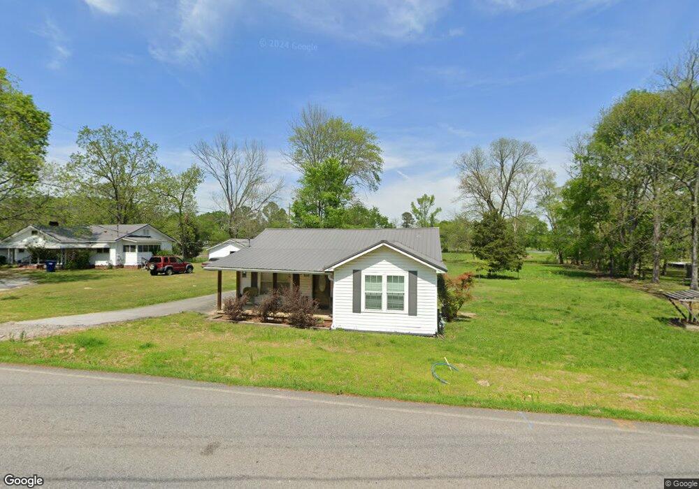
85 Steele Station Rd Steele, AL 35987
Estimated Value: $119,000 - $150,000
2
Beds
1
Bath
1,058
Sq Ft
$129/Sq Ft
Est. Value
About This Home
This home is located at 85 Steele Station Rd, Steele, AL 35987 and is currently estimated at $136,851, approximately $129 per square foot. 85 Steele Station Rd is a home located in St. Clair County with nearby schools including Steele Elementary School and Ashville High School.
Ownership History
Date
Name
Owned For
Owner Type
Purchase Details
Closed on
Aug 14, 2019
Sold by
Coffee Jason and Coffee Wendy
Bought by
Tucker Tammy
Current Estimated Value
Purchase Details
Closed on
Apr 12, 2013
Sold by
Tucker Donald and Tucker Tammy
Bought by
Coffee Jason and Lowe Wendy
Purchase Details
Closed on
Jun 6, 2012
Sold by
Carrier Mike and Carrier Patty
Bought by
Tucker Donald and Tucker Tammy
Purchase Details
Closed on
Sep 10, 2010
Sold by
Tucker Donald and Tucker Tammy
Bought by
Carrier Mike and Carrier Patty
Create a Home Valuation Report for This Property
The Home Valuation Report is an in-depth analysis detailing your home's value as well as a comparison with similar homes in the area
Home Values in the Area
Average Home Value in this Area
Purchase History
| Date | Buyer | Sale Price | Title Company |
|---|---|---|---|
| Tucker Tammy | $55,000 | None Available | |
| Coffee Jason | -- | None Available | |
| Coffee Jason | -- | -- | |
| Tucker Donald | $66,000 | None Available | |
| Carrier Mike | $66,000 | -- |
Source: Public Records
Tax History
| Year | Tax Paid | Tax Assessment Tax Assessment Total Assessment is a certain percentage of the fair market value that is determined by local assessors to be the total taxable value of land and additions on the property. | Land | Improvement |
|---|---|---|---|---|
| 2024 | $294 | $16,334 | $1,340 | $14,994 |
| 2023 | $294 | $13,444 | $1,214 | $12,230 |
| 2022 | $242 | $6,725 | $610 | $6,115 |
| 2021 | $243 | $6,722 | $607 | $6,115 |
| 2020 | $243 | $6,725 | $605 | $6,120 |
| 2019 | $193 | $6,675 | $605 | $6,070 |
| 2018 | $164 | $5,900 | $0 | $0 |
| 2017 | $161 | $5,900 | $0 | $0 |
| 2016 | $164 | $5,900 | $0 | $0 |
| 2015 | $161 | $5,900 | $0 | $0 |
| 2014 | $161 | $5,800 | $0 | $0 |
Source: Public Records
Map
Nearby Homes
- 3649 Pope Ave
- 75 Moore St
- 0 Pine St
- 38.1 acres Steele Station Rd
- 4639 Pope Ave
- 0 Steel Station Rd
- 0 County Road 42 Unit 26157833
- 0 County Road 42 Unit 21442134
- 1133 Canoe Creek Rd
- 37041 US Highway 411
- 140 Aubra Rd
- 3074 Beason Cove Rd
- 601 Loop Rd
- 9 Loop Rd
- 5492 Gilmer Ln
- 11175 Gallant Rd
- 7780 Gallant Rd
- 0 Gallant Rd Unit 21433814
- 0 Gallant Rd Unit 21431615
- Lot 1,2,3,4 Gallant Cove
- 139 Steele Station Rd
- 74 Steele Station Rd
- 115 Steele Station Rd
- 126 Steele Station Rd
- 3628 Pope Ave
- 88 Azalea St
- 3638 Pope Ave
- 0 Hwy 11 Unit 1034301
- 0 Hwy 11 Unit 1034303
- 186 Steele Station Rd
- 0 U S 11 Unit 509273
- 0 U S 11 Unit 120 AC 554531
- 0 U S 11 Unit 555910
- 8306 U S 11
- 0 U S 11 Unit 7.5 ac 732054
- 0 U S 11 Unit 5+ acres
- 35987 U S 11
- 0 Pope Ave Unit 874277
- 0 Pope Ave Unit 1278699
- 0 Pope Ave
Your Personal Tour Guide
Ask me questions while you tour the home.