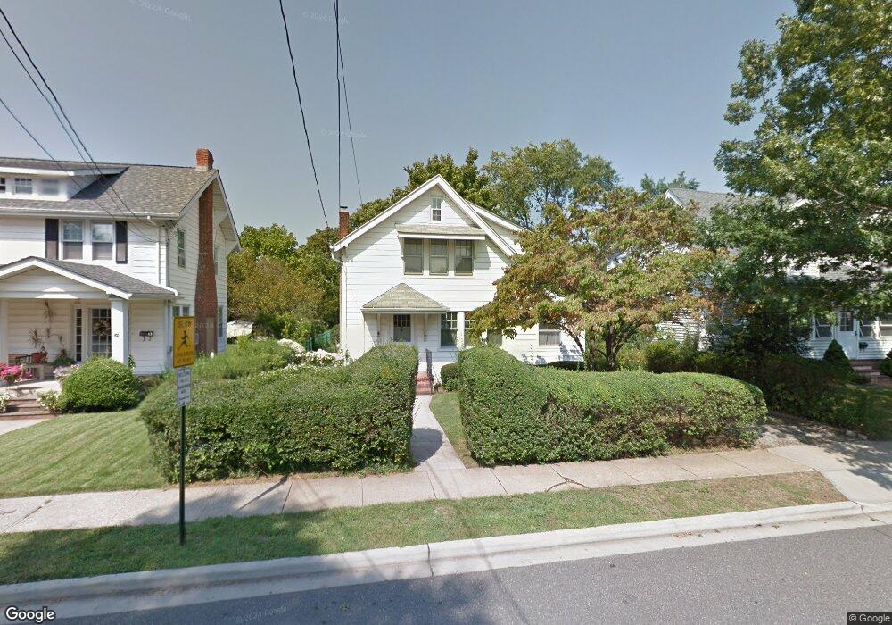
85 Vincent Place Lynbrook, NY 11563
Estimated Value: $659,496 - $774,000
--
Bed
1
Bath
1,366
Sq Ft
$525/Sq Ft
Est. Value
About This Home
This home is located at 85 Vincent Place, Lynbrook, NY 11563 and is currently estimated at $716,748, approximately $524 per square foot. 85 Vincent Place is a home located in Nassau County with nearby schools including East Rockaway Junior/Senior High School and St Agnes Cathedral School.
Ownership History
Date
Name
Owned For
Owner Type
Purchase Details
Closed on
Oct 28, 2022
Sold by
Massa Heather A and Meagher Richard J
Bought by
Massa Heather A and Massa Andrew
Current Estimated Value
Home Financials for this Owner
Home Financials are based on the most recent Mortgage that was taken out on this home.
Original Mortgage
$379,200
Outstanding Balance
$367,377
Interest Rate
6.92%
Mortgage Type
New Conventional
Estimated Equity
$349,371
Create a Home Valuation Report for This Property
The Home Valuation Report is an in-depth analysis detailing your home's value as well as a comparison with similar homes in the area
Home Values in the Area
Average Home Value in this Area
Purchase History
| Date | Buyer | Sale Price | Title Company |
|---|---|---|---|
| Massa Heather A | $474,000 | Fidelity National Ttl Ins Co |
Source: Public Records
Mortgage History
| Date | Status | Borrower | Loan Amount |
|---|---|---|---|
| Open | Massa Heather A | $379,200 |
Source: Public Records
Tax History Compared to Growth
Tax History
| Year | Tax Paid | Tax Assessment Tax Assessment Total Assessment is a certain percentage of the fair market value that is determined by local assessors to be the total taxable value of land and additions on the property. | Land | Improvement |
|---|---|---|---|---|
| 2025 | $10,927 | $485 | $215 | $270 |
| 2024 | $1,978 | $485 | $215 | $270 |
| 2023 | $10,700 | $485 | $215 | $270 |
| 2022 | $10,700 | $485 | $215 | $270 |
| 2021 | $11,312 | $471 | $209 | $262 |
| 2020 | $11,827 | $829 | $436 | $393 |
| 2019 | $10,054 | $829 | $436 | $393 |
| 2018 | $10,054 | $829 | $0 | $0 |
| 2017 | $7,656 | $829 | $436 | $393 |
| 2016 | $9,549 | $829 | $436 | $393 |
| 2015 | $1,857 | $829 | $436 | $393 |
| 2014 | $1,857 | $829 | $436 | $393 |
| 2013 | $1,728 | $829 | $436 | $393 |
Source: Public Records
Map
Nearby Homes
- 292 Ocean Ave
- 6 Windsor Place
- 160 Rocklyn Ave
- 107 Melrose Ave
- 70 Denton Ave
- 142 Rocklyn Ave
- 463 Ocean Ave
- 263 Village Ave
- 59 Manor Rd
- 3 Hampton Rd
- 19 Plainfield Ave
- 39 Munson Place
- 35 Ryder Ave
- 65 Earle Ave
- 280 Atlantic Ave Unit 140
- 290 Atlantic Ave Unit 211
- 290 Atlantic Ave Unit 245
- 320 Atlantic Ave Unit D2
- 320 Atlantic Ave Unit B4
- 108 Earle Ave
- 87 Vincent Place
- 83 Vincent Place
- 79 Vincent Place
- 91 Vincent Place
- 66 Jarvis Place
- 100 Vincent Place
- 56 Jarvis Place
- 70 Jarvis Place
- 95 Vincent Place
- 86 Vincent Place
- 75 Vincent Place
- 52 Jarvis Place
- 74 Jarvis Place
- 84 Vincent Place
- 90 Vincent Place
- 99 Vincent Place
- 82 Vincent Place
- 92 Vincent Place
- 48 Jarvis Place
- 78 Jarvis Place