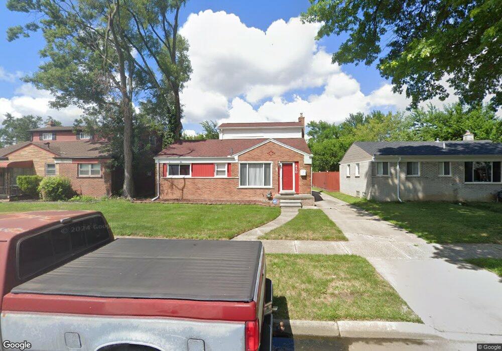
850 Central St Inkster, MI 48141
Estimated Value: $165,000 - $197,000
--
Bed
1
Bath
1,512
Sq Ft
$117/Sq Ft
Est. Value
About This Home
This home is located at 850 Central St, Inkster, MI 48141 and is currently estimated at $176,153, approximately $116 per square foot. 850 Central St is a home located in Wayne County with nearby schools including David Hicks School, Marshall Upper Elementary School, and John Glenn High School.
Ownership History
Date
Name
Owned For
Owner Type
Purchase Details
Closed on
Oct 21, 2004
Sold by
Whetstone Sumpter Nicole D and Sumpter Frank
Bought by
Frank Shonta L
Current Estimated Value
Purchase Details
Closed on
Apr 21, 2004
Sold by
Whetstone Nicole
Bought by
Sumpter Frank
Home Financials for this Owner
Home Financials are based on the most recent Mortgage that was taken out on this home.
Original Mortgage
$105,255
Interest Rate
6.46%
Mortgage Type
FHA
Purchase Details
Closed on
Nov 9, 2000
Sold by
Tate Jimmie L
Bought by
Whetstone Nicole
Create a Home Valuation Report for This Property
The Home Valuation Report is an in-depth analysis detailing your home's value as well as a comparison with similar homes in the area
Home Values in the Area
Average Home Value in this Area
Purchase History
| Date | Buyer | Sale Price | Title Company |
|---|---|---|---|
| Frank Shonta L | $122,500 | -- | |
| Sumpter Frank | -- | -- | |
| Whetstone Nicole | $94,500 | -- |
Source: Public Records
Mortgage History
| Date | Status | Borrower | Loan Amount |
|---|---|---|---|
| Previous Owner | Sumpter Frank | $105,255 |
Source: Public Records
Tax History Compared to Growth
Tax History
| Year | Tax Paid | Tax Assessment Tax Assessment Total Assessment is a certain percentage of the fair market value that is determined by local assessors to be the total taxable value of land and additions on the property. | Land | Improvement |
|---|---|---|---|---|
| 2025 | $1,524 | $74,000 | $0 | $0 |
| 2024 | $1,524 | $61,900 | $0 | $0 |
| 2023 | $1,945 | $49,100 | $0 | $0 |
| 2022 | $2,055 | $37,100 | $0 | $0 |
| 2021 | $2,189 | $33,500 | $0 | $0 |
| 2020 | $2,395 | $28,300 | $0 | $0 |
| 2019 | $2,584 | $23,600 | $0 | $0 |
| 2018 | $1,270 | $22,300 | $0 | $0 |
| 2017 | $713 | $22,200 | $0 | $0 |
| 2016 | $2,615 | $22,700 | $0 | $0 |
| 2015 | $2,490 | $24,900 | $0 | $0 |
| 2013 | $3,360 | $33,600 | $0 | $0 |
| 2012 | $2,240 | $37,000 | $3,000 | $34,000 |
Source: Public Records
Map
Nearby Homes
- 29118 Avondale St
- 28930 Birchwood St
- 28993 Glenwood St
- 29522 Grandview St
- 28645 Glenwood St
- 29142 Parkwood St
- 28541 Glenwood St
- 29477 Hazelwood St
- 28457 Oakwood St
- 29643 Steinhauer St
- 29760 Birchwood St
- 28999 Beechnut St
- 1435 Jeffrey Ln
- 29942 Avondale St
- 720 Magnolia Dr
- 29221 Barrington St
- 28338 Parkwood St
- 29215 Carlton St
- 30030 Glenwood St
- 28058 Avondale St
- 860 Central St
- 840 Central St
- 29014 Avondale St
- 820 Central St
- 28991 Grandview St
- 29000 Avondale St
- 29061 Avondale St
- 810 Central St
- 28981 Grandview St
- 28988 Avondale St
- 29021 Avondale St
- 760 Central St
- 29109 Avondale St
- 28971 Grandview St
- 29043 Avondale St
- 29005 Avondale St
- 29121 Avondale St
- 28976 Avondale St
- 750 Central St
- 29111 Gertrude Ct