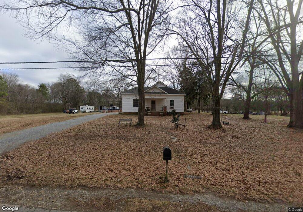
851 Berry Rd Cedartown, GA 30125
Estimated Value: $204,000 - $210,965
2
Beds
1
Bath
1,594
Sq Ft
$130/Sq Ft
Est. Value
About This Home
This home is located at 851 Berry Rd, Cedartown, GA 30125 and is currently estimated at $207,322, approximately $130 per square foot. 851 Berry Rd is a home located in Polk County with nearby schools including Cedar Christian School.
Ownership History
Date
Name
Owned For
Owner Type
Purchase Details
Closed on
Nov 10, 2022
Sold by
Knight Darrell
Bought by
Knight Keith Darrell
Current Estimated Value
Purchase Details
Closed on
Apr 22, 2010
Sold by
Dempsey Robert J
Bought by
Knight Darrell
Purchase Details
Closed on
Jun 6, 2008
Sold by
Not Provided
Bought by
Knight Darrell and Knight Ann
Purchase Details
Closed on
Apr 8, 2008
Sold by
Not Provided
Bought by
Knight Darrell and Knight Ann
Purchase Details
Closed on
Dec 23, 2003
Sold by
Dempsey Ruby Evans and Dempsey Robert J
Bought by
Dempsey Robert J
Purchase Details
Closed on
Jun 17, 1949
Bought by
Robert J Dempsey
Create a Home Valuation Report for This Property
The Home Valuation Report is an in-depth analysis detailing your home's value as well as a comparison with similar homes in the area
Home Values in the Area
Average Home Value in this Area
Purchase History
| Date | Buyer | Sale Price | Title Company |
|---|---|---|---|
| Knight Keith Darrell | -- | -- | |
| Knight Darrell | -- | -- | |
| Knight Darrell | -- | -- | |
| Knight Darrell | -- | -- | |
| Dempsey Robert J | -- | -- | |
| Robert J Dempsey | -- | -- |
Source: Public Records
Tax History Compared to Growth
Tax History
| Year | Tax Paid | Tax Assessment Tax Assessment Total Assessment is a certain percentage of the fair market value that is determined by local assessors to be the total taxable value of land and additions on the property. | Land | Improvement |
|---|---|---|---|---|
| 2024 | $1,467 | $72,199 | $18,723 | $53,476 |
| 2023 | $1,218 | $51,343 | $18,723 | $32,620 |
| 2022 | $947 | $39,888 | $12,482 | $27,406 |
| 2021 | $959 | $39,888 | $12,482 | $27,406 |
| 2020 | $1,043 | $39,888 | $12,482 | $27,406 |
| 2019 | $671 | $24,986 | $12,482 | $12,504 |
| 2018 | $677 | $24,577 | $12,482 | $12,095 |
| 2017 | $669 | $24,577 | $12,482 | $12,095 |
| 2016 | $670 | $24,638 | $12,543 | $12,095 |
| 2015 | $676 | $24,753 | $12,543 | $12,210 |
| 2014 | $681 | $24,753 | $12,543 | $12,210 |
Source: Public Records
Map
Nearby Homes
- 1789 Johnson Lake Rd
- 0 Judkin Mill Rd Unit LotWP001 19369404
- 0 Old Esom Hill Loop Unit 10611077
- 0 Old Esom Hill Loop Unit 7654342
- 240 Benedict Loop
- 966 Judkin Mill Rd
- 00 Buchanan Hwy
- 142 Acres On Judkin Mill Rd
- 1987 Buchanan Hwy
- 0 Wieuca Way Unit 10614129
- 000 Wieuca Way
- 35 Old Mill Rd
- 95 Wieuca Way
- 00 Cornelius Rd
- 255 Mildred Dr
- 9236 Tallapoosa Hwy
- 1003 Fairview Ave
- 480 Cason Rd
- 203 Cason Rd
- 0 Old Potash Rd Unit 7675402