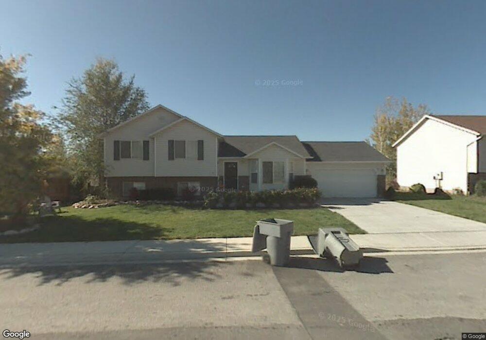
851 N 880 W Pleasant Grove, UT 84062
Estimated Value: $504,000 - $560,000
4
Beds
2
Baths
1,682
Sq Ft
$316/Sq Ft
Est. Value
About This Home
This home is located at 851 N 880 W, Pleasant Grove, UT 84062 and is currently estimated at $532,121, approximately $316 per square foot. 851 N 880 W is a home located in Utah County with nearby schools including Mount Mahogany School, Pleasant Grove Junior High School, and Pleasant Grove High School.
Ownership History
Date
Name
Owned For
Owner Type
Purchase Details
Closed on
Jul 31, 2019
Sold by
Lumsden Merle and Miller Lynn Lanae
Bought by
Miller Lynn and Miller Dion
Current Estimated Value
Purchase Details
Closed on
Aug 17, 2017
Sold by
Larsen Stephan P and Larsen Stephen P
Bought by
Larsen Stephan P and Larsen Kate A
Home Financials for this Owner
Home Financials are based on the most recent Mortgage that was taken out on this home.
Original Mortgage
$172,000
Outstanding Balance
$118,250
Interest Rate
3.96%
Estimated Equity
$413,871
Purchase Details
Closed on
Oct 10, 2005
Sold by
Bodhaine Kirk E
Bought by
Guerrero Ricardo
Purchase Details
Closed on
Dec 23, 2003
Sold by
Bodhaine Kirk E
Bought by
Bodhaine Kirk E and Bodhaine Emily
Home Financials for this Owner
Home Financials are based on the most recent Mortgage that was taken out on this home.
Original Mortgage
$138,400
Interest Rate
3.12%
Purchase Details
Closed on
Jul 20, 2001
Sold by
Lawyer Michael B and Lawyer Rebecca Y
Bought by
Bodhaine Kirk E and Bodhaine Emily A
Home Financials for this Owner
Home Financials are based on the most recent Mortgage that was taken out on this home.
Original Mortgage
$163,922
Interest Rate
7.21%
Purchase Details
Closed on
Dec 22, 2000
Sold by
Lawyer Michael B and Lawyer Rebecca Y
Bought by
Lawyer Michael B and Lawyer Rebecca Y
Home Financials for this Owner
Home Financials are based on the most recent Mortgage that was taken out on this home.
Original Mortgage
$122,141
Interest Rate
7.71%
Purchase Details
Closed on
Mar 7, 1997
Sold by
Valley Crest L C
Bought by
Lawyer Ii Michael B and Lawyer Rebecca Y
Home Financials for this Owner
Home Financials are based on the most recent Mortgage that was taken out on this home.
Original Mortgage
$125,919
Interest Rate
7.9%
Create a Home Valuation Report for This Property
The Home Valuation Report is an in-depth analysis detailing your home's value as well as a comparison with similar homes in the area
Home Values in the Area
Average Home Value in this Area
Purchase History
| Date | Buyer | Sale Price | Title Company |
|---|---|---|---|
| Miller Lynn | -- | None Available | |
| Larsen Stephan P | -- | Vanguard Title Ins Agency Ll | |
| Guerrero Ricardo | $150,900 | -- | |
| Bodhaine Kirk E | -- | Precision Title Company | |
| Bodhaine Kirk E | -- | Precision Title Company | |
| Bodhaine Kirk E | -- | Guardian Title Insurance Ag | |
| Lawyer Michael B | -- | Title West Title Co | |
| Lawyer Ii Michael B | -- | -- |
Source: Public Records
Mortgage History
| Date | Status | Borrower | Loan Amount |
|---|---|---|---|
| Open | Larsen Stephan P | $172,000 | |
| Previous Owner | Bodhaine Kirk E | $138,400 | |
| Previous Owner | Bodhaine Kirk E | $163,922 | |
| Previous Owner | Lawyer Michael B | $122,141 | |
| Previous Owner | Lawyer Ii Michael B | $125,919 | |
| Closed | Bodhaine Kirk E | $25,900 |
Source: Public Records
Tax History Compared to Growth
Tax History
| Year | Tax Paid | Tax Assessment Tax Assessment Total Assessment is a certain percentage of the fair market value that is determined by local assessors to be the total taxable value of land and additions on the property. | Land | Improvement |
|---|---|---|---|---|
| 2025 | $1,983 | $255,585 | $197,800 | $266,900 |
| 2024 | $1,983 | $236,775 | $0 | $0 |
| 2023 | $1,960 | $239,470 | $0 | $0 |
| 2022 | $2,052 | $249,480 | $0 | $0 |
| 2021 | $1,808 | $334,700 | $132,500 | $202,200 |
| 2020 | $1,656 | $300,500 | $118,300 | $182,200 |
| 2019 | $1,478 | $277,400 | $114,700 | $162,700 |
| 2018 | $1,403 | $249,000 | $107,500 | $141,500 |
| 2017 | $1,382 | $130,515 | $0 | $0 |
| 2016 | $1,329 | $121,165 | $0 | $0 |
| 2015 | $1,287 | $111,155 | $0 | $0 |
| 2014 | $1,168 | $99,935 | $0 | $0 |
Source: Public Records
Map
Nearby Homes
- 685 W 1000 N
- 909 W 1180 N
- 1130 W State Rd
- 1443 W 1010 N
- 1096 N 1420 St W Unit 27
- 1065 N 1420 W
- 1051 N 600 W
- 1031 N 600 W
- 1041 N 600 W
- 1491 W 1010 N
- 1515 W 1010 St N
- Konlee Plan at Makin Dreams
- Alexa Plan at Makin Dreams
- Callahan Plan at Makin Dreams
- Hailey Plan at Makin Dreams
- Alydia Plan at Makin Dreams
- Addison Plan at Makin Dreams
- Julia Plan at Makin Dreams
- 1531 N 750 W Unit 4
- Aaron Plan at Makin Dreams