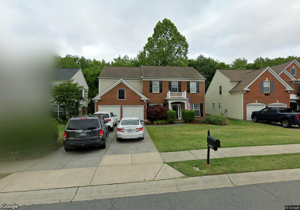
8519 Dennington Grove Ln Charlotte, NC 28277
Ballantyne NeighborhoodEstimated Value: $696,000 - $723,000
4
Beds
4
Baths
2,417
Sq Ft
$292/Sq Ft
Est. Value
About This Home
This home is located at 8519 Dennington Grove Ln, Charlotte, NC 28277 and is currently estimated at $706,855, approximately $292 per square foot. 8519 Dennington Grove Ln is a home located in Mecklenburg County with nearby schools including Polo Ridge Elementary, Jay M Robinson Middle School, and St. Matthew Catholic School.
Ownership History
Date
Name
Owned For
Owner Type
Purchase Details
Closed on
Aug 23, 2007
Sold by
Kinard Joel D and Kinard Arleen B
Bought by
Dorn David and Dorn Rhonda
Current Estimated Value
Home Financials for this Owner
Home Financials are based on the most recent Mortgage that was taken out on this home.
Original Mortgage
$224,800
Outstanding Balance
$142,259
Interest Rate
6.65%
Mortgage Type
Purchase Money Mortgage
Estimated Equity
$564,596
Purchase Details
Closed on
Dec 28, 2001
Sold by
Pulte Home Corp
Bought by
Kinard Joel D and Kinard Arleen B
Home Financials for this Owner
Home Financials are based on the most recent Mortgage that was taken out on this home.
Original Mortgage
$157,160
Interest Rate
6.49%
Create a Home Valuation Report for This Property
The Home Valuation Report is an in-depth analysis detailing your home's value as well as a comparison with similar homes in the area
Home Values in the Area
Average Home Value in this Area
Purchase History
| Date | Buyer | Sale Price | Title Company |
|---|---|---|---|
| Dorn David | $281,000 | Investors Title Insurance Co | |
| Kinard Joel D | $197,000 | -- |
Source: Public Records
Mortgage History
| Date | Status | Borrower | Loan Amount |
|---|---|---|---|
| Open | Dorn David | $224,800 | |
| Previous Owner | Kinard Joel D | $157,160 |
Source: Public Records
Tax History Compared to Growth
Tax History
| Year | Tax Paid | Tax Assessment Tax Assessment Total Assessment is a certain percentage of the fair market value that is determined by local assessors to be the total taxable value of land and additions on the property. | Land | Improvement |
|---|---|---|---|---|
| 2025 | $4,493 | $573,100 | $125,000 | $448,100 |
| 2024 | $4,493 | $573,100 | $125,000 | $448,100 |
| 2023 | $4,343 | $573,100 | $125,000 | $448,100 |
| 2022 | $3,513 | $351,000 | $100,000 | $251,000 |
| 2021 | $3,502 | $351,000 | $100,000 | $251,000 |
| 2020 | $3,494 | $351,000 | $100,000 | $251,000 |
| 2019 | $3,479 | $351,000 | $100,000 | $251,000 |
| 2018 | $3,285 | $244,800 | $55,000 | $189,800 |
| 2016 | $3,222 | $244,800 | $55,000 | $189,800 |
| 2015 | $3,211 | $244,800 | $55,000 | $189,800 |
| 2014 | $3,186 | $243,200 | $55,000 | $188,200 |
Source: Public Records
Map
Nearby Homes
- 8919 Darcy Hopkins Dr
- 8709 Barrelli Ct
- 7721 Raynor Rd
- 7633 Rathburn Ln
- 7819 Noland Woods Dr
- 10207 Garmoyle St
- 8715 Parkchester Dr
- 7803 Noland Woods Dr
- 8700 Parkchester Dr
- 8137 Noland Woods Dr
- 12214 Provincetowne Dr
- 12417 Bobhouse Dr
- 9339 Duckhorn Dr
- 11311 Blue Blossom Rd
- 9005 Grand Oak Dr Unit A
- 8189 Windsor Ridge Dr
- 8603 Bookwalter Ct
- 10121 Alexander Martin Ave
- 10928 Knight Castle Dr
- 10154 Alexander Martin Ave
- 8515 Dennington Grove Ln
- 8523 Dennington Grove Ln
- 8511 Dennington Grove Ln
- 8518 Dennington Grove Ln
- 8601 Beeswood Dr
- 8507 Dennington Grove Ln
- 8526 Dennington Grove Ln
- 8531 Dennington Grove Ln
- 8514 Dennington Grove Ln
- 8530 Dennington Grove Ln
- 8503 Dennington Grove Ln
- 8535 Dennington Grove Ln
- 8600 Beeswood Dr
- 8605 Beeswood Dr
- 10015 Westgarth Ave
- 8504 Dennington Grove Ln
- 9009 Darcy Hopkins Dr
- 8534 Dennington Grove Ln
- 8603 Dennington Grove Ln
- 12031 Richport Dr