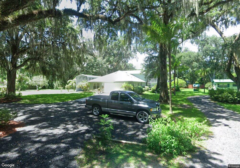
852 Bobcat Trail Port Orange, FL 32129
Estimated Value: $363,000 - $423,714
3
Beds
4
Baths
1,945
Sq Ft
$200/Sq Ft
Est. Value
About This Home
This home is located at 852 Bobcat Trail, Port Orange, FL 32129 and is currently estimated at $389,179, approximately $200 per square foot. 852 Bobcat Trail is a home located in Volusia County with nearby schools including Sugar Mill Elementary School, Silver Sands Middle School, and Spruce Creek High School.
Ownership History
Date
Name
Owned For
Owner Type
Purchase Details
Closed on
Jun 17, 2024
Sold by
White Timothy G and White Susan
Bought by
White Timothy G and White Susan
Current Estimated Value
Purchase Details
Closed on
Dec 26, 2013
Sold by
White Timothy G
Bought by
White Timothy and White Susan
Purchase Details
Closed on
Dec 6, 2005
Sold by
White Kenneth D and White Evelyn J
Bought by
White Timothy G
Home Financials for this Owner
Home Financials are based on the most recent Mortgage that was taken out on this home.
Original Mortgage
$100,000
Interest Rate
6.23%
Mortgage Type
Fannie Mae Freddie Mac
Create a Home Valuation Report for This Property
The Home Valuation Report is an in-depth analysis detailing your home's value as well as a comparison with similar homes in the area
Home Values in the Area
Average Home Value in this Area
Purchase History
| Date | Buyer | Sale Price | Title Company |
|---|---|---|---|
| White Timothy G | $100 | None Listed On Document | |
| White Timothy G | $100 | None Listed On Document | |
| White Timothy | $21,000 | None Available | |
| White Timothy G | -- | First American Title Ins Co |
Source: Public Records
Mortgage History
| Date | Status | Borrower | Loan Amount |
|---|---|---|---|
| Previous Owner | White Timothy G | $100,000 |
Source: Public Records
Tax History Compared to Growth
Tax History
| Year | Tax Paid | Tax Assessment Tax Assessment Total Assessment is a certain percentage of the fair market value that is determined by local assessors to be the total taxable value of land and additions on the property. | Land | Improvement |
|---|---|---|---|---|
| 2025 | $2,790 | $212,277 | -- | -- |
| 2024 | $2,790 | $200,008 | -- | -- |
| 2023 | $2,790 | $194,183 | $0 | $0 |
| 2022 | $2,602 | $183,459 | $0 | $0 |
| 2021 | $2,656 | $178,116 | $0 | $0 |
| 2020 | $2,586 | $175,657 | $0 | $0 |
| 2019 | $2,498 | $171,708 | $0 | $0 |
| 2018 | $2,497 | $168,506 | $0 | $0 |
| 2017 | $2,503 | $165,040 | $0 | $0 |
| 2016 | $2,510 | $161,645 | $0 | $0 |
| 2015 | $2,585 | $160,521 | $0 | $0 |
| 2014 | $2,193 | $140,313 | $0 | $0 |
Source: Public Records
Map
Nearby Homes
- 790 Biro Dr
- 746 Biro Dr
- 755 Biro Dr
- 834 Sugar House Dr
- 894 Quarters Ct
- 740 Biro Dr
- 818 Sugar House Blvd
- 809 Sugar House Blvd
- 918 McDonald Rd
- 813 Sugar House Dr
- 993 Commons Way
- Cali Plan at Campbell Crossing
- Harper Plan at Campbell Crossing
- Hayden Plan at Campbell Crossing
- Robie Plan at Campbell Crossing
- Allex Plan at Campbell Crossing
- 3488 Country Walk Dr
- 895 Nixon Ln
- 3484 Country Walk Dr
- 976 Commons Way
- 854 Bobcat Trail
- 850 Bobcat Trail
- 870 Sugar Grove Ct
- 868 Sugar Grove Ct
- 858 Nixon Ln
- 872 Sugar Grove Ct
- 866 Sugar Grove Ct
- 846 Bears Trail
- 842 Bears Trail
- 864 Sugar Grove Ct
- 874 Sugar Grove Ct
- 871 Sugar Grove Ct
- 851 Nixon Ln
- 780 Biro Dr
- 849 Sugar House Dr
- 847 Sugar House Dr
- 845 Sugar House Dr
- 785 Biro Dr
- 861 Sugar House Dr
- 873 Sugar Grove Ct