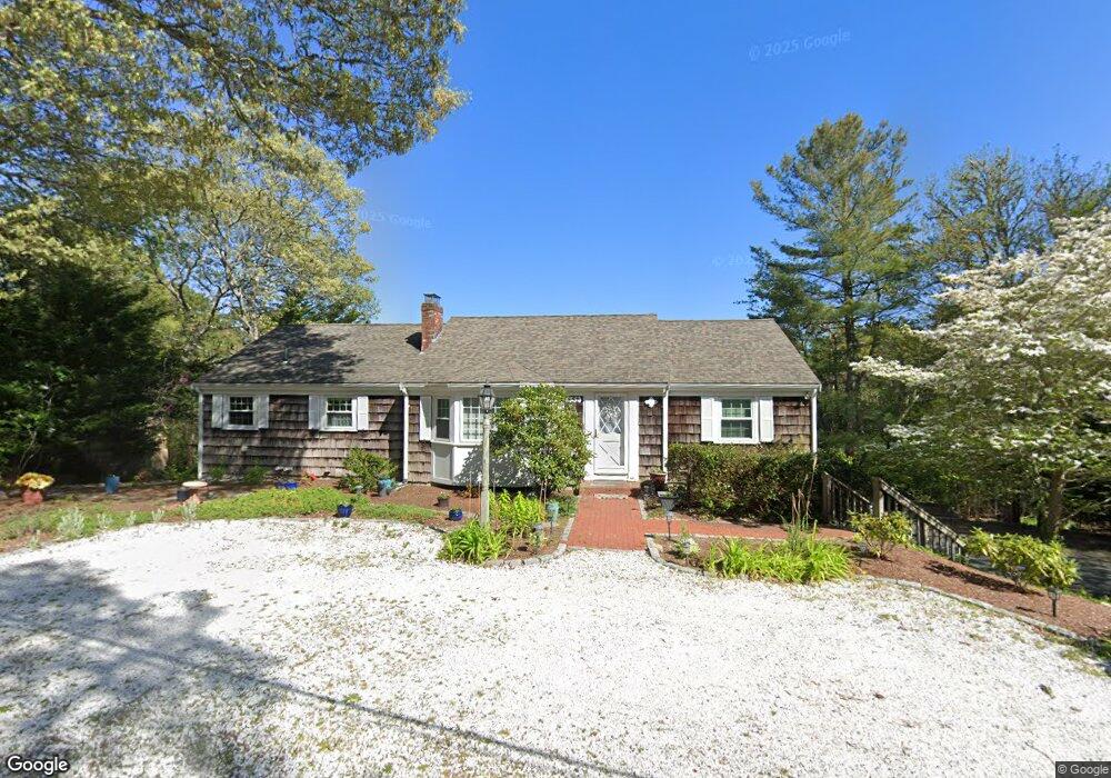
852 W Yarmouth Rd Yarmouth Port, MA 02675
Yarmouth Port NeighborhoodEstimated Value: $687,000 - $748,000
3
Beds
2
Baths
1,501
Sq Ft
$474/Sq Ft
Est. Value
About This Home
This home is located at 852 W Yarmouth Rd, Yarmouth Port, MA 02675 and is currently estimated at $711,648, approximately $474 per square foot. 852 W Yarmouth Rd is a home located in Barnstable County with nearby schools including Dennis-Yarmouth Regional High School, St. Pius X. School, and Trinity Christian Academy of Cape Cod.
Ownership History
Date
Name
Owned For
Owner Type
Purchase Details
Closed on
Oct 21, 2024
Sold by
Merrick Lorraine
Bought by
Merrick T T and Merrick M
Current Estimated Value
Purchase Details
Closed on
Sep 15, 1999
Sold by
Potter Ann B and Potter Russell
Bought by
Merick John T and Merick Lorraine
Create a Home Valuation Report for This Property
The Home Valuation Report is an in-depth analysis detailing your home's value as well as a comparison with similar homes in the area
Home Values in the Area
Average Home Value in this Area
Purchase History
| Date | Buyer | Sale Price | Title Company |
|---|---|---|---|
| Merrick T T | -- | None Available | |
| Merrick T T | -- | None Available | |
| Merick John T | $170,000 | -- | |
| Merick John T | $170,000 | -- |
Source: Public Records
Tax History Compared to Growth
Tax History
| Year | Tax Paid | Tax Assessment Tax Assessment Total Assessment is a certain percentage of the fair market value that is determined by local assessors to be the total taxable value of land and additions on the property. | Land | Improvement |
|---|---|---|---|---|
| 2025 | $4,972 | $702,200 | $236,200 | $466,000 |
| 2024 | $4,515 | $611,800 | $184,000 | $427,800 |
| 2023 | $4,389 | $541,200 | $162,400 | $378,800 |
| 2022 | $4,513 | $491,600 | $147,700 | $343,900 |
| 2021 | $4,263 | $445,900 | $155,100 | $290,800 |
| 2020 | $4,230 | $423,000 | $164,000 | $259,000 |
| 2019 | $4,033 | $384,800 | $164,000 | $220,800 |
| 2018 | $3,678 | $357,400 | $136,600 | $220,800 |
| 2017 | $3,581 | $357,400 | $136,600 | $220,800 |
| 2016 | $3,458 | $346,500 | $125,700 | $220,800 |
| 2015 | $3,180 | $316,700 | $112,600 | $204,100 |
Source: Public Records
Map
Nearby Homes
- 882 W Yarmouth Rd
- 933-935 W Yarmouth Rd
- 10 Balsam Way
- 50 Cottonwood St
- 209 Union St
- 32 Deveau Ln
- 371 Route 6a
- 24 Minnetuxet Way
- 607 W Yarmouth Rd
- 105 Old Hyannis Rd
- 8 Rowley Ln
- 17 Trowbridge Path
- 23 Dauphine Dr
- 186 Route 6a
- 560 W Yarmouth Rd
- 162 Route 6a
- 99 Old Hyannis Rd
- 111 Old Hyannis Rd
- 1 Barnacle Rd
- 16 Warren Rd Unit 16
- 858 W Yarmouth Rd
- 844 W Yarmouth Rd
- 46 Ridgewood Dr
- 859 W Yarmouth Rd
- 42 Ridgewood Dr
- 52 Ridgewood Dr
- 864 W Yarmouth Rd
- 2 Parsonage Point
- 2 Parsonage Point
- 7 Portsmouth Terrace
- 58 Ridgewood Dr
- 36 Ridgewood Dr
- 841 W Yarmouth Rd
- 865 W Yarmouth Rd
- 8 Parsonage Point
- 11 Portsmouth Terrace
- 45 Ridgewood Dr
- 41 Ridgewood Dr
- 51 Ridgewood Dr
- 66 Ridgewood Dr