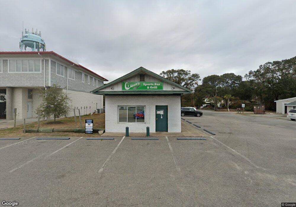
8520 E Oak Island Dr Oak Island, NC 28465
Estimated Value: $865,526
--
Bed
--
Bath
1,508
Sq Ft
$574/Sq Ft
Est. Value
About This Home
This home is located at 8520 E Oak Island Dr, Oak Island, NC 28465 and is currently estimated at $865,526, approximately $573 per square foot. 8520 E Oak Island Dr is a home located in Brunswick County with nearby schools including Southport Elementary School, South Brunswick Middle School, and South Brunswick High School.
Ownership History
Date
Name
Owned For
Owner Type
Purchase Details
Closed on
Jun 5, 2024
Sold by
Cole Amy Lynn
Bought by
Shark Hole Bar And Restaurant Llc
Current Estimated Value
Purchase Details
Closed on
May 15, 2012
Sold by
Shore Charles A
Bought by
Cole Amy Lynn
Home Financials for this Owner
Home Financials are based on the most recent Mortgage that was taken out on this home.
Original Mortgage
$280,000
Interest Rate
4.01%
Mortgage Type
Seller Take Back
Purchase Details
Closed on
Aug 26, 2005
Sold by
Shore Samuel David
Bought by
Shore Charles A
Create a Home Valuation Report for This Property
The Home Valuation Report is an in-depth analysis detailing your home's value as well as a comparison with similar homes in the area
Home Values in the Area
Average Home Value in this Area
Purchase History
| Date | Buyer | Sale Price | Title Company |
|---|---|---|---|
| Shark Hole Bar And Restaurant Llc | $850,000 | None Listed On Document | |
| Cole Amy Lynn | $280,000 | None Available | |
| Shore Charles A | -- | None Available |
Source: Public Records
Mortgage History
| Date | Status | Borrower | Loan Amount |
|---|---|---|---|
| Previous Owner | Cole Amy Lynn | $280,000 |
Source: Public Records
Tax History Compared to Growth
Tax History
| Year | Tax Paid | Tax Assessment Tax Assessment Total Assessment is a certain percentage of the fair market value that is determined by local assessors to be the total taxable value of land and additions on the property. | Land | Improvement |
|---|---|---|---|---|
| 2025 | -- | $427,390 | $154,440 | $272,950 |
| 2024 | $1,683 | $335,770 | $154,440 | $181,330 |
| 2023 | $1,761 | $335,770 | $154,440 | $181,330 |
| 2022 | $0 | $266,800 | $166,320 | $100,480 |
| 2021 | $0 | $266,800 | $166,320 | $100,480 |
| 2020 | $1,394 | $266,800 | $166,320 | $100,480 |
| 2019 | $1,651 | $167,950 | $166,320 | $1,630 |
| 2018 | $1,444 | $120,600 | $118,800 | $1,800 |
| 2017 | $1,444 | $120,600 | $118,800 | $1,800 |
| 2016 | $1,394 | $120,600 | $118,800 | $1,800 |
| 2015 | $1,394 | $227,500 | $118,800 | $108,700 |
| 2014 | $1,143 | $195,513 | $158,130 | $37,383 |
Source: Public Records
Map
Nearby Homes
- 314 Keziah St
- 300 Trott St
- 414 Keziah St
- 411 Keziah St
- 424 Trott St
- 412 Womble St
- 309 Womble St
- 407 Womble St
- 424 Keziah St
- 409 Womble St
- 217 Sellers St
- 107 Elizabeth Dr
- 206 Elizabeth Dr
- 512 Norton St
- 302 McGlamery St
- 81 Yaupon Dr
- 214 McGlamery St
- 700 Ocean Dr Unit 110
- 700 Ocean Dr Unit 117
- 509 Norton St
- 403 Norton St
- 8510 E Oak Island Dr
- 8600 E Oak Island Dr
- 8600 E Oak Island Dr Unit 1
- 405 Norton St
- 8517 E Oak Island Dr
- 402 Norton St
- 8509 E Oak Island Dr Unit 4
- 8509 E Oak Island Dr Unit 3
- 8509 E Oak Island Dr Unit 2
- 8515 E Oak Island Dr Unit 2
- 504 Norton St
- 16 Norton St
- 404 Norton St
- 8610 E Oak Island Dr
- 315 Norton St
- 8620 E Oak Island Dr
- 8501 E Oak Island Dr
- 409 Norton St
- 408 Norton St