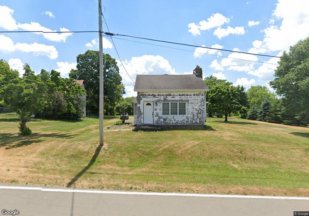
8521 Paris Ave Louisville, OH 44641
Estimated Value: $111,527 - $240,000
3
Beds
1
Bath
1,210
Sq Ft
$152/Sq Ft
Est. Value
About This Home
This home is located at 8521 Paris Ave, Louisville, OH 44641 and is currently estimated at $183,382, approximately $151 per square foot. 8521 Paris Ave is a home located in Stark County with nearby schools including Louisville High School.
Ownership History
Date
Name
Owned For
Owner Type
Purchase Details
Closed on
Oct 31, 1996
Sold by
Gusbar Louis P
Bought by
Cramer Larry M
Current Estimated Value
Home Financials for this Owner
Home Financials are based on the most recent Mortgage that was taken out on this home.
Original Mortgage
$72,200
Outstanding Balance
$6,828
Interest Rate
7.63%
Mortgage Type
New Conventional
Estimated Equity
$176,554
Create a Home Valuation Report for This Property
The Home Valuation Report is an in-depth analysis detailing your home's value as well as a comparison with similar homes in the area
Home Values in the Area
Average Home Value in this Area
Purchase History
| Date | Buyer | Sale Price | Title Company |
|---|---|---|---|
| Cramer Larry M | $76,000 | -- |
Source: Public Records
Mortgage History
| Date | Status | Borrower | Loan Amount |
|---|---|---|---|
| Open | Cramer Larry M | $72,200 |
Source: Public Records
Tax History Compared to Growth
Tax History
| Year | Tax Paid | Tax Assessment Tax Assessment Total Assessment is a certain percentage of the fair market value that is determined by local assessors to be the total taxable value of land and additions on the property. | Land | Improvement |
|---|---|---|---|---|
| 2025 | $40 | $16,810 | $10,540 | $6,270 |
| 2024 | $51 | $16,810 | $10,540 | $6,270 |
| 2023 | $1,010 | $18,660 | $9,030 | $9,630 |
| 2022 | $914 | $18,660 | $9,030 | $9,630 |
| 2021 | $917 | $18,660 | $9,030 | $9,630 |
| 2020 | $722 | $15,510 | $7,770 | $7,740 |
| 2019 | $725 | $15,510 | $7,770 | $7,740 |
| 2018 | $722 | $15,510 | $7,770 | $7,740 |
| 2017 | $1,150 | $13,520 | $7,320 | $6,200 |
| 2016 | $895 | $18,700 | $7,320 | $11,380 |
| 2015 | $887 | $18,700 | $7,320 | $11,380 |
| 2014 | $891 | $17,260 | $6,760 | $10,500 |
| 2013 | $449 | $17,260 | $6,760 | $10,500 |
Source: Public Records
Map
Nearby Homes
- 7844 Morningstar Dr
- 6052 N Nickelplate St
- 5990 Meese Rd NE
- 5765 Maplegrove St
- 5495 Meese Rd NE
- 5474 Ravenna Ave
- 6285 California Ave
- 6079 Eastlawn St NE
- 316 E Reno Dr
- 3580 Brookridge Ave Lot 15
- 910 Crosswyck Cir
- 0 Glenbar St
- 524 Glenbar St
- 6150 Pilot View Cir
- 1170 Winding Ridge Ave
- 0 Brookridge Ave
- 614 Reno Dr
- 428 Honeycrisp Dr NE
- 3047 Mcintosh Dr NE
- 432 Honeycrisp Dr NE
- 8489 Paris Ave
- 8525 Paris Ave
- 8462 Paris Ave
- 8480 Paris Ave
- 8448 Paris Ave
- 8569 Paris Ave
- 8570 Paris Ave
- 8421 Paris Ave
- 8430 Paris Ave
- 8409 Paris Ave
- 8409 Paris Ave
- 8402 Paris Ave
- 8385 Paris Ave
- 8969 Columbus Rd
- 8969 Columbus Rd
- 8969 Columbus Rd
- 8969 Columbus Rd
- 8969 Columbus Rd
- 9067 Columbus Rd
- 9085 Columbus Rd NE