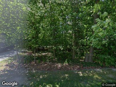
8526 Crow Rd Litchfield, OH 44253
Estimated Value: $571,771 - $700,000
4
Beds
3
Baths
2,435
Sq Ft
$263/Sq Ft
Est. Value
About This Home
This home is located at 8526 Crow Rd, Litchfield, OH 44253 and is currently estimated at $639,693, approximately $262 per square foot. 8526 Crow Rd is a home located in Medina County with nearby schools including Buckeye Intermediate School, Buckeye Primary School, and Buckeye Junior High School.
Ownership History
Date
Name
Owned For
Owner Type
Purchase Details
Closed on
Mar 31, 2008
Sold by
Westfall Michael L and Westfall Janine M
Bought by
Lee Thomas W
Current Estimated Value
Purchase Details
Closed on
Dec 21, 2000
Sold by
Rising Edna M and Rising Edwin George
Bought by
Westfall Michael L and Westfall Janine M
Create a Home Valuation Report for This Property
The Home Valuation Report is an in-depth analysis detailing your home's value as well as a comparison with similar homes in the area
Home Values in the Area
Average Home Value in this Area
Purchase History
| Date | Buyer | Sale Price | Title Company |
|---|---|---|---|
| Lee Thomas W | $334,000 | -- | |
| Westfall Michael L | $55,000 | -- |
Source: Public Records
Mortgage History
| Date | Status | Borrower | Loan Amount |
|---|---|---|---|
| Previous Owner | Westfall Michael L | $560,000 | |
| Previous Owner | Westfall Michael L | $196,500 | |
| Previous Owner | Westfall Michael L | $87,000 | |
| Previous Owner | Westfall Michael L | $60,000 | |
| Previous Owner | Westfall Michael L | $67,500 | |
| Previous Owner | Westfall Michael L | $65,000 |
Source: Public Records
Tax History Compared to Growth
Tax History
| Year | Tax Paid | Tax Assessment Tax Assessment Total Assessment is a certain percentage of the fair market value that is determined by local assessors to be the total taxable value of land and additions on the property. | Land | Improvement |
|---|---|---|---|---|
| 2024 | $5,559 | $147,010 | $30,430 | $116,580 |
| 2023 | $5,559 | $147,010 | $30,430 | $116,580 |
| 2022 | $5,640 | $147,010 | $30,430 | $116,580 |
| 2021 | $4,903 | $116,670 | $24,150 | $92,520 |
| 2020 | $5,102 | $116,670 | $24,150 | $92,520 |
| 2019 | $5,104 | $116,670 | $24,150 | $92,520 |
| 2018 | $4,563 | $100,540 | $21,600 | $78,940 |
| 2017 | $4,571 | $100,540 | $21,600 | $78,940 |
| 2016 | $4,703 | $100,540 | $21,600 | $78,940 |
| 2015 | $4,602 | $94,850 | $20,380 | $74,470 |
| 2014 | $4,584 | $94,850 | $20,380 | $74,470 |
| 2013 | $4,591 | $94,850 | $20,380 | $74,470 |
Source: Public Records
Map
Nearby Homes
- 0 Dunham Rd
- 0 Norwalk Rd
- 8266 Stone Rd
- 18710 State Route 57
- 3770 Station Rd
- 4152 Avon Lake Rd
- 4570 Vandemark Rd
- 2490 Station Rd
- 34433 Law Rd
- 7566 Stone Rd
- 9906 Norwalk Rd
- 7116 Norwalk Rd
- 8429 W Smith Rd
- 0 Smith Rd Unit 5116050
- 0 Spieth Rd
- 3215 Columbia Rd
- 6662 Norwalk Rd
- 2815 Columbia Rd
- 6566 Wolff Rd
- 6972 Stagecoach Trail
