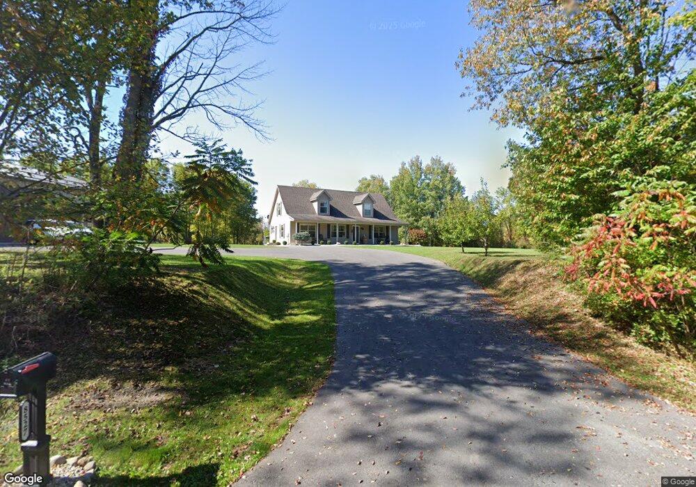
8527 Trumble Rd Port Byron, NY 13140
Estimated Value: $286,000 - $350,962
3
Beds
2
Baths
2,294
Sq Ft
$138/Sq Ft
Est. Value
About This Home
This home is located at 8527 Trumble Rd, Port Byron, NY 13140 and is currently estimated at $316,991, approximately $138 per square foot. 8527 Trumble Rd is a home with nearby schools including A.A. Gates Elementary School and Port Byron Senior High School.
Ownership History
Date
Name
Owned For
Owner Type
Purchase Details
Closed on
Dec 22, 2014
Sold by
Upfold Herbert
Bought by
Fronce Alan
Current Estimated Value
Home Financials for this Owner
Home Financials are based on the most recent Mortgage that was taken out on this home.
Original Mortgage
$155,000
Outstanding Balance
$119,165
Interest Rate
4.02%
Mortgage Type
New Conventional
Estimated Equity
$197,826
Purchase Details
Closed on
Dec 19, 2014
Sold by
Upfold Herbert and Upfold Gail
Bought by
Fronce Alan R
Home Financials for this Owner
Home Financials are based on the most recent Mortgage that was taken out on this home.
Original Mortgage
$155,000
Outstanding Balance
$119,165
Interest Rate
4.02%
Mortgage Type
New Conventional
Estimated Equity
$197,826
Purchase Details
Closed on
Apr 1, 2014
Sold by
Hara Daniel O and Boucheron Lorraine
Bought by
Upfold Herbert and Upfold Gail
Create a Home Valuation Report for This Property
The Home Valuation Report is an in-depth analysis detailing your home's value as well as a comparison with similar homes in the area
Home Values in the Area
Average Home Value in this Area
Purchase History
| Date | Buyer | Sale Price | Title Company |
|---|---|---|---|
| Fronce Alan | $150,000 | Norman Chirco | |
| Fronce Alan R | $150,000 | None Available | |
| Upfold Herbert | $150,000 | None Available |
Source: Public Records
Mortgage History
| Date | Status | Borrower | Loan Amount |
|---|---|---|---|
| Open | Fronce Alan R | $155,000 |
Source: Public Records
Tax History Compared to Growth
Tax History
| Year | Tax Paid | Tax Assessment Tax Assessment Total Assessment is a certain percentage of the fair market value that is determined by local assessors to be the total taxable value of land and additions on the property. | Land | Improvement |
|---|---|---|---|---|
| 2024 | $5,598 | $181,500 | $17,700 | $163,800 |
| 2023 | $5,687 | $181,500 | $17,700 | $163,800 |
| 2022 | $5,878 | $181,500 | $17,700 | $163,800 |
| 2021 | $6,040 | $181,500 | $17,700 | $163,800 |
| 2020 | $5,628 | $181,500 | $17,700 | $163,800 |
| 2019 | $2,427 | $181,500 | $17,700 | $163,800 |
| 2018 | $4,607 | $155,900 | $17,700 | $138,200 |
| 2017 | $4,652 | $155,900 | $17,700 | $138,200 |
| 2016 | $4,600 | $155,900 | $17,700 | $138,200 |
| 2015 | -- | $136,800 | $17,700 | $119,100 |
| 2014 | -- | $109,400 | $17,700 | $91,700 |
Source: Public Records
Map
Nearby Homes
- 1 Curtis St
- 11 Canal St
- 5 Canal St
- 134 Main St
- 179 Main St
- 1756 New York Central Rd
- 7959 State Street Rd
- 8089 State Route 90
- 8129 High St
- 1274 Haiti Rd
- 7410 Rice Rd
- 7639 State Street Rd
- 9762 State Route 38
- 2653 Washington St
- 2659 Tanner Rd
- 7514 State Street Rd
- 7422 Robinson Rd
- 7355 Powers Rd
- 8779 South St
- 2736 E Brutus St
- 8509 Trumble Rd
- 8485 Trumble Rd
- 8573 Thompson Rd
- 8578 Thompson Rd
- 8471 Trumble Rd
- 1372 Heel Path Rd
- 1382 Heel Path Rd
- 1379 Tow Path Rd
- 8628 Thompson Rd
- 8650 Thompson Rd
- 1391 State Route 31
- 1263 Tow Path Rd
- 1473 State Route 31
- 1407 State Route 31
- 1347 State Route 31
- 1468 State Route 31
- 8684 Thompson Rd
- 1504 State Route 31
- 1547 State Route 31
- 1512 State Route 31