Estimated Value: $269,982 - $369,000
--
Bed
2
Baths
2,584
Sq Ft
$122/Sq Ft
Est. Value
About This Home
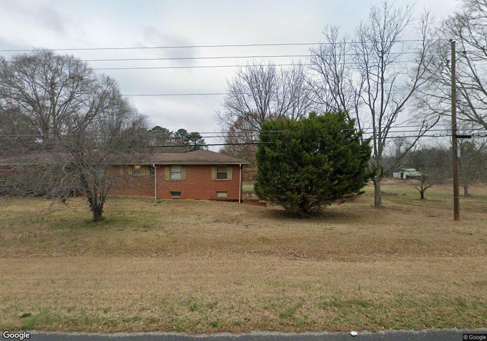
This home is located at 8528 Highway 72 W, Hull, GA 30646 and is currently estimated at $315,246, approximately $121 per square foot. 8528 Highway 72 W is a home located in Madison County with nearby schools including Madison County High School.
Ownership History
Date
Name
Owned For
Owner Type
Purchase Details
Closed on
Jul 28, 2003
Sold by
Bishop Marie M
Bought by
Mayfield Larry K and Mayfield Patricia C
Current Estimated Value
Purchase Details
Closed on
Jul 22, 2003
Sold by
Bishop Marie M
Bought by
Bishop Marie M
Purchase Details
Closed on
Jul 23, 1997
Bought by
Bishop Marie M
Purchase Details
Closed on
Jan 1, 1988
Bought by
Bishop Marie M
Create a Home Valuation Report for This Property
The Home Valuation Report is an in-depth analysis detailing your home's value as well as a comparison with similar homes in the area
Home Values in the Area
Average Home Value in this Area
Purchase History
| Date | Buyer | Sale Price | Title Company |
|---|---|---|---|
| Mayfield Larry K | $65,000 | -- | |
| Bishop Marie M | -- | -- | |
| Bishop Marie M | -- | -- | |
| Bishop Marie M | -- | -- |
Source: Public Records
Tax History Compared to Growth
Tax History
| Year | Tax Paid | Tax Assessment Tax Assessment Total Assessment is a certain percentage of the fair market value that is determined by local assessors to be the total taxable value of land and additions on the property. | Land | Improvement |
|---|---|---|---|---|
| 2024 | $1,583 | $62,812 | $13,364 | $49,448 |
| 2023 | $1,770 | $57,975 | $11,136 | $46,839 |
| 2022 | $1,327 | $50,124 | $7,657 | $42,467 |
| 2021 | $1,112 | $38,178 | $7,657 | $30,521 |
| 2020 | $1,078 | $37,065 | $6,544 | $30,521 |
| 2019 | $1,074 | $36,527 | $6,544 | $29,983 |
| 2018 | $1,042 | $35,406 | $5,986 | $29,420 |
| 2017 | $1,033 | $35,868 | $5,568 | $30,300 |
| 2016 | $856 | $31,832 | $5,067 | $26,766 |
| 2015 | $857 | $31,832 | $5,067 | $26,766 |
| 2014 | $858 | $31,698 | $5,071 | $26,627 |
| 2013 | -- | $31,698 | $5,071 | $26,627 |
Source: Public Records
Map
Nearby Homes
- 660 McCannon Morris Rd
- 385 McCannon Morris Rd
- 119 Jack Sharp Rd
- 489 Childers Rd
- 703 Jack Sharp Rd
- 0 Spratlin Mill Rd Unit 1025918
- 0 Spratlin Mill Rd Unit 10526335
- 0 Spratlin Mill Dr Unit 7665837
- 0 Spratlin Mill Dr Unit LOT 14-C
- 1 Lem Edwards Rd
- 2 Lem Edwards Rd
- 1270 McCannon Morris Rd
- 1330 McCannon-morris Rd
- 1750 Charlie Bolton Rd
- 200 Lem Edwards Rd
- 151 Rolling Woods Ln
- 1329 Spratlin Mill Dr
- 75 Madison Ave
- 201 Pittard Rd
- 0 Virginia Ln Unit Lot 15 CL336098
- 8576 Highway 72 W
- 8674 Highway 72 W
- 5 McCannon-morris Rd
- 8647 Highway 72 W
- 90 Meadow Ln
- 7 Meadow Ln
- 134 Meadow Ln
- 88 McCannon Morris Rd
- 119 Meadow Ln
- 8874 Highway 72 W
- 164 Meadow Ln
- 8631 Highway 72 W
- 145 McCannon Morris Rd
- 155 Meadow Ln
- 310 McCannon Morris Rd Unit 52
- 330 McCannon Morris Rd Unit 51
- 370 McCannon Morris Rd Unit 49
- 390 McCannon Morris Rd Unit 48
- 350 McCannon Morris Rd Unit 50
- 310 McCannon Morris Rd