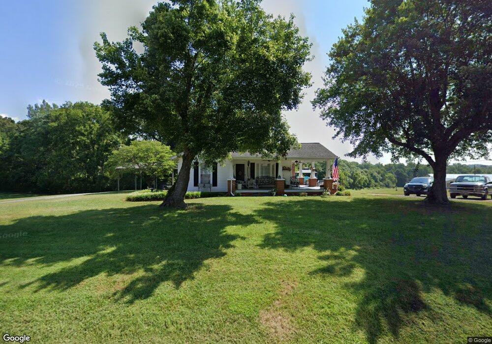
853 Nc Hwy 22 S Ramseur, NC 27316
Estimated Value: $273,270 - $287,000
--
Bed
1
Bath
1,578
Sq Ft
$177/Sq Ft
Est. Value
About This Home
This home is located at 853 Nc Hwy 22 S, Ramseur, NC 27316 and is currently estimated at $279,818, approximately $177 per square foot. 853 Nc Hwy 22 S is a home located in Randolph County with nearby schools including Ramseur Elementary School, Southeastern Randolph Middle School, and Eastern Randolph High School.
Ownership History
Date
Name
Owned For
Owner Type
Purchase Details
Closed on
Aug 11, 2025
Sold by
Arnett Garry C and Arnett Linda F
Bought by
Simon Nancy
Current Estimated Value
Purchase Details
Closed on
May 1, 2024
Sold by
Arnett Garry C and Arnett Linda F
Bought by
Arnett Garry C and Arnett Linda F
Purchase Details
Closed on
Aug 5, 2003
Bought by
Arnett Garry Carnett Linda F
Purchase Details
Closed on
Aug 17, 1988
Bought by
Arnett Garry Carnett Linda F
Create a Home Valuation Report for This Property
The Home Valuation Report is an in-depth analysis detailing your home's value as well as a comparison with similar homes in the area
Home Values in the Area
Average Home Value in this Area
Purchase History
| Date | Buyer | Sale Price | Title Company |
|---|---|---|---|
| Simon Nancy | $280,000 | None Listed On Document | |
| Simon Nancy | $280,000 | None Listed On Document | |
| Arnett Garry C | -- | None Listed On Document | |
| Arnett Garry C | -- | None Listed On Document | |
| Arnett Garry Carnett Linda F | $90,000 | -- | |
| Arnett Garry Carnett Linda F | $22,500 | -- |
Source: Public Records
Tax History Compared to Growth
Tax History
| Year | Tax Paid | Tax Assessment Tax Assessment Total Assessment is a certain percentage of the fair market value that is determined by local assessors to be the total taxable value of land and additions on the property. | Land | Improvement |
|---|---|---|---|---|
| 2025 | $1,128 | $187,100 | $36,700 | $150,400 |
| 2024 | $1,128 | $176,320 | $36,700 | $139,620 |
| 2023 | $1,049 | $163,860 | $36,700 | $127,160 |
| 2022 | $811 | $105,000 | $19,090 | $85,910 |
| 2021 | $811 | $105,000 | $19,090 | $85,910 |
| 2020 | $790 | $105,000 | $19,090 | $85,910 |
| 2019 | $790 | $105,000 | $19,090 | $85,910 |
| 2018 | $800 | $103,590 | $21,550 | $82,040 |
| 2016 | $800 | $103,588 | $21,550 | $82,038 |
| 2015 | $782 | $103,588 | $22,270 | $81,318 |
| 2014 | -- | $103,588 | $22,270 | $81,318 |
Source: Public Records
Map
Nearby Homes
- 1001 Meadowood Dr
- 5182 Foushee Rd
- 545 Coleridge Rd
- 324 Elam Ave
- 321 Coleridge Rd
- 715 Liberty St
- 2050 Welborn Cir
- 507 Columbia Ave
- 309 Elam Ave
- 2110 Newell St
- 0 State Highway 49
- 7187 Jordan Rd
- 4737 Huntingwood Rd
- 4650 Huntingwood Rd
- 4659 Huntingwood Rd
- 5713 Us Highway 64 E
- 518 E Main St
- 0 Mulberry Academy St Unit 1198788
- 8521 Us Highway 64 E
- 4319 Young Rd
- 805 Nc Hwy 22 S
- 1019 Chisholm Rd
- 864 Nc Hwy 22 S
- 793 N Carolina 22
- 793 Nc Hwy 22 S
- 796 Nc Hwy 22 S
- 873 Nc Hwy 22 S
- 787 Nc Hwy 22 S
- 5166 Gracewood Rd
- 1020 Chisholm Rd
- 1010 Chisholm Rd
- 780 Coleridge Rd
- 5178 Gracewood Rd
- 0 Chisholm Rd
- 5146 Gracewood Rd
- 5126 Gracewood Rd
- 763 Coleridge Rd
- 1012 Chisholm Rd
- 1134 Richardson St
- 764 Coleridge Rd