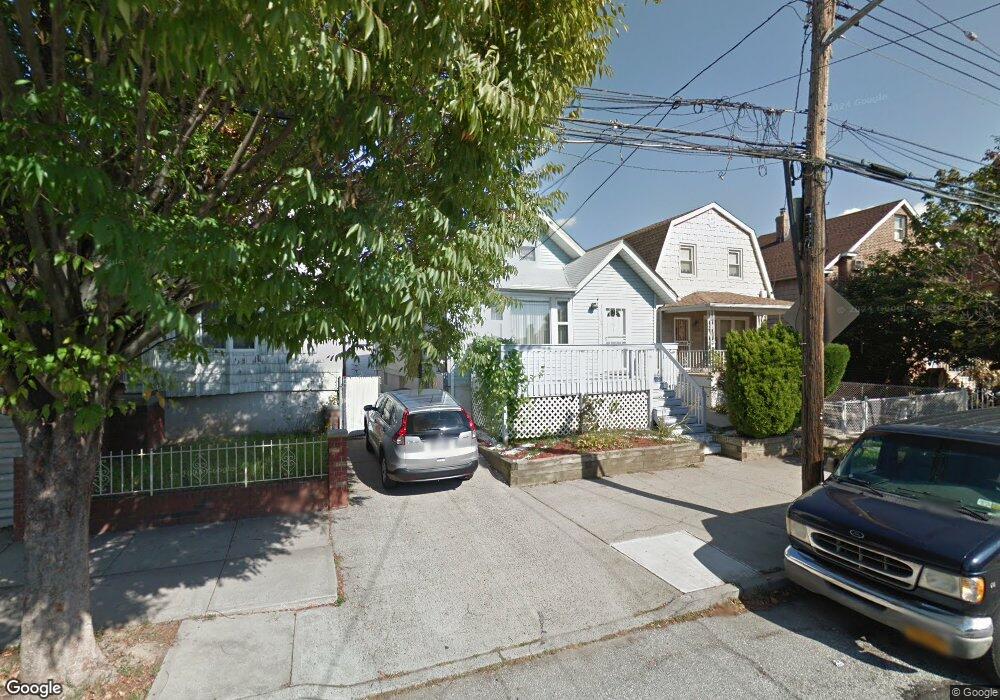
854 Calhoun Ave Bronx, NY 10465
Throgs Neck-Edgewater Park NeighborhoodEstimated Value: $603,416 - $850,000
--
Bed
--
Bath
1,610
Sq Ft
$442/Sq Ft
Est. Value
About This Home
This home is located at 854 Calhoun Ave, Bronx, NY 10465 and is currently estimated at $711,854, approximately $442 per square foot. 854 Calhoun Ave is a home located in Bronx County with nearby schools including P.S. 14 Senator John Calandra, Herbert H Lehman High School, and St Benedict School.
Ownership History
Date
Name
Owned For
Owner Type
Purchase Details
Closed on
Nov 25, 2008
Sold by
Lugo Josely E and Lugo Maria D
Bought by
Perez Alcenio
Current Estimated Value
Home Financials for this Owner
Home Financials are based on the most recent Mortgage that was taken out on this home.
Original Mortgage
$337,500
Outstanding Balance
$224,523
Interest Rate
6.27%
Mortgage Type
Purchase Money Mortgage
Estimated Equity
$487,331
Purchase Details
Closed on
Jun 27, 2003
Sold by
Disalvatore Fernando and Sulpizi Disalvatore Joan
Bought by
Lugo Josely E and Lugo Maria D
Create a Home Valuation Report for This Property
The Home Valuation Report is an in-depth analysis detailing your home's value as well as a comparison with similar homes in the area
Home Values in the Area
Average Home Value in this Area
Purchase History
| Date | Buyer | Sale Price | Title Company |
|---|---|---|---|
| Perez Alcenio | $375,000 | -- | |
| Lugo Josely E | $350,000 | -- |
Source: Public Records
Mortgage History
| Date | Status | Borrower | Loan Amount |
|---|---|---|---|
| Open | Perez Alcenio | $337,500 | |
| Closed | Lugo Josely E | $0 |
Source: Public Records
Tax History Compared to Growth
Tax History
| Year | Tax Paid | Tax Assessment Tax Assessment Total Assessment is a certain percentage of the fair market value that is determined by local assessors to be the total taxable value of land and additions on the property. | Land | Improvement |
|---|---|---|---|---|
| 2025 | $5,727 | $29,290 | $5,816 | $23,474 |
| 2024 | $5,727 | $28,512 | $5,550 | $22,962 |
| 2023 | $5,791 | $28,512 | $5,744 | $22,768 |
| 2022 | $5,475 | $38,040 | $8,280 | $29,760 |
| 2021 | $5,445 | $32,820 | $8,280 | $24,540 |
| 2020 | $5,166 | $36,240 | $8,280 | $27,960 |
| 2019 | $4,970 | $32,760 | $8,280 | $24,480 |
| 2018 | $4,843 | $23,760 | $5,845 | $17,915 |
| 2017 | $4,659 | $22,853 | $6,696 | $16,157 |
| 2016 | $4,310 | $21,560 | $6,731 | $14,829 |
| 2015 | $2,900 | $20,340 | $9,180 | $11,160 |
| 2014 | $2,900 | $19,800 | $9,180 | $10,620 |
Source: Public Records
Map
Nearby Homes
- 836 Revere Ave
- 2916 Sullivan Place
- - Ave
- 837 Swinton Ave
- 831 Swinton Ave
- 2808 Philip Ave
- 815 Swinton Ave
- 710 Revere Ave
- 945 Swinton Ave
- 854 Logan Ave
- 755 Logan Ave
- 819 Hollywood Ave
- 1032 Swinton Ave
- 840 Hollywood Ave
- 2921 Greene Place
- 1009 Brinsmade Ave
- 730 Logan Ave
- 731 Hollywood Ave
- 946 Balcom Ave
- 3021 Barkley Ave
- 852 Calhoun Ave
- 860 Calhoun Ave
- 850 Calhoun Ave
- 0 Calhoun Ave
- 856 Calhoun Ave
- 842 Calhoun Ave
- 840 Calhoun Ave
- 849 Revere Ave
- 857 Revere Ave
- 845 Revere Ave
- 862 Calhoun Ave
- 859 Revere Ave
- 843 Revere Ave
- 864 Calhoun Ave
- 834 Calhoun Ave
- 861 Revere Ave
- 861 Revere Ave Unit 2
- 861 Revere Ave Unit 3
- 866 Calhoun Ave
- 863 Revere Ave