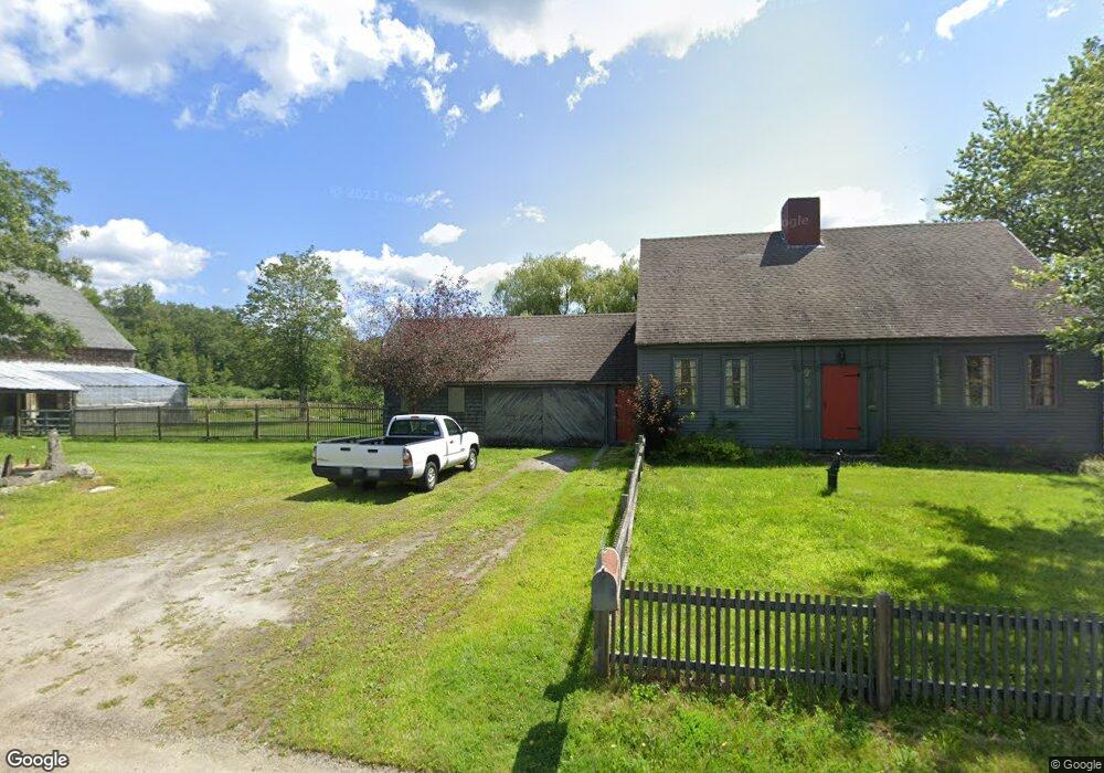
854 Main Rd Westport Island, ME 04578
Estimated Value: $625,310 - $959,000
2
Beds
1
Bath
4,354
Sq Ft
$187/Sq Ft
Est. Value
About This Home
This home is located at 854 Main Rd, Westport Island, ME 04578 and is currently estimated at $812,078, approximately $186 per square foot. 854 Main Rd is a home located in Lincoln County.
Ownership History
Date
Name
Owned For
Owner Type
Purchase Details
Closed on
Dec 26, 2024
Sold by
Pfosi Frank and Pfosi Sherry
Bought by
Shields James G and Slater Jan
Current Estimated Value
Purchase Details
Closed on
Oct 13, 2009
Sold by
Slater Jan
Bought by
Slater Jan and Sheilds James G
Create a Home Valuation Report for This Property
The Home Valuation Report is an in-depth analysis detailing your home's value as well as a comparison with similar homes in the area
Home Values in the Area
Average Home Value in this Area
Purchase History
| Date | Buyer | Sale Price | Title Company |
|---|---|---|---|
| Shields James G | -- | None Available | |
| Shields James G | -- | None Available | |
| Slater Jan | -- | -- | |
| Slater Jan | -- | -- |
Source: Public Records
Tax History Compared to Growth
Tax History
| Year | Tax Paid | Tax Assessment Tax Assessment Total Assessment is a certain percentage of the fair market value that is determined by local assessors to be the total taxable value of land and additions on the property. | Land | Improvement |
|---|---|---|---|---|
| 2024 | $3,544 | $478,954 | $117,486 | $361,468 |
| 2023 | $2,896 | $442,149 | $80,681 | $361,468 |
| 2022 | $3,008 | $362,418 | $66,132 | $296,286 |
| 2021 | $2,863 | $362,418 | $66,132 | $296,286 |
| 2020 | $2,936 | $362,418 | $66,132 | $296,286 |
| 2019 | $2,707 | $362,418 | $66,132 | $296,286 |
| 2018 | $2,392 | $362,418 | $66,132 | $296,286 |
| 2016 | $2,609 | $362,418 | $66,132 | $296,286 |
| 2014 | $2,545 | $338,830 | $0 | $0 |
| 2013 | $2,626 | $338,830 | $77,870 | $260,960 |
Source: Public Records
Map
Nearby Homes
- 0 Maine 144
- M4 L12.30B McCarty Cove Rd
- 13 Porcupine Ln
- 19 Riverside Ave
- 44 Stone Point Ln
- 15 Lewis Dr
- 30 Taylor Rd
- 91 Tree Farm Dr
- 712 Back River Rd
- 23 Sunny Acres Ln
- 576 Back River Rd
- 27 Doggett Rd
- 18 High Head Rd
- 17 Lester Rd
- 2 Ready Point Rd
- Lot 1 Sanders Rd
- Lot 4 Fawn Meadow Dr
- 4 Fawn Meadow Dr
- Lot 7 Moose Way
- Lot 9 Fawn Meadow Dr
- 841 Main Rd
- 843 Main Rd
- 2 Jeremysquam Way
- 0 Jeremy Squam Way Unit 1041632
- 0 Oak Run Unit 839646
- 0 Oak Run Unit 814955
- 0 Oak Run Unit 1145124
- 4 Jeremysquam Way
- 47 Pettey Rd
- Lot38 Maine 144
- 54 Maine 144
- 54 Maine 144
- 814 Main Rd
- 9 Bakers Rd
- 32 Pettey Rd
- 15 Bakers Rd
- 28 Pettey Rd
- 877 Main Rd
- 797 Main Rd
- 809 Main Rd