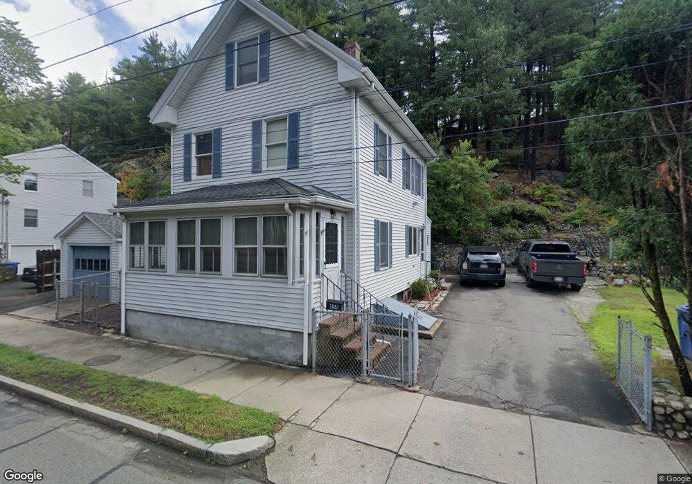
854 Main St Wakefield, MA 01880
Greenwood NeighborhoodEstimated Value: $631,000 - $714,000
4
Beds
2
Baths
1,134
Sq Ft
$598/Sq Ft
Est. Value
About This Home
This home is located at 854 Main St, Wakefield, MA 01880 and is currently estimated at $678,674, approximately $598 per square foot. 854 Main St is a home located in Middlesex County with nearby schools including Wakefield Memorial High School, St Joseph School, and St. Patrick Elementary School.
Ownership History
Date
Name
Owned For
Owner Type
Purchase Details
Closed on
Nov 30, 1994
Sold by
Aloise Alfred E and Aloise Michelle A
Bought by
Narkun John W and Abromavage Karin
Current Estimated Value
Home Financials for this Owner
Home Financials are based on the most recent Mortgage that was taken out on this home.
Original Mortgage
$130,500
Interest Rate
8.81%
Mortgage Type
Purchase Money Mortgage
Purchase Details
Closed on
Aug 23, 1990
Sold by
Pebley Harry C
Bought by
Aloise Alfred E
Create a Home Valuation Report for This Property
The Home Valuation Report is an in-depth analysis detailing your home's value as well as a comparison with similar homes in the area
Home Values in the Area
Average Home Value in this Area
Purchase History
| Date | Buyer | Sale Price | Title Company |
|---|---|---|---|
| Narkun John W | $145,000 | -- | |
| Narkun John W | $145,000 | -- | |
| Aloise Alfred E | $155,000 | -- |
Source: Public Records
Mortgage History
| Date | Status | Borrower | Loan Amount |
|---|---|---|---|
| Open | Aloise Alfred E | $136,000 | |
| Closed | Aloise Alfred E | $130,500 | |
| Previous Owner | Aloise Alfred E | $138,500 |
Source: Public Records
Tax History
| Year | Tax Paid | Tax Assessment Tax Assessment Total Assessment is a certain percentage of the fair market value that is determined by local assessors to be the total taxable value of land and additions on the property. | Land | Improvement |
|---|---|---|---|---|
| 2025 | $6,315 | $556,400 | $314,600 | $241,800 |
| 2024 | $6,198 | $550,900 | $311,400 | $239,500 |
| 2023 | $5,877 | $501,000 | $282,900 | $218,100 |
| 2022 | $5,668 | $460,100 | $259,500 | $200,600 |
| 2021 | $5,380 | $422,600 | $234,300 | $188,300 |
| 2020 | $5,157 | $403,800 | $223,900 | $179,900 |
| 2019 | $4,890 | $381,100 | $211,300 | $169,800 |
| 2018 | $4,644 | $358,600 | $198,800 | $159,800 |
| 2017 | $4,515 | $346,500 | $192,100 | $154,400 |
| 2016 | $4,542 | $336,700 | $188,800 | $147,900 |
| 2015 | $4,330 | $321,200 | $180,000 | $141,200 |
| 2014 | $4,027 | $315,100 | $176,500 | $138,600 |
Source: Public Records
Map
Nearby Homes
- 858 Main St Unit 4
- 858 Main St Unit 3
- 858 Main St Unit 2
- 858 Main St Unit 1
- 858 Main St
- 850 Main St
- 850 Main St Unit 850
- 852 Main St
- 862 Main St
- 5 Forest St
- 7 Forest St
- 14 Gates Ln Unit B
- 14 Gates Ln Unit 1
- 14 Gates Ln Unit A
- 14 Gates Ln Unit 14B
- 14 Gates Ln Unit 14A
- 16 Gates Ln Unit B
- 16 Gates Ln Unit A
- 16 Gates Ln Unit 16B
- 16 Gates Ln Unit 16A
Your Personal Tour Guide
Ask me questions while you tour the home.