Estimated Value: $302,000 - $396,000
3
Beds
2
Baths
1,344
Sq Ft
$263/Sq Ft
Est. Value
About This Home
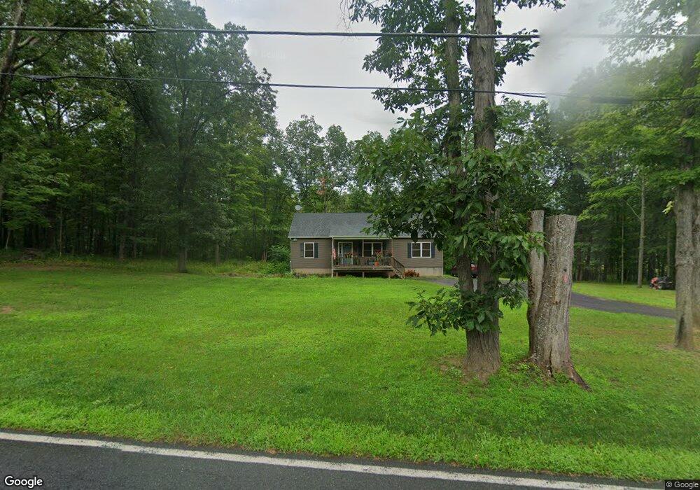
This home is located at 854 Route 67, Leeds, NY 12451 and is currently estimated at $353,333, approximately $262 per square foot. 854 Route 67 is a home with nearby schools including Cairo-Durham Elementary School, Cairo-Durham Middle School, and Cairo-Durham High School.
Create a Home Valuation Report for This Property
The Home Valuation Report is an in-depth analysis detailing your home's value as well as a comparison with similar homes in the area
Home Values in the Area
Average Home Value in this Area
Tax History Compared to Growth
Tax History
| Year | Tax Paid | Tax Assessment Tax Assessment Total Assessment is a certain percentage of the fair market value that is determined by local assessors to be the total taxable value of land and additions on the property. | Land | Improvement |
|---|---|---|---|---|
| 2024 | $5,579 | $134,700 | $29,508 | $105,192 |
| 2023 | -- | $134,700 | $29,508 | $105,192 |
Source: Public Records
Map
Nearby Homes
- 1927 Route 67
- 802 Ira Vail Rd
- 953 Ira Vail Rd
- 626 Bross St
- TBD Anthony Dr
- 271 Route 67
- 84 Orchard Dr
- 214 County Route 67
- 284 Bross St
- 86 Main St
- 0 New York 23
- 78 Bross St
- 326 Main St
- 0 Lake Mills Rd Unit 153003
- 24 Grove St
- 7 Grove St
- 54 Grove St
- 1320 Rudolph Weir Junior Rd
- 2640 Schoharie Turnpike
- 479 Main St
- 880 Route 67
- 868 Route 67
- 848 County Rte 67
- 0 Wilson Rd Unit 20094358
- 0 Wilson Rd Unit 145394
- 52 Wilson Rd
- 852 Route 67
- 914 Route 67
- 914 County Road 67
- 934 County Road 67
- 933 Route 67
- 970 Route 67
- 980 Route 67
- 759 Route 67
- 973 County Rd
- 973 Cr 67
- 973 Route 67
- 982 Route 67
- 1040 Route 67
- 1040 Route 67