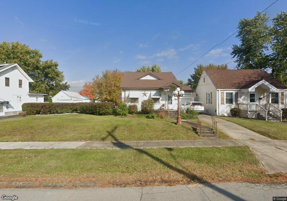
854 Sheridan Rd Marion, OH 43302
Estimated Value: $136,000 - $163,000
2
Beds
1
Bath
1,394
Sq Ft
$107/Sq Ft
Est. Value
About This Home
This home is located at 854 Sheridan Rd, Marion, OH 43302 and is currently estimated at $149,749, approximately $107 per square foot. 854 Sheridan Rd is a home located in Marion County with nearby schools including William McKinley Elementary School, Ulysses S. Grant Middle School, and Harding High School.
Ownership History
Date
Name
Owned For
Owner Type
Purchase Details
Closed on
Jun 21, 2006
Sold by
Watson Iola Ruth
Bought by
Watson Iola Ruth and Watson Tracey R
Current Estimated Value
Purchase Details
Closed on
Apr 11, 2006
Sold by
Watson Iola Ruth
Bought by
Watson Iola Ruth
Purchase Details
Closed on
May 18, 1998
Bought by
Watson Iola Ruth Life Estate
Create a Home Valuation Report for This Property
The Home Valuation Report is an in-depth analysis detailing your home's value as well as a comparison with similar homes in the area
Home Values in the Area
Average Home Value in this Area
Purchase History
| Date | Buyer | Sale Price | Title Company |
|---|---|---|---|
| Watson Iola Ruth | -- | None Available | |
| Watson Iola Ruth | -- | None Available | |
| Watson Iola Ruth | -- | None Available | |
| Watson Iola Ruth | -- | None Available | |
| Watson Iola Ruth | -- | None Available | |
| Watson Iola Ruth Life Estate | -- | -- |
Source: Public Records
Tax History Compared to Growth
Tax History
| Year | Tax Paid | Tax Assessment Tax Assessment Total Assessment is a certain percentage of the fair market value that is determined by local assessors to be the total taxable value of land and additions on the property. | Land | Improvement |
|---|---|---|---|---|
| 2024 | $1,333 | $34,730 | $2,980 | $31,750 |
| 2023 | $1,333 | $34,730 | $2,980 | $31,750 |
| 2022 | $1,237 | $34,730 | $2,980 | $31,750 |
| 2021 | $1,069 | $27,010 | $2,590 | $24,420 |
| 2020 | $1,071 | $27,010 | $2,590 | $24,420 |
| 2019 | $1,071 | $27,010 | $2,590 | $24,420 |
| 2018 | $877 | $22,130 | $2,560 | $19,570 |
| 2017 | $523 | $22,130 | $2,560 | $19,570 |
| 2016 | $519 | $22,130 | $2,560 | $19,570 |
| 2015 | $511 | $21,630 | $2,440 | $19,190 |
| 2014 | $513 | $21,630 | $2,440 | $19,190 |
| 2012 | $514 | $21,600 | $2,240 | $19,360 |
Source: Public Records
Map
Nearby Homes
- 904 Merkle Ave
- 786 Sheridan Rd
- 796 Woodrow Ave
- 757 Merkle Ave
- 0 Bellefontaine Ave
- 889 Oak Grove Ave
- 720 Woodrow Ave
- 824 Oak Grove Ave
- 716 Uncapher Ave
- 625 Rochelle Dr
- 668 Uncapher Ave
- 981 Davids St
- 645 Henry St
- 681 Davids St
- 1117 Woodrow Ave
- 579 Henry St
- 512 Henry St
- 1406 Plantation Dr
- 472 Clinton St
- 4 Poppy Place
- 848 Sheridan Rd
- 864 Sheridan Rd
- 836 Sheridan Rd
- 868 Sheridan Rd
- 857 Merkle Ave
- 832 Sheridan Rd
- 853 Merkle Ave
- 876 Sheridan Rd
- 861 Merkle Ave
- 845 Merkle Ave
- 855 Sheridan Rd
- 867 Merkle Ave
- 847 Sheridan Rd
- 839 Merkle Ave
- 826 Sheridan Rd
- 873 Merkle Ave
- 867 Sheridan Rd
- 863 Sheridan Rd
- 833 Merkle Ave
- 879 Merkle Ave