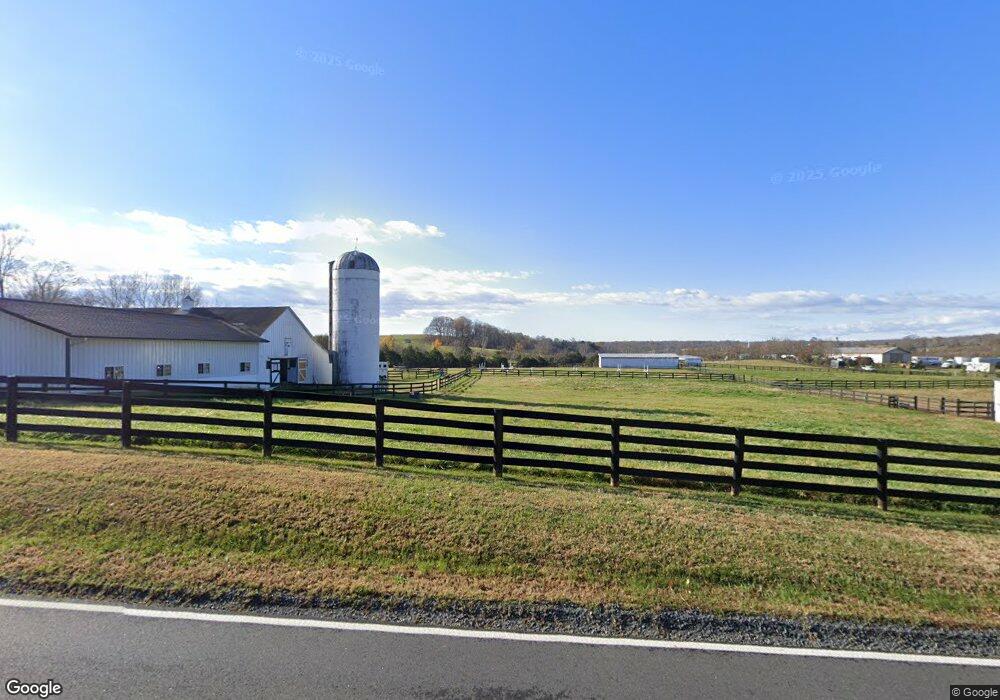
8541 Opal Rd Warrenton, VA 20186
Estimated Value: $524,000 - $768,000
2
Beds
1
Bath
1,107
Sq Ft
$577/Sq Ft
Est. Value
About This Home
This home is located at 8541 Opal Rd, Warrenton, VA 20186 and is currently estimated at $638,557, approximately $576 per square foot. 8541 Opal Rd is a home located in Fauquier County with nearby schools including Margaret M. Pierce Elementary School, W.C. Taylor Middle School, and Liberty High School.
Ownership History
Date
Name
Owned For
Owner Type
Purchase Details
Closed on
Mar 30, 2021
Sold by
Pearson Dennis J and Pearson Miriam R
Bought by
Folly Hill Farm Llc
Current Estimated Value
Purchase Details
Closed on
Jun 14, 2017
Sold by
Hartman Glenn L
Bought by
Pearson Dennis J and Pearson Miriam R
Home Financials for this Owner
Home Financials are based on the most recent Mortgage that was taken out on this home.
Original Mortgage
$368,000
Interest Rate
4.02%
Mortgage Type
Credit Line Revolving
Purchase Details
Closed on
Jun 2, 1998
Sold by
Foroyce Katherine F
Bought by
Hartman Glenn L and Hartman Susan E
Home Financials for this Owner
Home Financials are based on the most recent Mortgage that was taken out on this home.
Original Mortgage
$188,000
Interest Rate
7.12%
Mortgage Type
Credit Line Revolving
Create a Home Valuation Report for This Property
The Home Valuation Report is an in-depth analysis detailing your home's value as well as a comparison with similar homes in the area
Purchase History
| Date | Buyer | Sale Price | Title Company |
|---|---|---|---|
| Folly Hill Farm Llc | $560,000 | None Available | |
| Pearson Dennis J | $480,000 | Title Solutions Inc | |
| Hartman Glenn L | $235,000 | -- |
Source: Public Records
Mortgage History
| Date | Status | Borrower | Loan Amount |
|---|---|---|---|
| Previous Owner | Pearson Dennis J | $368,000 | |
| Previous Owner | Hartman Glenn L | $188,000 |
Source: Public Records
Tax History
| Year | Tax Paid | Tax Assessment Tax Assessment Total Assessment is a certain percentage of the fair market value that is determined by local assessors to be the total taxable value of land and additions on the property. | Land | Improvement |
|---|---|---|---|---|
| 2025 | $3,020 | $312,300 | $149,700 | $162,600 |
| 2024 | $2,959 | $312,300 | $149,700 | $162,600 |
| 2023 | $2,834 | $312,300 | $149,700 | $162,600 |
| 2022 | $2,834 | $312,300 | $149,700 | $162,600 |
| 2021 | $2,607 | $260,900 | $138,800 | $122,100 |
| 2020 | $2,607 | $260,900 | $138,800 | $122,100 |
| 2019 | $2,607 | $260,900 | $138,800 | $122,100 |
| 2018 | $2,576 | $481,100 | $359,000 | $122,100 |
| 2016 | $2,139 | $387,300 | $290,800 | $96,500 |
| 2015 | -- | $387,300 | $290,800 | $96,500 |
| 2014 | -- | $387,300 | $290,800 | $96,500 |
Source: Public Records
Map
Nearby Homes
- 8564 Opal Rd
- 8318 Diamond Hill Rd
- 8487 Botha Rd
- 8423 Lock Ln
- 18508 NewMacHar Ct
- 4679 Jeffersonton Rd
- 0 Botha Rd Unit VAFQ2016276
- 7296 Burke Ln
- 18149 Telford Dr
- 2093 Whithorn Hill
- 2114 Whithorn Hill
- 2094 Whithorn Hill
- 19126 Isabel Blvd
- 3259 Southampton Dr
- 9315 Lees Ridge Rd
- 3534 Southampton Dr
- Rt 688 (Leeds Manor NW Rt 688 NW
- 10442 Saint Pauls Rd
- 9105 Old Culpeper Rd
- 17291 Pepperstock Ln
Your Personal Tour Guide
Ask me questions while you tour the home.