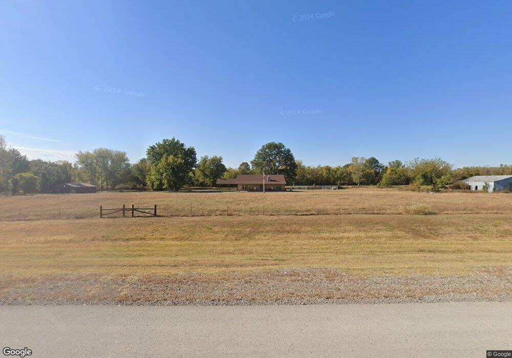
8545 State Highway 16 Wagoner, OK 74467
Estimated Value: $312,975 - $332,000
3
Beds
2
Baths
1,560
Sq Ft
$207/Sq Ft
Est. Value
About This Home
This home is located at 8545 State Highway 16, Wagoner, OK 74467 and is currently estimated at $322,658, approximately $206 per square foot. 8545 State Highway 16 is a home located in Wagoner County with nearby schools including Okay Elementary School and Okay High School.
Ownership History
Date
Name
Owned For
Owner Type
Purchase Details
Closed on
Aug 8, 2024
Sold by
Boswell Ronnie
Bought by
R A Line Holdings
Current Estimated Value
Purchase Details
Closed on
Nov 16, 2023
Sold by
Line Robb and Line Angie
Bought by
R A Line Holdings A Revocable Trust and Line
Purchase Details
Closed on
Sep 15, 2005
Sold by
Freeman Callie Jean
Bought by
Line Robb and Line Angie
Home Financials for this Owner
Home Financials are based on the most recent Mortgage that was taken out on this home.
Original Mortgage
$28,840
Interest Rate
5.88%
Mortgage Type
Credit Line Revolving
Purchase Details
Closed on
Dec 3, 2004
Sold by
Haggard Joe C and Haggard Callie
Purchase Details
Closed on
Dec 14, 1999
Sold by
Haggard Joe and Haggard Callie
Purchase Details
Closed on
Jul 8, 1999
Sold by
Sec Of Housing & Urban Develop
Purchase Details
Closed on
Dec 23, 1998
Sold by
Blackburn Warren and Blackburn Linda
Purchase Details
Closed on
Feb 17, 1994
Sold by
Houston Danny and Houston Angela
Create a Home Valuation Report for This Property
The Home Valuation Report is an in-depth analysis detailing your home's value as well as a comparison with similar homes in the area
Home Values in the Area
Average Home Value in this Area
Purchase History
| Date | Buyer | Sale Price | Title Company |
|---|---|---|---|
| R A Line Holdings | $18,000 | None Listed On Document | |
| R A Line Holdings A Revocable Trust | -- | None Listed On Document | |
| Line Robb | $144,500 | First American Title & Abstr | |
| -- | -- | -- | |
| -- | $16,000 | -- | |
| -- | -- | -- | |
| -- | $37,000 | -- | |
| -- | $38,000 | -- |
Source: Public Records
Mortgage History
| Date | Status | Borrower | Loan Amount |
|---|---|---|---|
| Previous Owner | Line Robb | $215,000 | |
| Previous Owner | Line Robb | $75,600 | |
| Previous Owner | Line Robb | $141,600 | |
| Previous Owner | Line Robb | $96,000 | |
| Previous Owner | Line Robb | $28,840 |
Source: Public Records
Tax History Compared to Growth
Tax History
| Year | Tax Paid | Tax Assessment Tax Assessment Total Assessment is a certain percentage of the fair market value that is determined by local assessors to be the total taxable value of land and additions on the property. | Land | Improvement |
|---|---|---|---|---|
| 2024 | $1,602 | $22,334 | $581 | $21,753 |
| 2023 | $1,553 | $21,684 | $581 | $21,103 |
| 2022 | $1,518 | $21,052 | $581 | $20,471 |
| 2021 | $1,500 | $20,657 | $581 | $20,076 |
| 2020 | $735 | $10,393 | $574 | $9,819 |
| 2019 | $738 | $10,090 | $569 | $9,521 |
| 2018 | $737 | $10,090 | $569 | $9,521 |
| 2017 | $722 | $9,950 | $309 | $9,641 |
| 2016 | $704 | $9,661 | $323 | $9,338 |
| 2015 | -- | $9,379 | $323 | $9,056 |
| 2014 | -- | $9,837 | $1,443 | $8,394 |
Source: Public Records
Map
Nearby Homes
- 12 E 90th St N
- 1925 E 100th St N
- 3999 E 100th St N
- 10125 N West 20th St
- 10585 N West 20th St
- 6050 N 38th St E
- 5526 N 25 St E
- 7586 Us Hwy 69
- 5740 E 84th St N
- 6106 E 82nd St N
- 6122 E 83rd St N
- 30400 E 760 Rd
- 07 W 90th St N
- 5999 E 109th St N
- 5917 E 109th St N
- 11609 N 59th St E
- 0 Hwy 69 Rd Unit 2543411
- 0 Hwy 69 Rd Unit 2543409
- 0 S 250 Rd Unit 2540937
- 0 S 250 Rd Unit 2538670
- 8614 State Highway 16
- 8465 State Highway 16
- 8712 State Highway 16
- 23 N 25th St E
- 20 E 90th St N
- 8225 N 25th St E
- 1740 E 88th St N
- 8805 N 25th St E
- 1863 E 89th St N
- 1835 E 89th St N
- 8409 State Highway 16
- 1151 E 89th St N
- 815 W 90th St N
- 8946 N 19th St E
- 8951 N 18th St E
- 8950 N 18th St E
- 8752 N 25th St E
- 8244 N 25th St E
- 8824 N 25th St E
- 0 Hwy 16 Hwy Unit 1541954