Estimated Value: $409,643 - $594,000
4
Beds
3
Baths
1,991
Sq Ft
$251/Sq Ft
Est. Value
About This Home
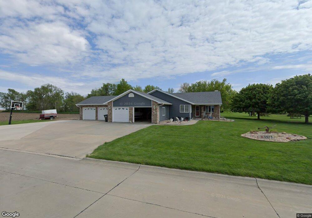
This home is located at 855 5th St, Utica, NE 68456 and is currently estimated at $499,911, approximately $251 per square foot. 855 5th St is a home located in Seward County with nearby schools including Centennial Elementary School, Centennial High School, and St. Paul Lutheran School.
Ownership History
Date
Name
Owned For
Owner Type
Purchase Details
Closed on
Jul 7, 2014
Sold by
Richters Kimberly R
Bought by
Nisly Mitchell and Nisly Betty
Current Estimated Value
Purchase Details
Closed on
Jun 5, 2012
Sold by
Dey M Douglas and Dey Marilyn J
Bought by
Richters Kimberly R
Purchase Details
Closed on
Oct 21, 2011
Sold by
Sorensen Craig L and Sorensen Julie Ann
Bought by
Dey M Douglas and Dey Marilyn J
Home Financials for this Owner
Home Financials are based on the most recent Mortgage that was taken out on this home.
Original Mortgage
$280,000
Interest Rate
4.13%
Mortgage Type
Future Advance Clause Open End Mortgage
Create a Home Valuation Report for This Property
The Home Valuation Report is an in-depth analysis detailing your home's value as well as a comparison with similar homes in the area
Purchase History
| Date | Buyer | Sale Price | Title Company |
|---|---|---|---|
| Nisly Mitchell | $280,000 | Community Title Co | |
| Richters Kimberly R | -- | Title Services | |
| Dey M Douglas | $280,000 | -- |
Source: Public Records
Mortgage History
| Date | Status | Borrower | Loan Amount |
|---|---|---|---|
| Previous Owner | Dey M Douglas | $280,000 |
Source: Public Records
Tax History
| Year | Tax Paid | Tax Assessment Tax Assessment Total Assessment is a certain percentage of the fair market value that is determined by local assessors to be the total taxable value of land and additions on the property. | Land | Improvement |
|---|---|---|---|---|
| 2025 | $3,011 | $415,645 | $21,194 | $394,451 |
| 2024 | $3,700 | $360,629 | $19,438 | $341,191 |
| 2023 | $4,347 | $338,522 | $19,438 | $319,084 |
| 2022 | $4,292 | $318,401 | $19,438 | $298,963 |
| 2021 | $3,707 | $282,525 | $19,438 | $263,087 |
| 2020 | $3,657 | $282,525 | $19,438 | $263,087 |
| 2019 | $3,473 | $274,340 | $19,273 | $255,067 |
| 2018 | $3,371 | $269,212 | $18,913 | $250,299 |
| 2017 | $3,222 | $238,445 | $17,981 | $220,464 |
| 2016 | $3,127 | $256,392 | $18,012 | $238,380 |
| 2015 | $3,000 | $256,392 | $18,012 | $238,380 |
| 2013 | $3,407 | $254,228 | $18,012 | $236,216 |
Source: Public Records
Map
Nearby Homes
- 410 B St
- 325 D St
- 141 Bronco Cir
- 1026 Frances St
- 735 Dimery Ave
- 603 Omaha St
- 2307 Nebraska 69
- 1107 Road P
- 640 A St
- 0 Tbd 294 Rd Unit 11552208
- 0 Tbd 294 Rd Unit 24423505
- 2304 E 16th St
- 1719 N Brookside Ln
- 536 Graham Dr
- 1436 N Maine Ave
- Lot 15 Blk 2 E Paradise Pond View
- 1503 Meadow Ln
- 442 364th
- 928 N 12th St
- Lot 4 Vista Way
Your Personal Tour Guide
Ask me questions while you tour the home.