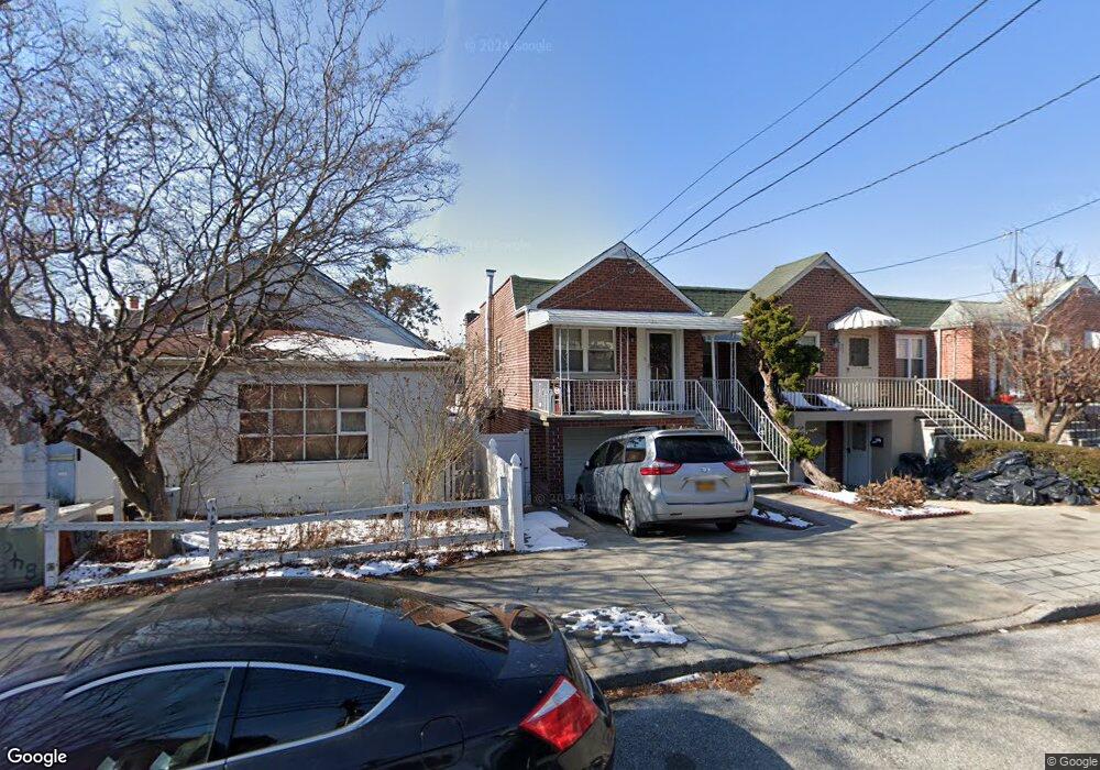
855 Calhoun Ave Bronx, NY 10465
Throgs Neck-Edgewater Park NeighborhoodEstimated Value: $605,000 - $767,000
Studio
--
Bath
1,680
Sq Ft
$422/Sq Ft
Est. Value
About This Home
This home is located at 855 Calhoun Ave, Bronx, NY 10465 and is currently estimated at $709,028, approximately $422 per square foot. 855 Calhoun Ave is a home located in Bronx County with nearby schools including P.S. 14 Senator John Calandra, Herbert H Lehman High School, and St Benedict School.
Ownership History
Date
Name
Owned For
Owner Type
Purchase Details
Closed on
Oct 21, 2016
Sold by
Gjeka Vjollca
Bought by
Cheng Lai Ching and Cheng Sin Mui
Current Estimated Value
Purchase Details
Closed on
Nov 21, 2013
Sold by
Bonfiglio Michael
Bought by
Gjeka Vjollca
Purchase Details
Closed on
Oct 31, 2013
Sold by
Pagano Edith
Bought by
Bonfiglio Michael and Kastrati Gjevat
Purchase Details
Closed on
Aug 28, 2013
Sold by
Pagano Edith and Profetti Catherine
Bought by
Pagano Edith
Create a Home Valuation Report for This Property
The Home Valuation Report is an in-depth analysis detailing your home's value as well as a comparison with similar homes in the area
Home Values in the Area
Average Home Value in this Area
Purchase History
| Date | Buyer | Sale Price | Title Company |
|---|---|---|---|
| Cheng Lai Ching | $300,000 | -- | |
| Gjeka Vjollca | $100,000 | -- | |
| Bonfiglio Michael | $200,000 | -- | |
| Pagano Edith | -- | -- |
Source: Public Records
Tax History
| Year | Tax Paid | Tax Assessment Tax Assessment Total Assessment is a certain percentage of the fair market value that is determined by local assessors to be the total taxable value of land and additions on the property. | Land | Improvement |
|---|---|---|---|---|
| 2025 | $6,681 | $34,646 | $8,849 | $25,797 |
| 2024 | $6,681 | $33,264 | $8,643 | $24,621 |
| 2023 | $6,756 | $33,264 | $8,881 | $24,383 |
| 2022 | $5,983 | $31,620 | $9,900 | $21,720 |
| 2021 | $6,441 | $31,560 | $9,900 | $21,660 |
| 2020 | $6,111 | $30,660 | $9,900 | $20,760 |
| 2019 | $5,799 | $31,080 | $9,900 | $21,180 |
| 2018 | $5,651 | $27,720 | $9,057 | $18,663 |
| 2017 | $1,758 | $27,033 | $8,885 | $18,148 |
| 2016 | $4,477 | $25,503 | $8,641 | $16,862 |
| 2015 | $1,142 | $24,060 | $10,980 | $13,080 |
| 2014 | $1,142 | $23,100 | $10,980 | $12,120 |
Source: Public Records
Map
Nearby Homes
- 815 Quincy Ave
- 836 Revere Ave
- 815 Swinton Ave
- 755 Quincy Ave
- 941 Revere Ave
- 945 Swinton Ave
- 750 Swinton Ave
- 1039 Calhoun Ave
- 710 Revere Ave
- 1052 Brinsmade Ave
- 755 Logan Ave
- 1049 Huntington Ave
- 2886 Randall Ave
- 725 Logan Ave
- 820 Hollywood Ave
- 822 Hollywood Ave
- 730 Logan Ave
- 924 Hollywood Ave
- 2887 Lamport Place
- 854 Throgs Neck Expy
- 857 Calhoun Ave
- 849 Calhoun Ave
- 859 Calhoun Ave
- 859 Calhoun St
- 847 Calhoun Ave
- 863 Calhoun Ave
- 845 Calhoun Ave
- 865 Calhoun Ave
- 852 Quincy Ave
- 854 Quincy Ave
- 850 Quincy Ave
- 843 Calhoun Ave
- 856 Quincy Ave
- 897 Calhoun Ave
- 848 Quincy Ave
- 860 Quincy Ave
- 846 Quincy Ave
- 860 Calhoun Ave
- 844 Quincy Ave
- 2840 Lafayette Ave
Your Personal Tour Guide
Ask me questions while you tour the home.