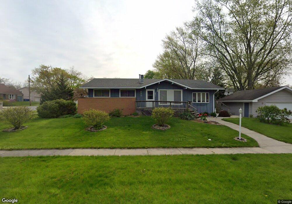
855 Carol Dr Crown Point, IN 46307
Estimated Value: $268,166 - $320,000
2
Beds
2
Baths
1,421
Sq Ft
$211/Sq Ft
Est. Value
About This Home
This home is located at 855 Carol Dr, Crown Point, IN 46307 and is currently estimated at $299,292, approximately $210 per square foot. 855 Carol Dr is a home located in Lake County with nearby schools including Lake Street Elementary School, Robert Taft Middle School, and Crown Point High School.
Ownership History
Date
Name
Owned For
Owner Type
Purchase Details
Closed on
Nov 10, 2012
Sold by
Kwiecien Damon
Bought by
Kwiecien Damon and Kwiecien Frank S
Current Estimated Value
Home Financials for this Owner
Home Financials are based on the most recent Mortgage that was taken out on this home.
Original Mortgage
$119,149
Interest Rate
3.5%
Mortgage Type
FHA
Purchase Details
Closed on
Aug 20, 2009
Sold by
Kwiecien Damon
Bought by
Kwiecien Damon and Kwiecien Frank
Home Financials for this Owner
Home Financials are based on the most recent Mortgage that was taken out on this home.
Original Mortgage
$122,100
Interest Rate
5.15%
Mortgage Type
FHA
Purchase Details
Closed on
Aug 3, 2007
Sold by
Kwiecien Frank and Kwiecien Phyllis
Bought by
Kwiecien Damon
Home Financials for this Owner
Home Financials are based on the most recent Mortgage that was taken out on this home.
Original Mortgage
$84,800
Interest Rate
6.71%
Mortgage Type
Purchase Money Mortgage
Create a Home Valuation Report for This Property
The Home Valuation Report is an in-depth analysis detailing your home's value as well as a comparison with similar homes in the area
Home Values in the Area
Average Home Value in this Area
Purchase History
| Date | Buyer | Sale Price | Title Company |
|---|---|---|---|
| Kwiecien Damon | -- | None Available | |
| Kwiecien Damon | -- | Accommodation | |
| Kwiecien Damon | -- | Stewart Title |
Source: Public Records
Mortgage History
| Date | Status | Borrower | Loan Amount |
|---|---|---|---|
| Previous Owner | Kwiecien Damon | $119,149 | |
| Previous Owner | Kwiecien Damon | $122,100 | |
| Previous Owner | Kwiecien Damon | $84,800 |
Source: Public Records
Tax History Compared to Growth
Tax History
| Year | Tax Paid | Tax Assessment Tax Assessment Total Assessment is a certain percentage of the fair market value that is determined by local assessors to be the total taxable value of land and additions on the property. | Land | Improvement |
|---|---|---|---|---|
| 2024 | $5,431 | $213,600 | $31,200 | $182,400 |
| 2023 | $2,085 | $197,600 | $31,200 | $166,400 |
| 2022 | $2,085 | $189,400 | $31,200 | $158,200 |
| 2021 | $1,936 | $178,800 | $24,300 | $154,500 |
| 2020 | $2,017 | $183,400 | $24,300 | $159,100 |
| 2019 | $1,981 | $176,300 | $24,300 | $152,000 |
| 2018 | $2,037 | $169,900 | $24,300 | $145,600 |
| 2017 | $1,910 | $160,800 | $24,300 | $136,500 |
| 2016 | $1,903 | $158,500 | $24,300 | $134,200 |
| 2014 | $1,754 | $158,200 | $24,300 | $133,900 |
| 2013 | $1,693 | $153,200 | $24,300 | $128,900 |
Source: Public Records
Map
Nearby Homes
- 114 S Chase Dr
- 290 S Chase Dr
- 1 Walnut Pkwy
- 629 W South St
- 301 Hoffman St
- 0 W Joliet St
- 306 Holton Ridge
- 316 W South St
- 221 N West St
- 321 Bluebird Ave
- 621 Pratt St
- 767 Kenmare Pkwy
- 771 Kenmare Pkwy
- 7830 W 106th Ln
- 7770 W 106th Ln
- 511 N West St
- 334 Ellendale Pkwy
- 11341 Lakewood St
- 10813 Lane St
- 640 Eleanor Rose Ct