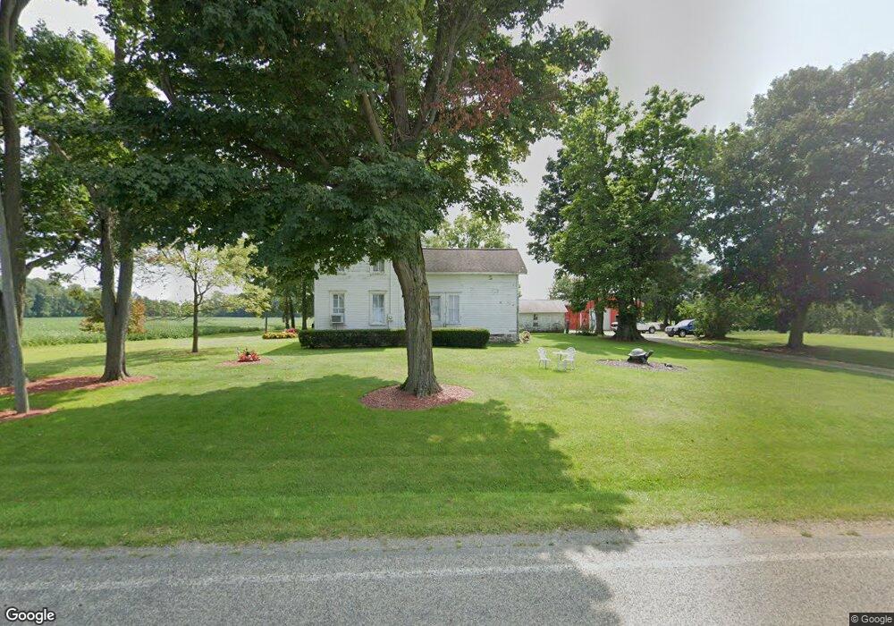
855 E Central Rd Quincy, MI 49082
Estimated Value: $143,000 - $268,000
3
Beds
1
Bath
1,996
Sq Ft
$106/Sq Ft
Est. Value
About This Home
This home is located at 855 E Central Rd, Quincy, MI 49082 and is currently estimated at $211,852, approximately $106 per square foot. 855 E Central Rd is a home located in Branch County with nearby schools including Jennings Elementary School, Quincy Middle School, and Quincy High School.
Ownership History
Date
Name
Owned For
Owner Type
Purchase Details
Closed on
Aug 6, 2024
Sold by
Everline Wallace D and Everline Laura
Bought by
Wallace D And Laura Everline Trust and Everline
Current Estimated Value
Purchase Details
Closed on
Jan 23, 2023
Sold by
Everline Wallace D
Bought by
Everline Wallace D and Everline Laura
Purchase Details
Closed on
Aug 7, 1998
Purchase Details
Closed on
Jul 1, 1993
Sold by
Everline Samuel E and Everline Yvonne
Bought by
Everline Wallace D and Everline Laura L
Create a Home Valuation Report for This Property
The Home Valuation Report is an in-depth analysis detailing your home's value as well as a comparison with similar homes in the area
Purchase History
| Date | Buyer | Sale Price | Title Company |
|---|---|---|---|
| Wallace D And Laura Everline Trust | -- | None Listed On Document | |
| Everline Wallace D | -- | None Listed On Document | |
| -- | $27,000 | -- | |
| Everline Wallace D | $27,000 | -- |
Source: Public Records
Tax History
| Year | Tax Paid | Tax Assessment Tax Assessment Total Assessment is a certain percentage of the fair market value that is determined by local assessors to be the total taxable value of land and additions on the property. | Land | Improvement |
|---|---|---|---|---|
| 2025 | $1,279 | $80,317 | $0 | $0 |
| 2024 | $12 | $74,948 | $0 | $0 |
| 2023 | $443 | $68,572 | $0 | $0 |
| 2022 | $1,160 | $66,083 | $0 | $0 |
| 2021 | $825 | $60,633 | $0 | $0 |
| 2020 | $825 | $59,307 | $0 | $0 |
| 2019 | -- | $61,384 | $0 | $0 |
| 2018 | -- | $58,214 | $0 | $0 |
| 2017 | -- | $54,469 | $0 | $0 |
| 2016 | -- | $48,908 | $0 | $0 |
| 2015 | -- | $49,115 | $0 | $0 |
| 2014 | -- | $50,313 | $0 | $0 |
| 2013 | -- | $47,973 | $0 | $0 |
Source: Public Records
Map
Nearby Homes
- 0 Brocklebank Rd
- 204 Crockett Dr
- 242 Bickford Dr
- 204 Dons Dr
- 727 Skipper Ln
- 202 Dons Dr
- 181 Dons Dr
- 211 S Ray Quincy Rd
- 944 Lukesport Rd
- 808 Rolling Meadows Dr
- 382 W Russell Dr
- 981 Generic Dr
- 481 Quimby Rd
- 201 Wildwood Beach Rd
- 0 Warren Rd
- 585 Berrynoll Ct
- 536 Hickory Ln
- 534 Hickory Ln
- 564 Lake Dr
- 566 Lake Dr Unit A
- 860 E Central Rd
- 849 E Central Rd
- 866 E Central Rd
- 818 E Central Rd
- 262 Brocklebank Rd
- 898 E Central Rd
- 823 E Central Rd
- 263 Brocklebank Rd
- 451 E Central Rd
- 256 Brocklebank Rd
- 913 E Central Rd
- 862 Hall Rd
- 349 Brocklebank Rd
- 236 Brocklebank Rd
- 809 E Central Rd
- 880 Hall Rd
- 845 Hall Rd
- 870 Hall Rd
- 240 Brocklebank Rd
- 246 Brocklebank Rd
Your Personal Tour Guide
Ask me questions while you tour the home.