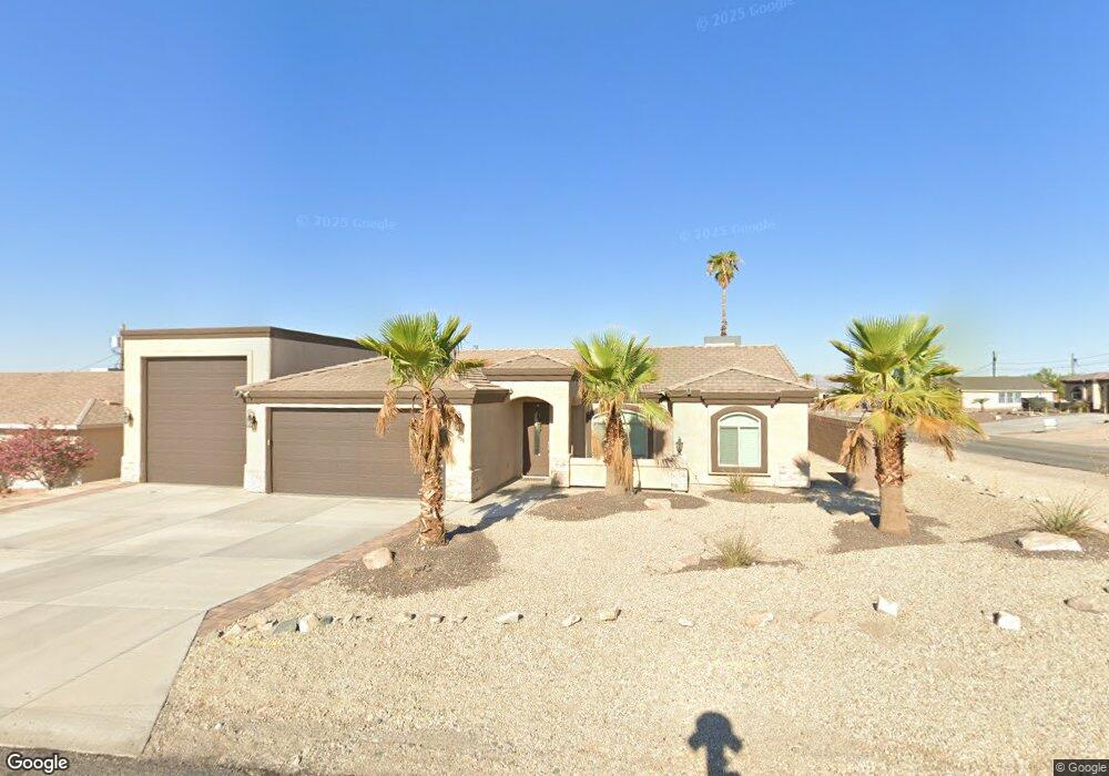
855 Fern Ln Lake Havasu City, AZ 86403
Estimated Value: $591,869 - $660,000
--
Bed
--
Bath
1,586
Sq Ft
$386/Sq Ft
Est. Value
About This Home
This home is located at 855 Fern Ln, Lake Havasu City, AZ 86403 and is currently estimated at $612,217, approximately $386 per square foot. 855 Fern Ln is a home located in Mohave County with nearby schools including Smoketree Elementary School, Thunderbolt Middle School, and Lake Havasu High School.
Ownership History
Date
Name
Owned For
Owner Type
Purchase Details
Closed on
Aug 29, 2019
Sold by
Shafonsky Enterprises Llc
Bought by
Coffman Don D and Coffman Debra A
Current Estimated Value
Purchase Details
Closed on
Apr 2, 2019
Sold by
Shafonsky Kirk
Bought by
Shafonsky Enterprises Llc
Purchase Details
Closed on
Mar 28, 2018
Sold by
Bogue Patricia A
Bought by
Shafonsky Kirk
Purchase Details
Closed on
Apr 13, 2013
Sold by
Bogue Patricia A and Bogue Arlie
Bought by
Bogue Patricia A and Bogue Beuford A
Create a Home Valuation Report for This Property
The Home Valuation Report is an in-depth analysis detailing your home's value as well as a comparison with similar homes in the area
Home Values in the Area
Average Home Value in this Area
Purchase History
| Date | Buyer | Sale Price | Title Company |
|---|---|---|---|
| Coffman Don D | $375,000 | Pioneer Title Agency Inc | |
| Shafonsky Enterprises Llc | -- | None Available | |
| Shafonsky Kirk | $49,000 | Chicago Title Agency Inc | |
| Bogue Patricia A | -- | None Available |
Source: Public Records
Tax History Compared to Growth
Tax History
| Year | Tax Paid | Tax Assessment Tax Assessment Total Assessment is a certain percentage of the fair market value that is determined by local assessors to be the total taxable value of land and additions on the property. | Land | Improvement |
|---|---|---|---|---|
| 2026 | $1,136 | -- | -- | -- |
| 2025 | $2,304 | $49,517 | $0 | $0 |
| 2024 | $2,304 | $52,548 | $0 | $0 |
| 2023 | $2,304 | $46,750 | $0 | $0 |
| 2022 | $2,204 | $35,074 | $0 | $0 |
| 2021 | $2,389 | $33,038 | $0 | $0 |
| 2019 | $333 | $6,334 | $0 | $0 |
| 2018 | $326 | $5,559 | $0 | $0 |
| 2017 | $324 | $5,495 | $0 | $0 |
| 2016 | $305 | $3,049 | $0 | $0 |
| 2015 | $308 | $2,497 | $0 | $0 |
Source: Public Records
Map
Nearby Homes
- 1911 Holly Ave
- 1901 Holly Ave
- 1541 Holly Ave
- 2090 San Juan Dr
- 2257 Barranca Dr
- 2100 Chaparral Dr
- 2162 Runabout Dr
- 2091 Holly Ave
- 2285 Pennant Ln
- 2030 Commander Dr
- 2183 Runabout Dr
- 2301 Sahara Dr
- 2264 Barranca Dr
- 2272 Barranca Dr
- 2148 Sandwood Dr
- 2021 Industrial
- 2050 Kiowa Blvd N
- 1986 Bahama Ave
- 2205 Sandwood Dr
- 2200 Clarke Dr