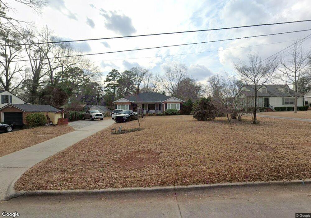
855 Hillcrest Ave Griffin, GA 30224
Spalding County NeighborhoodEstimated Value: $277,000 - $286,000
2
Beds
2
Baths
2,379
Sq Ft
$119/Sq Ft
Est. Value
About This Home
This home is located at 855 Hillcrest Ave, Griffin, GA 30224 and is currently estimated at $282,077, approximately $118 per square foot. 855 Hillcrest Ave is a home located in Spalding County with nearby schools including Futral Road Elementary School, Rehoboth Road Middle School, and Spalding High School.
Ownership History
Date
Name
Owned For
Owner Type
Purchase Details
Closed on
Oct 18, 1991
Sold by
Griffin Mary
Bought by
Cloud Charles R and Cloud Lubowen H
Current Estimated Value
Purchase Details
Closed on
Jan 5, 1990
Sold by
Ward Lillie G and Griffin Mary
Bought by
Griffin Mary
Purchase Details
Closed on
Jun 1, 1973
Sold by
Woodward William M
Bought by
Ward Lillie G and Griffin Mary
Purchase Details
Closed on
Jul 1, 1964
Bought by
Woodward William M
Create a Home Valuation Report for This Property
The Home Valuation Report is an in-depth analysis detailing your home's value as well as a comparison with similar homes in the area
Home Values in the Area
Average Home Value in this Area
Purchase History
| Date | Buyer | Sale Price | Title Company |
|---|---|---|---|
| Cloud Charles R | $66,000 | -- | |
| Griffin Mary | -- | -- | |
| Ward Lillie G | $19,700 | -- | |
| Woodward William M | $6,100 | -- |
Source: Public Records
Tax History
| Year | Tax Paid | Tax Assessment Tax Assessment Total Assessment is a certain percentage of the fair market value that is determined by local assessors to be the total taxable value of land and additions on the property. | Land | Improvement |
|---|---|---|---|---|
| 2025 | $2,527 | $104,034 | $14,000 | $90,034 |
| 2024 | $2,470 | $104,034 | $14,000 | $90,034 |
| 2023 | $2,395 | $90,628 | $14,000 | $76,628 |
| 2022 | $2,152 | $79,836 | $13,200 | $66,636 |
| 2021 | $1,871 | $68,058 | $13,200 | $54,858 |
| 2020 | $1,877 | $68,058 | $13,200 | $54,858 |
| 2019 | $1,330 | $43,492 | $10,560 | $32,932 |
| 2018 | $1,501 | $41,309 | $10,560 | $30,749 |
| 2017 | $1,489 | $41,917 | $10,560 | $31,357 |
| 2016 | $1,359 | $38,270 | $10,560 | $27,710 |
| 2015 | $1,381 | $38,270 | $10,560 | $27,710 |
| 2014 | $1,419 | $38,270 | $10,560 | $27,710 |
Source: Public Records
Map
Nearby Homes
- 722 Maple Dr
- 816 Woodland Dr
- 824 Woodland Dr
- 729 Springer Dr
- 711 Maple Dr
- 411 Terrace St
- 310 Terrace St
- 839 Bieze St
- 505 Kincaid Ave
- 159 Milner Ave
- 1099 Pine Valley Rd
- 923 Mockingbird Ln
- 922 Springer Dr
- 226 Tilney Ave
- 805 Hale Ave
- 874 Crescent Ln Unit 52
- 859 Crescent Ln
- 862 Crescent Ln
- 861 Crescent Ln
- 1541 Zebulon Rd & Unit 4 TRACTS 35 ACRES
- 847 Hillcrest Ave
- 423 Crescent Rd
- 433 Crescent Rd
- 843 Hillcrest Ave
- 850 Hillcrest Ave
- 833 Hillcrest Ave
- 824 Maple Dr
- 812 Maple Dr
- 511 Crescent Rd
- 836 Maple Dr
- 840 Hillcrest Ave
- 810 Maple Dr
- 829 Hillcrest Ave
- 820 Hillcrest Ave
- 827 Hillcrest Ave
- 521 Crescent Rd
- 806 Maple Dr
- 504 Crescent Rd
- 906 Maple Dr
- 531 Crescent Rd
Your Personal Tour Guide
Ask me questions while you tour the home.