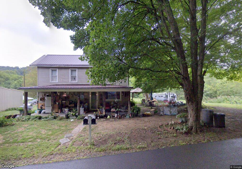
855 Poes Run Rd Londonderry, OH 45647
Estimated Value: $146,000 - $194,000
3
Beds
1
Bath
4,224
Sq Ft
$40/Sq Ft
Est. Value
About This Home
This home is located at 855 Poes Run Rd, Londonderry, OH 45647 and is currently estimated at $169,565, approximately $40 per square foot. 855 Poes Run Rd is a home located in Ross County with nearby schools including Southeastern Elementary School, Southeastern Middle School, and Southeastern High School.
Ownership History
Date
Name
Owned For
Owner Type
Purchase Details
Closed on
Nov 17, 2020
Sold by
Carroll David R and Carroll Deanita J
Bought by
Carroll Chase R and Carroll Cierra
Current Estimated Value
Home Financials for this Owner
Home Financials are based on the most recent Mortgage that was taken out on this home.
Original Mortgage
$84,000
Interest Rate
2.8%
Mortgage Type
New Conventional
Create a Home Valuation Report for This Property
The Home Valuation Report is an in-depth analysis detailing your home's value as well as a comparison with similar homes in the area
Home Values in the Area
Average Home Value in this Area
Purchase History
| Date | Buyer | Sale Price | Title Company |
|---|---|---|---|
| Carroll Chase R | $105,000 | Northwest Ttl Fam Companies |
Source: Public Records
Mortgage History
| Date | Status | Borrower | Loan Amount |
|---|---|---|---|
| Closed | Carroll Chase R | $84,000 |
Source: Public Records
Tax History Compared to Growth
Tax History
| Year | Tax Paid | Tax Assessment Tax Assessment Total Assessment is a certain percentage of the fair market value that is determined by local assessors to be the total taxable value of land and additions on the property. | Land | Improvement |
|---|---|---|---|---|
| 2024 | $1,110 | $32,850 | $15,620 | $17,230 |
| 2023 | $1,110 | $34,920 | $17,690 | $17,230 |
| 2022 | $1,206 | $34,920 | $17,690 | $17,230 |
| 2021 | $1,279 | $32,520 | $17,320 | $15,200 |
| 2020 | $1,307 | $32,520 | $17,320 | $15,200 |
| 2019 | $1,308 | $32,520 | $17,320 | $15,200 |
| 2018 | $1,234 | $30,230 | $15,740 | $14,490 |
| 2017 | $1,236 | $30,230 | $15,740 | $14,490 |
| 2016 | $1,206 | $30,230 | $15,740 | $14,490 |
| 2015 | $1,212 | $30,230 | $15,740 | $14,490 |
| 2014 | $1,185 | $30,230 | $15,740 | $14,490 |
| 2013 | $1,191 | $30,230 | $15,740 | $14,490 |
Source: Public Records
Map
Nearby Homes
- 36665 U S 50
- 32120 Fout Rd
- 52753 Ohio 671
- 31557 French Rd
- 32905 Graves Rd
- 53430 State Route 671
- 30129 Steven Branch Rd
- 26702 E Fork Rd
- 54038 Old Route 50
- 0 State Route 327 Unit 225031635
- 0 E Fork Rd
- 149 Brown Hollow Rd
- 667 Bronx Corner Rd
- 0 Ponetown Rd
- 108 Lane Dr
- 498 Schrader Rd
- 0 Woodruff Rd
- 587 John W Barbee Rd
- 0 Hutt Rd
- 164 Cunningham Rd
- 1067 Poes Run Rd
- 55 Cunningham Rd
- 1149 Poes Run Rd
- 554 Poes Run Rd
- 1172 Poes Run Rd
- 585 Poes Run Rd
- 135 Cunningham Rd
- 1175 Poes Run Rd
- 279 Poes Run Rd
- 1361 Poes Run Rd
- 1445 Poes Run Rd
- 51419 U S 50 Unit Tract 3
- 181 Poes Run Rd
- 109 Poes Run Rd
- 123 Poes Run Rd
- 50421 State Route 671
- 35194 Ohio 327
- 29992 Ohio 327
- Lot #17 Ohio 327