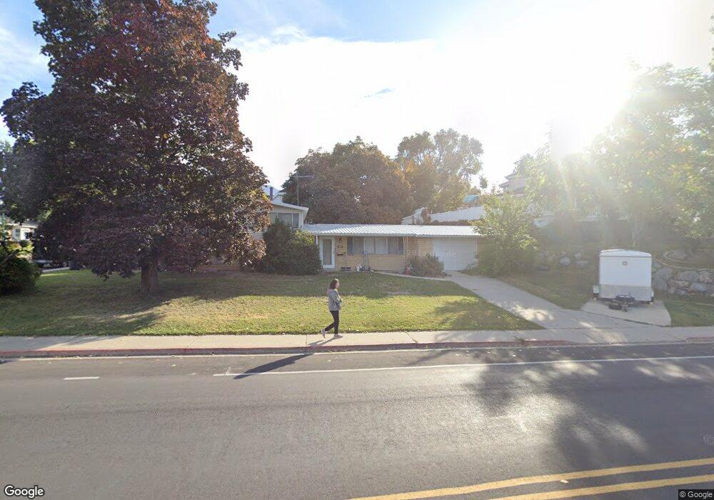
855 S 400 W Orem, UT 84058
Westmore NeighborhoodEstimated Value: $505,000 - $506,000
4
Beds
3
Baths
135
Sq Ft
$3,745/Sq Ft
Est. Value
About This Home
Right across from UVU this is within walking distance to several shopping centers while still being quiet and comfortable.
Ownership History
Date
Name
Owned For
Owner Type
Purchase Details
Closed on
Aug 4, 2023
Sold by
Marble Merrilee Denison
Bought by
Norman Delno Marble And Merrilee Denison Marb and Marble
Current Estimated Value
Purchase Details
Closed on
May 18, 2023
Sold by
Marble Norman D
Bought by
Marble Norman Delno and Marble Merrilee Denison
Home Financials for this Owner
Home Financials are based on the most recent Mortgage that was taken out on this home.
Original Mortgage
$190,000
Interest Rate
6.28%
Mortgage Type
New Conventional
Create a Home Valuation Report for This Property
The Home Valuation Report is an in-depth analysis detailing your home's value as well as a comparison with similar homes in the area
Home Values in the Area
Average Home Value in this Area
Purchase History
| Date | Buyer | Sale Price | Title Company |
|---|---|---|---|
| Norman Delno Marble And Merrilee Denison Marb | -- | Meridian Title Company | |
| Marble Norman Delno | -- | Meridian Title |
Source: Public Records
Mortgage History
| Date | Status | Borrower | Loan Amount |
|---|---|---|---|
| Previous Owner | Marble Norman Delno | $190,000 |
Source: Public Records
Property History
| Date | Event | Price | List to Sale | Price per Sq Ft |
|---|---|---|---|---|
| 09/27/2025 09/27/25 | Off Market | $600 | -- | -- |
| 08/25/2025 08/25/25 | For Rent | $600 | -- | -- |
Tax History
| Year | Tax Paid | Tax Assessment Tax Assessment Total Assessment is a certain percentage of the fair market value that is determined by local assessors to be the total taxable value of land and additions on the property. | Land | Improvement |
|---|---|---|---|---|
| 2025 | $1,935 | $246,235 | -- | -- |
| 2024 | $1,935 | $236,555 | $0 | $0 |
| 2023 | $1,801 | $236,720 | $0 | $0 |
| 2022 | $1,804 | $229,680 | $0 | $0 |
| 2021 | $1,677 | $323,500 | $178,100 | $145,400 |
| 2020 | $1,504 | $285,000 | $142,500 | $142,500 |
| 2019 | $1,390 | $274,000 | $131,500 | $142,500 |
| 2018 | $1,259 | $237,100 | $113,200 | $123,900 |
| 2017 | $1,193 | $120,395 | $0 | $0 |
| 2016 | $1,168 | $108,625 | $0 | $0 |
| 2015 | $1,132 | $99,550 | $0 | $0 |
| 2014 | $1,085 | $94,985 | $0 | $0 |
Source: Public Records
Map
Nearby Homes
- 308 W 730 S
- 217 W 900 S
- 881 S 635 W
- 193 W 530 S
- 842 S 50 E
- 55 Hanover Dr
- 1068 S Ellen Cir
- 912 S 100 E
- 1700 S Sandhill Rd Unit F401
- 570 S 800 West St Unit 15
- 510 S 20 E
- 442 W 1430 S Unit 421
- 87 E 600 S Unit D
- 139 E 800 S
- 56 E 1100 S
- 1121 S 50 E
- 520 S 800 W Unit 14
- 506 S 800 West St Unit 13
- 1445 S 430 W
- 216 S 400 W
Your Personal Tour Guide
Ask me questions while you tour the home.