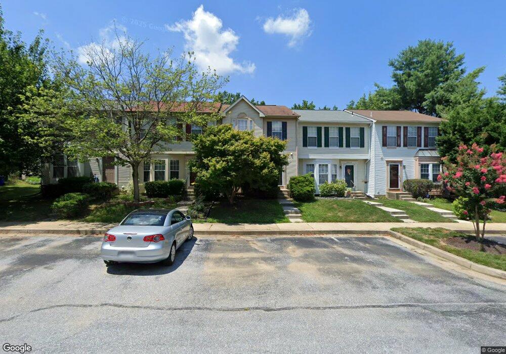
8552 Black Star Cir Columbia, MD 21045
Long Reach NeighborhoodEstimated Value: $350,097 - $453,000
--
Bed
3
Baths
1,360
Sq Ft
$287/Sq Ft
Est. Value
About This Home
This home is located at 8552 Black Star Cir, Columbia, MD 21045 and is currently estimated at $390,774, approximately $287 per square foot. 8552 Black Star Cir is a home located in Howard County with nearby schools including Waterloo Elementary School, Mayfield Woods Middle School, and Long Reach High School.
Ownership History
Date
Name
Owned For
Owner Type
Purchase Details
Closed on
Nov 5, 1999
Sold by
Williams Annie M
Bought by
Chung Hsin
Current Estimated Value
Purchase Details
Closed on
May 11, 1992
Sold by
Ryland Group Inc The
Bought by
Williams Annie M
Purchase Details
Closed on
Jan 14, 1991
Sold by
Howard Research Develop Corp The
Bought by
Ryland Group Inc The
Home Financials for this Owner
Home Financials are based on the most recent Mortgage that was taken out on this home.
Original Mortgage
$1,100,000
Interest Rate
9.63%
Create a Home Valuation Report for This Property
The Home Valuation Report is an in-depth analysis detailing your home's value as well as a comparison with similar homes in the area
Home Values in the Area
Average Home Value in this Area
Purchase History
| Date | Buyer | Sale Price | Title Company |
|---|---|---|---|
| Chung Hsin | $133,000 | -- | |
| Williams Annie M | $127,400 | -- | |
| Ryland Group Inc The | $1,404,000 | -- |
Source: Public Records
Mortgage History
| Date | Status | Borrower | Loan Amount |
|---|---|---|---|
| Previous Owner | Ryland Group Inc The | $1,100,000 |
Source: Public Records
Tax History Compared to Growth
Tax History
| Year | Tax Paid | Tax Assessment Tax Assessment Total Assessment is a certain percentage of the fair market value that is determined by local assessors to be the total taxable value of land and additions on the property. | Land | Improvement |
|---|---|---|---|---|
| 2025 | $4,805 | $321,167 | $0 | $0 |
| 2024 | $4,805 | $304,433 | $0 | $0 |
| 2023 | $4,514 | $287,700 | $130,000 | $157,700 |
| 2022 | $3,136 | $278,467 | $0 | $0 |
| 2021 | $4,194 | $269,233 | $0 | $0 |
| 2020 | $4,127 | $260,000 | $91,000 | $169,000 |
| 2019 | $3,749 | $260,000 | $91,000 | $169,000 |
| 2018 | $3,871 | $260,000 | $91,000 | $169,000 |
| 2017 | $3,880 | $277,200 | $0 | $0 |
| 2016 | $696 | $260,600 | $0 | $0 |
| 2015 | $696 | $244,000 | $0 | $0 |
| 2014 | $679 | $227,400 | $0 | $0 |
Source: Public Records
Map
Nearby Homes
- 8709 Hayshed Ln Unit 13
- 8373 Silver Trumpet Dr
- 8704 Tamar Dr
- 8790 Tamar Dr
- 6118 Starburn Path
- 6125 Honeycomb Gate
- 8611 Open Meadow Way
- 6137 Quiet Times
- 6119 Starburn Path
- 8611 Meadowsweet Ct
- 5901 Millrace Ct
- 5941 Millrace Ct Unit D101
- 6238 Deep Earth Ln
- 8602 Hayshed Ln
- 5803 Lois Ln
- 5810 Lois Ln
- 5642 Waterloo Rd
- 8854 Spiral Cut Unit LG40
- 5948 Logans Way
- 6028 Talbot Dr
- 8554 Black Star Cir
- 8550 Black Star Cir
- 8556 Black Star Cir
- 8548 Black Star Cir
- 8558 Black Star Cir
- 8560 Black Star Cir
- 8536 Black Star Cir
- 8534 Black Star Cir
- 8538 Black Star Cir
- 8532 Black Star Cir
- 8562 Black Star Cir
- 8530 Black Star Cir
- 8528 Black Star Cir
- 8564 Black Star Cir
- 8583 Black Star Cir
- 8585 Black Star Cir
- 8581 Black Star Cir
- 8526 Black Star Cir
- 8587 Black Star Cir
- 8579 Black Star Cir