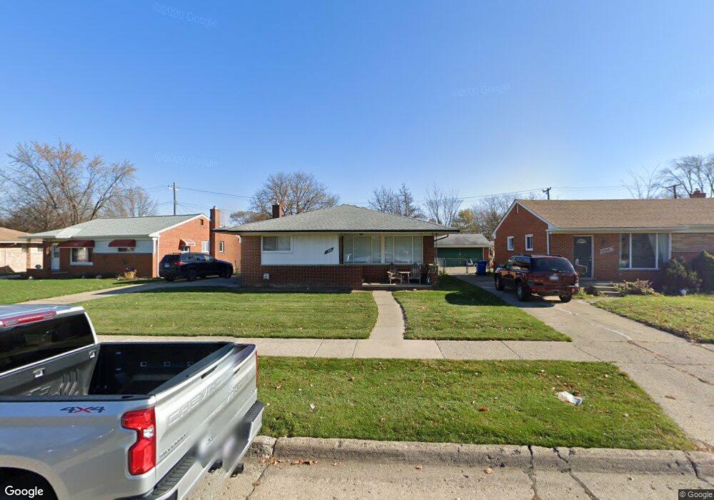
8555 Francine St Warren, MI 48093
Northeast Warren NeighborhoodEstimated Value: $214,773 - $241,000
--
Bed
1
Bath
1,048
Sq Ft
$217/Sq Ft
Est. Value
About This Home
This home is located at 8555 Francine St, Warren, MI 48093 and is currently estimated at $227,193, approximately $216 per square foot. 8555 Francine St is a home located in Macomb County with nearby schools including Cromie Elementary School, Carter Middle School, and Paul K. Cousino High School.
Ownership History
Date
Name
Owned For
Owner Type
Purchase Details
Closed on
Jun 29, 2018
Sold by
Durecki Barbara A
Bought by
Hwozdecky Justin Walter and Hwozdecky Rose Anne
Current Estimated Value
Home Financials for this Owner
Home Financials are based on the most recent Mortgage that was taken out on this home.
Original Mortgage
$90,000
Outstanding Balance
$66,698
Interest Rate
4.6%
Mortgage Type
New Conventional
Estimated Equity
$160,495
Purchase Details
Closed on
Apr 19, 2011
Sold by
Durecki Dorothy R and Durecki E C
Bought by
Durecki Dorothy R
Create a Home Valuation Report for This Property
The Home Valuation Report is an in-depth analysis detailing your home's value as well as a comparison with similar homes in the area
Home Values in the Area
Average Home Value in this Area
Purchase History
| Date | Buyer | Sale Price | Title Company |
|---|---|---|---|
| Hwozdecky Justin Walter | -- | None Available | |
| Durecki Dorothy R | -- | None Available |
Source: Public Records
Mortgage History
| Date | Status | Borrower | Loan Amount |
|---|---|---|---|
| Open | Hwozdecky Justin Walter | $90,000 |
Source: Public Records
Tax History Compared to Growth
Tax History
| Year | Tax Paid | Tax Assessment Tax Assessment Total Assessment is a certain percentage of the fair market value that is determined by local assessors to be the total taxable value of land and additions on the property. | Land | Improvement |
|---|---|---|---|---|
| 2025 | $3,516 | $104,450 | $0 | $0 |
| 2024 | $3,413 | $96,900 | $0 | $0 |
| 2023 | $3,235 | $88,410 | $0 | $0 |
| 2022 | $3,152 | $79,520 | $0 | $0 |
| 2021 | $3,074 | $74,020 | $0 | $0 |
| 2020 | $2,969 | $66,550 | $0 | $0 |
| 2019 | $2,854 | $62,530 | $0 | $0 |
| 2018 | $2,864 | $58,050 | $0 | $0 |
| 2017 | $2,799 | $53,580 | $10,680 | $42,900 |
| 2016 | $2,783 | $53,580 | $0 | $0 |
| 2015 | -- | $48,870 | $0 | $0 |
| 2013 | $2,201 | $39,950 | $0 | $0 |
Source: Public Records
Map
Nearby Homes
- 28031 Lorraine Ave
- 8460 Busko Ave
- 8263 Linda St
- 8475 Farnum Ave
- 8210 Linda St
- 8250 Gerald Ave
- 8147 Busko St
- 8210 Hettenberger Ave
- 11234 Irvington Dr
- 27524 Gail Dr
- 11011 Garbor Dr
- 27506 Lorraine Ave
- 27566 Concord Ave
- 28876 Palm Beach Dr
- 8475 Stout Ave
- 27263 Arsenal Ave
- 29150 Geraldine Ct
- 11483 Newbern Dr
- 11511 Gerald Dr
- 29242 Lorraine Ct
- 8567 Francine St
- 8541 Francine St
- 8579 Francine St
- 28151 Lorraine Ave
- 28163 Lorraine Ave
- 28139 Lorraine Ave
- 8531 Francine St
- 8506 Francine St
- 28175 Lorraine Ave
- 8593 Francine St
- 28127 Lorraine Ave
- 8523 Francine St
- 28187 Lorraine Ave
- 28115 Lorraine Ave
- 8515 Francine St
- 8494 Francine St
- 8505 Francine St
- 28199 Lorraine Ave
- 8559 Darlene St
- 8482 Francine St
