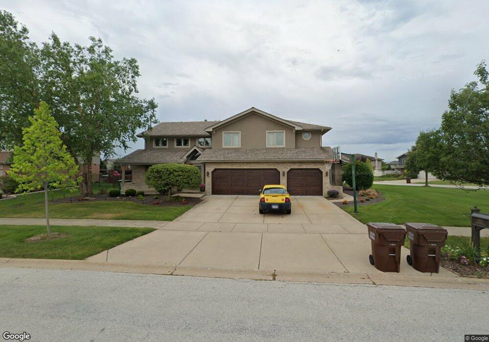
8555 Monaghan Dr Tinley Park, IL 60487
Brookside Glen NeighborhoodEstimated Value: $649,000 - $761,000
6
Beds
5
Baths
4,853
Sq Ft
$141/Sq Ft
Est. Value
About This Home
This home is located at 8555 Monaghan Dr, Tinley Park, IL 60487 and is currently estimated at $683,328, approximately $140 per square foot. 8555 Monaghan Dr is a home located in Will County with nearby schools including Summit Hill Junior High School, Lincoln-Way East High School, and Noonan Elementary Academy.
Ownership History
Date
Name
Owned For
Owner Type
Purchase Details
Closed on
Aug 23, 2006
Sold by
Marquette Bank
Bought by
Kuzur Michael G and Kuzur Katalin
Current Estimated Value
Home Financials for this Owner
Home Financials are based on the most recent Mortgage that was taken out on this home.
Original Mortgage
$365,000
Outstanding Balance
$218,425
Interest Rate
6.7%
Mortgage Type
Purchase Money Mortgage
Estimated Equity
$464,903
Create a Home Valuation Report for This Property
The Home Valuation Report is an in-depth analysis detailing your home's value as well as a comparison with similar homes in the area
Home Values in the Area
Average Home Value in this Area
Purchase History
| Date | Buyer | Sale Price | Title Company |
|---|---|---|---|
| Kuzur Michael G | $481,500 | Chicago Title Insurance Co |
Source: Public Records
Mortgage History
| Date | Status | Borrower | Loan Amount |
|---|---|---|---|
| Open | Kuzur Michael G | $365,000 |
Source: Public Records
Tax History Compared to Growth
Tax History
| Year | Tax Paid | Tax Assessment Tax Assessment Total Assessment is a certain percentage of the fair market value that is determined by local assessors to be the total taxable value of land and additions on the property. | Land | Improvement |
|---|---|---|---|---|
| 2024 | $17,357 | $212,076 | $39,492 | $172,584 |
| 2023 | $17,357 | $189,404 | $35,270 | $154,134 |
| 2022 | $16,884 | $172,515 | $32,125 | $140,390 |
| 2021 | $15,334 | $161,395 | $30,054 | $131,341 |
| 2020 | $15,240 | $156,846 | $29,207 | $127,639 |
| 2019 | $14,850 | $152,648 | $28,425 | $124,223 |
| 2018 | $13,945 | $148,260 | $27,608 | $120,652 |
| 2017 | $13,942 | $144,800 | $26,964 | $117,836 |
| 2016 | $13,791 | $139,836 | $26,040 | $113,796 |
| 2015 | $12,771 | $134,912 | $25,123 | $109,789 |
| 2014 | $12,771 | $133,974 | $24,948 | $109,026 |
| 2013 | $12,771 | $135,711 | $25,271 | $110,440 |
Source: Public Records
Map
Nearby Homes
- 19829 Silverside Dr
- 8607 Glenshire St
- 8500 Brookside Glen Dr
- 19608 Ridgemont Dr
- 19536 Tramore Ln
- 19502 Tramore Ln
- 19503 Waterford Ln
- 19504 Waterford Ln
- 19501 Waterford Ln
- 24455 S 88th Ave
- 20158 S Rosewood Dr
- 8803 Willow Ln Unit MODEL
- 8510 W Saint Francis Rd
- 20252 Pepperwood Ct
- 191 S 88th Ave
- 8025 Stonegate Dr
- 8124 Glenbrook Place Unit 1
- 8036 Highfield Ct
- 20408 Fallingwater Cir
- 20375 Grosse Point Dr Unit 102
- 8543 Monaghan Dr
- 19815 Silverside Dr
- 8611 Monaghan Dr
- 19814 Silverside Dr
- 8556 Monaghan Dr
- 8548 Monaghan Dr
- 19802 Clare Dr
- 19819 Silverside Dr
- 19822 Silverside Dr
- 8612 Monaghan Dr
- 19806 Clare Dr
- 8542 Monaghan Dr
- 8536 Monaghan Dr
- 19814 Clare Dr
- 19817 Tulla Ct
- 19737 Silverside Dr
- 19828 Silverside Dr
- 19821 Tulla Ct
- 8616 Monaghan Dr
- 19824 Clare Dr