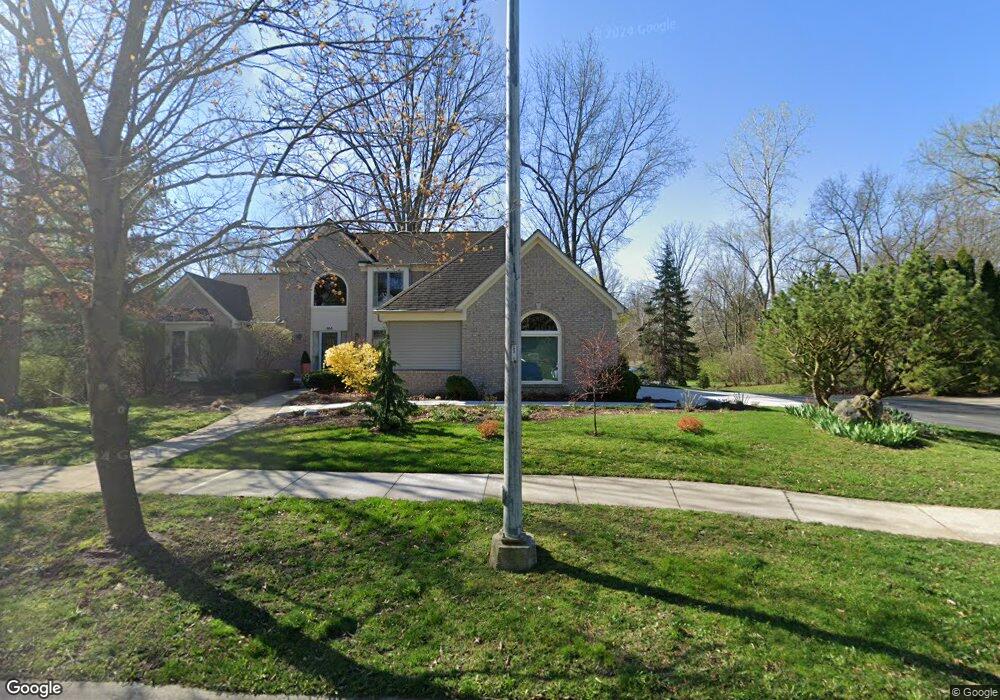
856 Brookside Dr Unit 31 Ann Arbor, MI 48105
Northern Ann Arbor NeighborhoodEstimated Value: $575,967 - $753,000
4
Beds
3
Baths
2,230
Sq Ft
$292/Sq Ft
Est. Value
About This Home
This home is located at 856 Brookside Dr Unit 31, Ann Arbor, MI 48105 and is currently estimated at $651,992, approximately $292 per square foot. 856 Brookside Dr Unit 31 is a home located in Washtenaw County with nearby schools including Ann Arbor STEAM at Northside, Clague Middle School, and Skyline High School.
Ownership History
Date
Name
Owned For
Owner Type
Purchase Details
Closed on
Jun 15, 2009
Sold by
Rex Lesley A
Bought by
Pletcher Scott and Gendron Christi
Current Estimated Value
Purchase Details
Closed on
Jul 16, 2002
Sold by
Rex Lesley A Trust
Bought by
Rex Lesley A Trust
Purchase Details
Closed on
Jun 21, 1997
Sold by
Mckay Douglas L
Bought by
Rex Lesley A
Home Financials for this Owner
Home Financials are based on the most recent Mortgage that was taken out on this home.
Original Mortgage
$163,000
Interest Rate
7.68%
Mortgage Type
New Conventional
Create a Home Valuation Report for This Property
The Home Valuation Report is an in-depth analysis detailing your home's value as well as a comparison with similar homes in the area
Home Values in the Area
Average Home Value in this Area
Purchase History
| Date | Buyer | Sale Price | Title Company |
|---|---|---|---|
| Pletcher Scott | $345,000 | Liberty Title | |
| Rex Lesley A Trust | -- | -- | |
| Rex Lesley A | $255,000 | -- |
Source: Public Records
Mortgage History
| Date | Status | Borrower | Loan Amount |
|---|---|---|---|
| Previous Owner | Rex Lesley A | $163,000 |
Source: Public Records
Tax History
| Year | Tax Paid | Tax Assessment Tax Assessment Total Assessment is a certain percentage of the fair market value that is determined by local assessors to be the total taxable value of land and additions on the property. | Land | Improvement |
|---|---|---|---|---|
| 2025 | $9,617 | $285,700 | $0 | $0 |
| 2024 | $8,956 | $274,700 | $0 | $0 |
| 2023 | $8,258 | $258,500 | $0 | $0 |
| 2022 | $8,998 | $239,600 | $0 | $0 |
| 2021 | $8,786 | $238,200 | $0 | $0 |
| 2020 | $8,609 | $216,500 | $0 | $0 |
| 2019 | $8,193 | $203,900 | $203,900 | $0 |
| 2018 | $8,078 | $190,000 | $0 | $0 |
| 2017 | $7,858 | $185,500 | $0 | $0 |
| 2016 | $6,693 | $157,128 | $0 | $0 |
| 2015 | $7,219 | $156,659 | $0 | $0 |
| 2014 | $7,219 | $151,764 | $0 | $0 |
| 2013 | -- | $151,764 | $0 | $0 |
Source: Public Records
Map
Nearby Homes
- 502 Larkspur St
- 374 Hilldale Dr
- 352 Manor Dr
- 1713 Pontiac Trail
- 1621 Peach St
- 704 Amherst Ave
- 2757 Polson St
- 2793 Bristol Ridge Dr Unit 45
- 2783 Bristol Ridge Dr Unit 40
- 2778 Bristol Ridge Dr Unit 38
- 2776 Bristol Ridge Dr Unit 37
- 2772 Bristol Ridge Dr Unit 35
- 2774 Bristol Ridge Dr Unit 36
- 2768 S Knightsbridge Cir
- 2738 S Knightsbridge Cir
- 2981 Havre St
- 2887 Dillon Dr
- 2994 Montana Way
- 1858 Upland Dr
- 2678 S Knightsbridge Cir Unit 24
- 866 Brookside Dr Unit 30
- 2018 Pontiac Trail
- 2018 Pontiac Trail Unit 1
- 2059 Tibbits Ct
- 836 Brookside Dr
- 2069 Tibbits Ct Unit 29
- 2049 Tibbits Ct Unit 27
- 816 Brookside Dr
- 2039 Tibbits Ct
- 0 Tibbits Ct
- 865 Brookside Dr Unit 9
- 806 Brookside Dr
- 2029 Tibbits Ct Unit 25
- 873 Brookside Dr Unit 10
- 2050 Tibbits Ct
- 2040 Tibbits Ct Unit 19
- 881 Brookside Dr
- 2060 Tibbits Ct
- 2070 Tibbits Ct Unit 16
- 841 Brookside Dr Unit 6
Your Personal Tour Guide
Ask me questions while you tour the home.