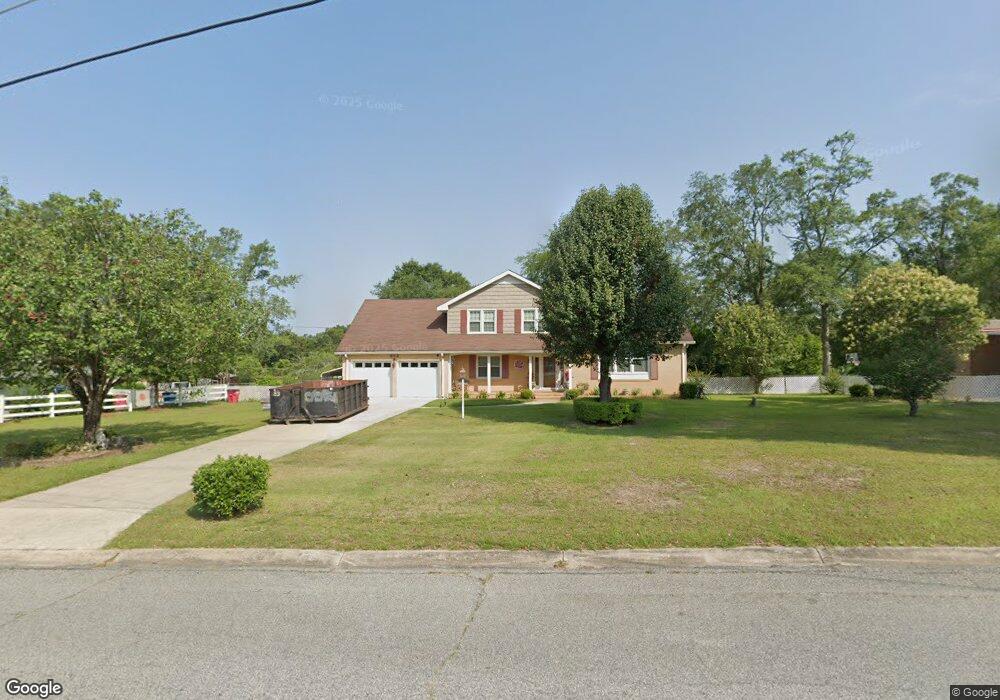
856 Mccall Rd Macon, GA 31217
Estimated Value: $156,000 - $211,000
5
Beds
3
Baths
2,217
Sq Ft
$80/Sq Ft
Est. Value
About This Home
This home is located at 856 Mccall Rd, Macon, GA 31217 and is currently estimated at $177,334, approximately $79 per square foot. 856 Mccall Rd is a home located in Bibb County with nearby schools including Bernd Elementary School, Appling Middle School, and Northeast High School.
Ownership History
Date
Name
Owned For
Owner Type
Purchase Details
Closed on
Oct 9, 2006
Sold by
Husan Jan H
Bought by
Adeen Ephrain
Current Estimated Value
Purchase Details
Closed on
Dec 8, 2005
Sold by
Adeen Ephraim Husam
Bought by
Adeen Ephraim Husam and Adeen Jan H Husam
Purchase Details
Closed on
Jul 20, 2005
Sold by
Jackson Alphonso
Bought by
Aeen Ephraim Husam and Adeen Jan H Husam
Purchase Details
Closed on
Jan 10, 2005
Purchase Details
Closed on
Jan 4, 2005
Create a Home Valuation Report for This Property
The Home Valuation Report is an in-depth analysis detailing your home's value as well as a comparison with similar homes in the area
Home Values in the Area
Average Home Value in this Area
Purchase History
| Date | Buyer | Sale Price | Title Company |
|---|---|---|---|
| Adeen Ephrain | -- | None Avilebel | |
| Adeen Ephraim Husam | -- | None Avilebel | |
| Adeen Ephraim Husam | -- | None Avilebel | |
| Aeen Ephraim Husam | $94,100 | None Available | |
| -- | $118,700 | -- | |
| -- | $118,700 | -- | |
| Washington Mutual Bank Fa | $118,698 | None Available |
Source: Public Records
Tax History Compared to Growth
Tax History
| Year | Tax Paid | Tax Assessment Tax Assessment Total Assessment is a certain percentage of the fair market value that is determined by local assessors to be the total taxable value of land and additions on the property. | Land | Improvement |
|---|---|---|---|---|
| 2025 | $1,557 | $63,377 | $5,280 | $58,097 |
| 2024 | $1,610 | $63,377 | $5,280 | $58,097 |
| 2023 | $1,443 | $56,811 | $3,922 | $52,889 |
| 2022 | $1,205 | $41,791 | $6,670 | $35,121 |
| 2021 | $1,322 | $41,791 | $6,670 | $35,121 |
| 2020 | $1,351 | $41,791 | $6,670 | $35,121 |
| 2019 | $1,510 | $45,574 | $6,670 | $38,904 |
| 2018 | $1,776 | $33,626 | $6,670 | $26,956 |
| 2017 | $998 | $33,626 | $6,670 | $26,956 |
| 2016 | $921 | $33,625 | $6,670 | $26,956 |
| 2015 | $1,304 | $33,625 | $6,670 | $26,956 |
| 2014 | $1,551 | $33,625 | $6,670 | $26,956 |
Source: Public Records
Map
Nearby Homes
- 860 Morningside Dr
- 2370 Recreation Rd
- 2675 Andy Dr
- 2720 Jordan Ave
- 2750 Lakeshore Dr
- 2130 New Clinton Rd
- 2066 Melton Ave
- 4436 Jeffersonville Rd
- 875 Artic Cir
- 2229 New Clinton Rd
- 1840 Kinder Kare Dr
- 1818 Kinder Kare Dr
- 3164 Riggins Mill Rd
- 875 Artic Place
- 2146 Melton Ave
- 837 Artic Cir
- 3380 Goodwin Ln
- 909 Johnson St
- 2954 Tyler Place
- 2940 Shurling Dr
- 854 Mccall Rd
- 872 Mccall Rd
- 848 Mccall Rd
- 880 Mccall Rd
- 859 Mccall Rd
- 849 Mccall Rd
- 845 Morningside Dr
- 832 Mccall Rd
- 879 Mccall Rd
- 853 Morningside Dr
- 863 Morningside Dr
- 892 Mccall Rd
- 843 Mccall Rd
- 867 Morningside Dr
- 829 Morningside Dr
- 873 Morningside Dr
- 881 Morningside Dr
- 904 Irving Dr
- 881 Mccall Rd
- 831 Mccall Rd