Estimated Value: $356,187 - $393,000
--
Bed
1
Bath
1,277
Sq Ft
$292/Sq Ft
Est. Value
About This Home
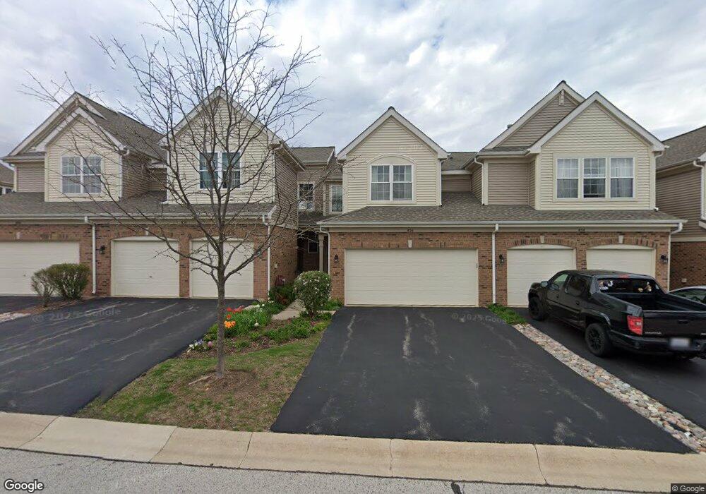
This home is located at 856 Mckenzie Station Dr, Lisle, IL 60532 and is currently estimated at $372,297, approximately $291 per square foot. 856 Mckenzie Station Dr is a home located in DuPage County with nearby schools including Lisle Elementary School, Lisle Jr High School, and Lisle High School.
Ownership History
Date
Name
Owned For
Owner Type
Purchase Details
Closed on
Aug 1, 2003
Sold by
Loconsole George
Bought by
Svec Christine
Current Estimated Value
Home Financials for this Owner
Home Financials are based on the most recent Mortgage that was taken out on this home.
Original Mortgage
$100,000
Outstanding Balance
$19,275
Interest Rate
5.47%
Mortgage Type
Purchase Money Mortgage
Estimated Equity
$353,022
Purchase Details
Closed on
Jun 22, 2001
Sold by
Theisen Scott A and Theisen Melissa S
Bought by
Loconsole George
Home Financials for this Owner
Home Financials are based on the most recent Mortgage that was taken out on this home.
Original Mortgage
$169,600
Interest Rate
7.27%
Purchase Details
Closed on
Nov 1, 1996
Sold by
The Ryland Group Inc
Bought by
Theisen Scott A and Theisen Melissa S
Home Financials for this Owner
Home Financials are based on the most recent Mortgage that was taken out on this home.
Original Mortgage
$162,000
Interest Rate
7.74%
Mortgage Type
Balloon
Create a Home Valuation Report for This Property
The Home Valuation Report is an in-depth analysis detailing your home's value as well as a comparison with similar homes in the area
Home Values in the Area
Average Home Value in this Area
Purchase History
| Date | Buyer | Sale Price | Title Company |
|---|---|---|---|
| Svec Christine | $243,000 | -- | |
| Loconsole George | $212,000 | -- | |
| Theisen Scott A | $181,000 | -- |
Source: Public Records
Mortgage History
| Date | Status | Borrower | Loan Amount |
|---|---|---|---|
| Open | Svec Christine | $100,000 | |
| Previous Owner | Loconsole George | $169,600 | |
| Previous Owner | Theisen Scott A | $162,000 |
Source: Public Records
Tax History Compared to Growth
Tax History
| Year | Tax Paid | Tax Assessment Tax Assessment Total Assessment is a certain percentage of the fair market value that is determined by local assessors to be the total taxable value of land and additions on the property. | Land | Improvement |
|---|---|---|---|---|
| 2024 | $6,438 | $104,574 | $24,007 | $80,567 |
| 2023 | $6,099 | $95,440 | $21,910 | $73,530 |
| 2022 | $6,030 | $90,900 | $20,870 | $70,030 |
| 2021 | $5,833 | $87,460 | $20,080 | $67,380 |
| 2020 | $5,582 | $85,890 | $19,720 | $66,170 |
| 2019 | $5,468 | $82,180 | $18,870 | $63,310 |
| 2018 | $5,948 | $83,600 | $19,200 | $64,400 |
| 2017 | $5,887 | $80,780 | $18,550 | $62,230 |
| 2016 | $5,745 | $77,860 | $17,880 | $59,980 |
| 2015 | $5,479 | $71,110 | $16,840 | $54,270 |
| 2014 | $5,309 | $68,550 | $16,230 | $52,320 |
| 2013 | $5,208 | $68,720 | $16,270 | $52,450 |
Source: Public Records
Map
Nearby Homes
- 875 Mckenzie Station Dr
- 4721 Saint Joseph Creek Rd Unit 1B
- 4721 Saint Joseph Creek Rd Unit 4A
- 4711 Saint Joseph Creek Rd Unit 4H
- 4906 Center Ave
- 1002 Ogden Ave
- 4542 Basswood Dr
- 4703 Garfield Ave
- Lots 02,03,12,13,14, Southport Ave
- 1161 Lisle Place
- 4705 Elm St
- 000 Main St
- 1510A Burlington Ave
- 4610 Dumoulin Ave
- 5201 Riverview Dr
- 752 Rolling Dr
- 1007 Rolling Dr
- 1632 Ogden Ave
- Lots 010, 011 Route 53
- 4617 Devon Ave
- 854 Mckenzie Station Dr
- 860 Mckenzie Station Dr
- 852 Mckenzie Station Dr
- 850 Mckenzie Station Dr
- 820 Mckenzie Station Dr
- 885 Mckenzie Station Dr
- 883 Mckenzie Station Dr
- 887 Mckenzie Station Dr
- 818 Mckenzie Station Dr
- 859 Mckenzie Station Dr
- 857 Mckenzie Station Dr
- 889 Mckenzie Station Dr
- 855 Mckenzie Station Dr
- 861 Mckenzie Station Dr
- 853 Mckenzie Station Dr
- 891 Mckenzie Station Dr
- 816 Mckenzie Station Dr
- 851 Mckenzie Station Dr
- 863 Mckenzie Station Dr
- 893 Mckenzie Station Dr