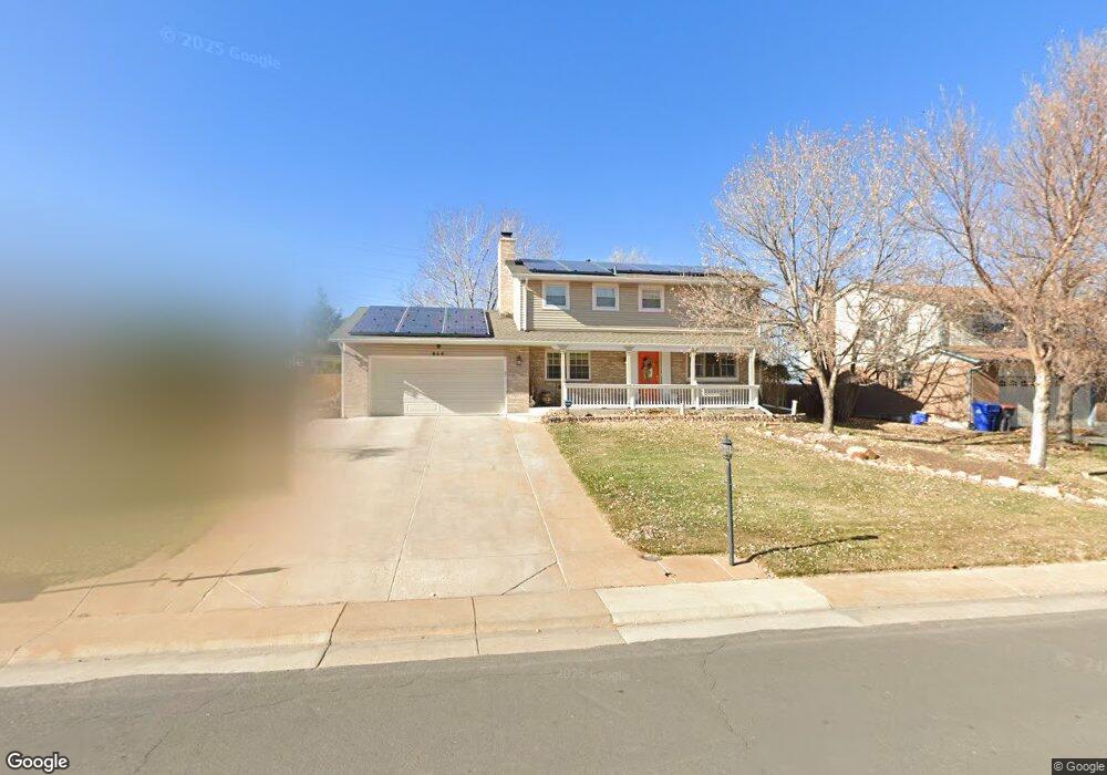
856 Mercury Cir Lone Tree, CO 80124
Estimated Value: $612,708 - $677,000
3
Beds
3
Baths
1,936
Sq Ft
$333/Sq Ft
Est. Value
About This Home
This home is located at 856 Mercury Cir, Lone Tree, CO 80124 and is currently estimated at $644,854, approximately $333 per square foot. 856 Mercury Cir is a home located in Douglas County with nearby schools including Acres Green Elementary School, Cresthill Middle School, and Highlands Ranch High School.
Ownership History
Date
Name
Owned For
Owner Type
Purchase Details
Closed on
Oct 6, 2010
Sold by
Ervin Rodney D and Ervin Deborah J
Bought by
Ervin Rodney D and Ervin Deborah J
Current Estimated Value
Purchase Details
Closed on
Jul 30, 1993
Sold by
Warner Dale Warner C and Warner Diane T
Bought by
Ervin Rodney D and Ervin Deborah J
Purchase Details
Closed on
Dec 15, 1983
Sold by
Johnson & Sons Const Inc
Bought by
Warner C Dale C and Warner Diane T
Create a Home Valuation Report for This Property
The Home Valuation Report is an in-depth analysis detailing your home's value as well as a comparison with similar homes in the area
Home Values in the Area
Average Home Value in this Area
Purchase History
| Date | Buyer | Sale Price | Title Company |
|---|---|---|---|
| Ervin Rodney D | -- | None Available | |
| Ervin Rodney D | $132,500 | -- | |
| Warner C Dale C | $109,000 | -- |
Source: Public Records
Tax History
| Year | Tax Paid | Tax Assessment Tax Assessment Total Assessment is a certain percentage of the fair market value that is determined by local assessors to be the total taxable value of land and additions on the property. | Land | Improvement |
|---|---|---|---|---|
| 2025 | $3,105 | $39,790 | $9,190 | $30,600 |
| 2024 | $3,105 | $44,220 | $10,040 | $34,180 |
| 2023 | $3,137 | $44,220 | $10,040 | $34,180 |
| 2022 | $2,193 | $31,580 | $8,530 | $23,050 |
| 2021 | $2,281 | $31,580 | $8,530 | $23,050 |
| 2020 | $2,165 | $31,100 | $7,800 | $23,300 |
| 2019 | $2,172 | $31,100 | $7,800 | $23,300 |
| 2018 | $1,622 | $26,350 | $7,070 | $19,280 |
| 2017 | $1,648 | $26,350 | $7,070 | $19,280 |
| 2016 | $1,396 | $23,850 | $6,420 | $17,430 |
| 2015 | $1,428 | $23,850 | $6,420 | $17,430 |
| 2014 | $556 | $19,540 | $3,980 | $15,560 |
Source: Public Records
Map
Nearby Homes
- 13226 Canopus Dr
- 8852 Chestnut Hill Ln
- 789 Mercury Cir
- 6823 Edgewood Place
- 9345 Erminedale Dr
- 7191 Palisade Dr
- 8049 Sweet Water Rd
- 6483 Laguna Cir
- 8159 Lodgepole Trail
- 8046 Lodgepole Trail
- 8214 Lodgepole Trail
- 9466 Wiltshire Dr
- 9390 Yale Ln
- 6494 Silver Mesa Dr Unit A
- 8638 Gold Peak Dr Unit D
- 8626 Gold Peak Dr Unit B
- 6452 Silver Mesa Dr Unit A
- 8614 Gold Peak Dr Unit B
- 8578 Gold Peak Dr Unit C
- 7459 La Quinta Place
- 854 Mercury Cir
- 858 Mercury Cir
- 855 Mercury Cir
- 848 Mercury Cir
- 849 Mercury Cir
- 864 Mercury Cir
- 859 Mercury Cir
- 845 Mercury Cir
- 866 Mercury Cir
- 844 Mercury Cir
- 13245 Canopus Dr
- 839 Mercury Cir
- 13173 Hadar Dr
- 13193 Canopus Dr
- 832 Mercury Cir
- 868 Mercury Cir
- 13256 Canopus Dr
- 835 Mercury Cir
- 13163 Hadar Dr
- 869 Mercury Cir
Your Personal Tour Guide
Ask me questions while you tour the home.