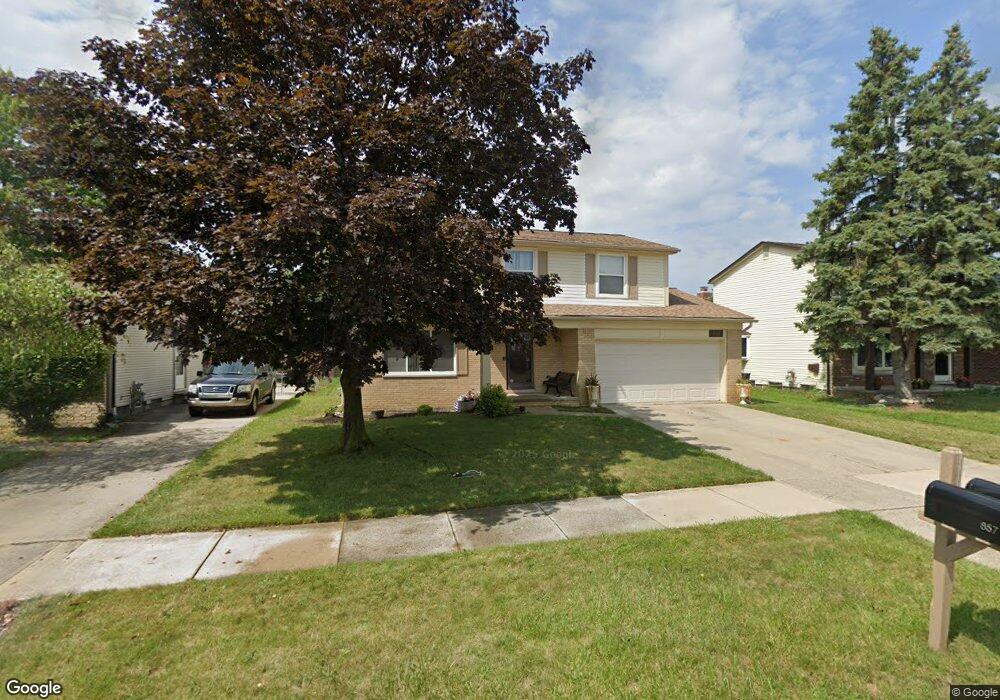
856 Queens Way Canton, MI 48188
Estimated Value: $380,249 - $400,000
About This Home
This home is located at 856 Queens Way, Canton, MI 48188 and is currently estimated at $389,812, approximately $207 per square foot. 856 Queens Way is a home located in Wayne County with nearby schools including Canton High School, Salem High School, and Plymouth High School.
Ownership History
We collect this data history from publicly available records. To have your information removed, we recommend requesting removal directly through your county’s website.
Purchase Details
Purchase Details
Home Values in the Area
Average Home Value in this Area
Purchase History
We collect this data history from publicly available records. To have your information removed, we recommend requesting removal directly through your county’s website.
| Date | Buyer | Sale Price | Title Company |
|---|---|---|---|
| $120,750 | None Available | ||
| $259,745 | None Available |
Tax History
We collect this data history from publicly available records. To have your information removed, we recommend requesting removal directly through your county’s website.
| Year | Tax Paid | Tax Assessment Tax Assessment Total Assessment is a certain percentage of the fair market value that is determined by local assessors to be the total taxable value of land and additions on the property. | Land | Improvement |
|---|---|---|---|---|
| 2025 | $1,665 | $163,600 | $0 | $0 |
| 2024 | $1,617 | $160,400 | $0 | $0 |
| 2023 | $1,542 | $140,400 | $0 | $0 |
| 2022 | $3,427 | $125,800 | $0 | $0 |
| 2021 | $3,325 | $119,600 | $0 | $0 |
| 2020 | $3,280 | $113,500 | $0 | $0 |
| 2019 | $3,222 | $106,100 | $0 | $0 |
| 2018 | $1,310 | $102,520 | $0 | $0 |
| 2017 | $3,331 | $96,700 | $0 | $0 |
| 2016 | $2,936 | $91,400 | $0 | $0 |
| 2015 | $7,200 | $81,430 | $0 | $0 |
| 2013 | $6,975 | $72,600 | $0 | $0 |
| 2010 | -- | $76,860 | $42,000 | $34,860 |
Map
- 43060 Providence Ln
- 136 Sheffield Ct Unit 24
- 379 Cherry Orchard Rd Unit 105
- 531 Cherry Grove Rd Unit 169
- 42063 Trent Dr
- 41531 SiMcOe Dr
- 417 Shana St
- 42779 Lilley Pointe Dr Unit 152
- 42764 Lilley Pointe Dr Unit 165
- 42739 Lilley Pointe Dr Unit 119
- 1632 Bennington Ct Unit 1632
- 42263 Palmer Rd
- 42317 Gloria Dr
- 43673 Antietam Ct
- 41374 Southwind Dr Unit 194
- 41390 Southwind Dr Unit 197
- 41379 Southwind Dr
- 1646 Heritage Dr
- 44089 Harsdale Dr
- 41226 Southwind Dr Unit 138
- 832 Queens Way
- 820 Queens Way
- 661 Princess Dr
- 880 Queens Way
- 794 Queens Way
- 673 Princess Dr
- 649 Princess Dr
- 685 Princess Dr
- 770 Queens Way
- 641 Princess Dr
- 904 Queens Way
- 819 Queens Way
- 857 Queens Way
- 697 Princess Dr
- 795 Queens Way
- 881 Queens Way
- 633 Princess Dr
- 746 Queens Way
- 926 Queens Way
- 771 Queens Way
Ask me questions while you tour the home.