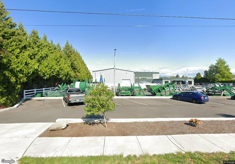
8566 Benson Rd Lynden, WA 98264
Estimated Value: $373,000
3
Beds
2
Baths
2,463
Sq Ft
$151/Sq Ft
Est. Value
About This Home
This home is located at 8566 Benson Rd, Lynden, WA 98264 and is currently estimated at $373,000, approximately $151 per square foot. 8566 Benson Rd is a home located in Whatcom County with nearby schools including Lynden High School, Lynden Christian School, and Lynden Christian Schools: Administration.
Ownership History
Date
Name
Owned For
Owner Type
Purchase Details
Closed on
Feb 6, 2023
Sold by
R & H Property Holdings Llc
Bought by
Dna Properties Llc
Current Estimated Value
Purchase Details
Closed on
May 17, 2012
Sold by
Dewaard Ryan and Dewaard Heidi
Bought by
R&H Property Holdings Llc
Purchase Details
Closed on
Aug 29, 2011
Sold by
Delappe John A and Delappe Myla D
Bought by
Dewaard Ryan J and Dewaard Heidi L
Home Financials for this Owner
Home Financials are based on the most recent Mortgage that was taken out on this home.
Original Mortgage
$185,500
Interest Rate
4.46%
Mortgage Type
Future Advance Clause Open End Mortgage
Create a Home Valuation Report for This Property
The Home Valuation Report is an in-depth analysis detailing your home's value as well as a comparison with similar homes in the area
Home Values in the Area
Average Home Value in this Area
Purchase History
| Date | Buyer | Sale Price | Title Company |
|---|---|---|---|
| Dna Properties Llc | -- | -- | |
| R&H Property Holdings Llc | -- | Accommodation | |
| Dewaard Ryan J | $250,280 | Chicago Title Insurance |
Source: Public Records
Mortgage History
| Date | Status | Borrower | Loan Amount |
|---|---|---|---|
| Previous Owner | Dewaard Ryan J | $185,500 |
Source: Public Records
Tax History Compared to Growth
Tax History
| Year | Tax Paid | Tax Assessment Tax Assessment Total Assessment is a certain percentage of the fair market value that is determined by local assessors to be the total taxable value of land and additions on the property. | Land | Improvement |
|---|---|---|---|---|
| 2024 | $485 | $70,265 | $50,495 | $19,770 |
| 2023 | $485 | $66,919 | $48,090 | $18,829 |
| 2022 | $3,250 | $114,296 | $103,175 | $11,121 |
| 2021 | $3,188 | $352,855 | $104,426 | $248,429 |
| 2020 | $2,793 | $315,058 | $93,240 | $221,818 |
| 2019 | $2,484 | $288,943 | $85,610 | $203,333 |
| 2018 | $2,715 | $263,518 | $77,987 | $185,531 |
| 2017 | $2,536 | $236,530 | $70,000 | $166,530 |
| 2016 | $2,390 | $234,936 | $63,800 | $171,136 |
| 2015 | $2,119 | $220,292 | $61,364 | $158,928 |
| 2014 | -- | $212,830 | $59,276 | $153,554 |
| 2013 | -- | $211,554 | $58,000 | $153,554 |
Source: Public Records
Map
Nearby Homes
- 902 Captain Bay Ct
- 0 Benson Rd Unit NWM2378945
- 761 Sunrise Dr
- 872 Sunrise Dr
- 1739 Emerald Way
- 1584 Main St
- 1877 Emerald Way
- 1725 Harrison Place Unit 104
- 908 Glenning St
- 307 Kwanzan Dr
- 1800 Pine St
- 518 Edson St
- 515 17th St
- 500 Fieldstone Loop Unit 13
- 8780 Depot Rd Unit 309
- 8780 Depot Rd Unit 308
- 8780 Depot Rd Unit 207
- 211 E Sunrise Dr
- 0 Guide Meridian Unit NWM2369980
- 107 Springview Dr
