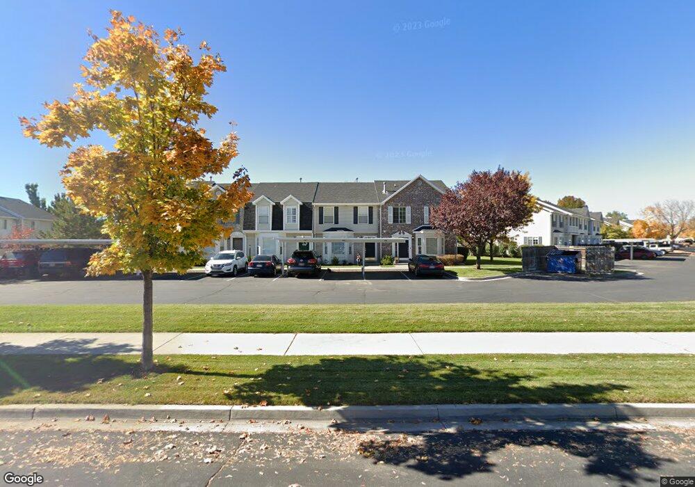
857 N 1760 W Provo, UT 84604
Rivergrove NeighborhoodEstimated Value: $349,196 - $375,000
3
Beds
2
Baths
1,282
Sq Ft
$279/Sq Ft
Est. Value
About This Home
This home is located at 857 N 1760 W, Provo, UT 84604 and is currently estimated at $357,799, approximately $279 per square foot. 857 N 1760 W is a home located in Utah County with nearby schools including Westridge Elementary School, Dixon Middle School, and Provo High School.
Ownership History
Date
Name
Owned For
Owner Type
Purchase Details
Closed on
Jun 12, 2020
Sold by
Taylor Dennis L and Taylor Mary Lee
Bought by
Taylor Dennis L and Taylor Marylee
Current Estimated Value
Purchase Details
Closed on
Jul 29, 2010
Sold by
Gehring Jeff A and Gehring Melissa
Bought by
Taylor Dennis L and Taylor Mary Lee
Home Financials for this Owner
Home Financials are based on the most recent Mortgage that was taken out on this home.
Original Mortgage
$128,700
Outstanding Balance
$84,997
Interest Rate
4.52%
Mortgage Type
New Conventional
Estimated Equity
$272,802
Purchase Details
Closed on
Jun 7, 2001
Sold by
Dester Melissa and Gehring Melissa
Bought by
Gehring Jeff A and Gehring Melissa
Home Financials for this Owner
Home Financials are based on the most recent Mortgage that was taken out on this home.
Original Mortgage
$104,800
Interest Rate
7.24%
Create a Home Valuation Report for This Property
The Home Valuation Report is an in-depth analysis detailing your home's value as well as a comparison with similar homes in the area
Home Values in the Area
Average Home Value in this Area
Purchase History
| Date | Buyer | Sale Price | Title Company |
|---|---|---|---|
| Taylor Dennis L | -- | None Available | |
| Taylor Dennis L | -- | Access Title Company | |
| Gehring Jeff A | -- | First American Title Co |
Source: Public Records
Mortgage History
| Date | Status | Borrower | Loan Amount |
|---|---|---|---|
| Open | Taylor Dennis L | $128,700 | |
| Previous Owner | Gehring Jeff A | $104,800 |
Source: Public Records
Tax History Compared to Growth
Tax History
| Year | Tax Paid | Tax Assessment Tax Assessment Total Assessment is a certain percentage of the fair market value that is determined by local assessors to be the total taxable value of land and additions on the property. | Land | Improvement |
|---|---|---|---|---|
| 2025 | $1,819 | $180,785 | $48,300 | $280,400 |
| 2024 | $1,819 | $179,080 | $0 | $0 |
| 2023 | $1,769 | $171,710 | $0 | $0 |
| 2022 | $1,785 | $174,680 | $0 | $0 |
| 2021 | $1,399 | $238,800 | $35,800 | $203,000 |
| 2020 | $1,409 | $219,900 | $33,000 | $186,900 |
| 2019 | $1,274 | $212,000 | $28,000 | $184,000 |
| 2018 | $1,126 | $190,000 | $24,000 | $166,000 |
| 2017 | $985 | $91,300 | $0 | $0 |
| 2016 | $929 | $80,300 | $0 | $0 |
| 2015 | $885 | $77,330 | $0 | $0 |
| 2014 | $819 | $74,580 | $0 | $0 |
Source: Public Records
Map
Nearby Homes
- 932 N 1760 W
- 927 Independence Ave
- 1620 W 1000 N
- 2075 W 1080 N
- 2043 W 1100 N
- 1127 Independence Ave
- 1451 Arthur Dr
- 1503 N 1980 W
- 2397 W 1160 N
- 1471 W 1460 N
- 2216 W 480 N
- 2316 W 510 N
- 1375 W 1460 N
- 255 N 1600 W Unit 148
- 255 N 1600 W Unit 52
- 1215 W 580 N
- 1375 W 500 N Unit 95
- 1616 N 2100 W
- 1188 W 1380 N
- 630 N 1100 W
- 855 N 1760 W
- 859 N 1760 W
- 853 N 1760 W
- 851 N 1760 W
- 854 Independence Ave
- 879 N 1760 W
- 879 N 1760 W Unit 1
- 856 Independence Ave
- 881 N 1760 W
- 878 Independence Ave Unit 11
- 883 N 1760 W
- 883 N 1760 W Unit 3
- 880 Independence Ave
- 880 Independence Ave Unit 12
- 1784 W 820 N
- 885 N 1760 W
- 1786 W 820 N
- 882 Independence Ave
- 882 Independence Ave Unit 13
- 1788 W 820 N