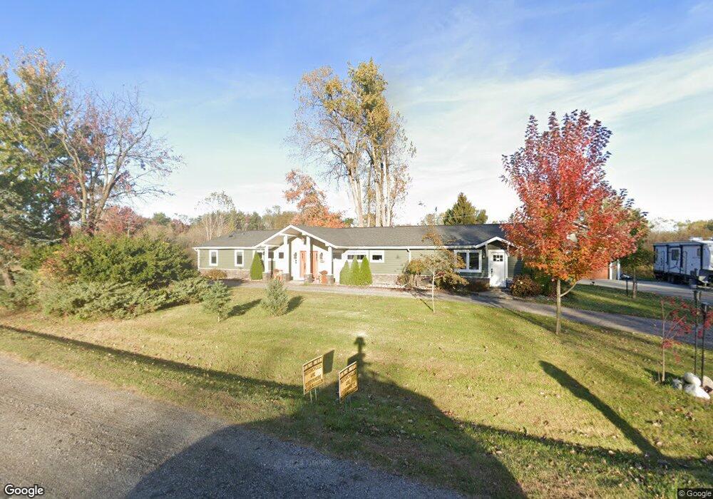
857 S Hospital Rd Waterford, MI 48327
Waterford Township NeighborhoodEstimated Value: $465,000 - $492,204
3
Beds
2
Baths
2,700
Sq Ft
$178/Sq Ft
Est. Value
About This Home
This home is located at 857 S Hospital Rd, Waterford, MI 48327 and is currently estimated at $481,551, approximately $178 per square foot. 857 S Hospital Rd is a home located in Oakland County with nearby schools including Beaumont Elementary School, Pierce Middle School, and Waterford Mott High School.
Ownership History
Date
Name
Owned For
Owner Type
Purchase Details
Closed on
Nov 18, 2015
Sold by
Voorheis Mark D
Bought by
Voorheis Mark and Voorheis Marita
Current Estimated Value
Home Financials for this Owner
Home Financials are based on the most recent Mortgage that was taken out on this home.
Original Mortgage
$158,500
Outstanding Balance
$64,959
Interest Rate
3.78%
Mortgage Type
New Conventional
Estimated Equity
$416,592
Purchase Details
Closed on
Oct 30, 2003
Sold by
Ledford William J and Ledford Janet M
Bought by
Voorheis Mark D
Create a Home Valuation Report for This Property
The Home Valuation Report is an in-depth analysis detailing your home's value as well as a comparison with similar homes in the area
Home Values in the Area
Average Home Value in this Area
Purchase History
| Date | Buyer | Sale Price | Title Company |
|---|---|---|---|
| Voorheis Mark | -- | Title Connect Llc | |
| Voorheis Mark D | $192,541 | Philip R Seaver Title Co Inc |
Source: Public Records
Mortgage History
| Date | Status | Borrower | Loan Amount |
|---|---|---|---|
| Open | Voorheis Mark | $158,500 |
Source: Public Records
Tax History Compared to Growth
Tax History
| Year | Tax Paid | Tax Assessment Tax Assessment Total Assessment is a certain percentage of the fair market value that is determined by local assessors to be the total taxable value of land and additions on the property. | Land | Improvement |
|---|---|---|---|---|
| 2024 | $2,952 | $247,980 | $0 | $0 |
| 2023 | $2,815 | $206,770 | $0 | $0 |
| 2022 | $4,625 | $194,400 | $0 | $0 |
| 2021 | $4,286 | $188,010 | $0 | $0 |
| 2020 | $1,840 | $151,390 | $0 | $0 |
| 2019 | $3,031 | $139,610 | $0 | $0 |
| 2018 | $3,006 | $117,330 | $0 | $0 |
| 2017 | $2,763 | $117,330 | $0 | $0 |
| 2016 | $2,705 | $106,540 | $0 | $0 |
| 2015 | -- | $90,870 | $0 | $0 |
| 2014 | -- | $80,220 | $0 | $0 |
| 2011 | -- | $79,090 | $0 | $0 |
Source: Public Records
Map
Nearby Homes
- 437 Cove View Dr
- 7244 Lavender Ln Unit 43
- 1314 Lilac Ln Unit 136
- 7053 Magnolia Ln
- 1150 Jay St
- 7040 Villa Dr Unit 2
- 393 Deer Path Trail
- 1276 Jay St Unit 6
- 7846 Fawn Ct
- 9999 Cooley Lake Rd
- 7666 Woodview Dr Unit 11
- 7943 Jordan Dr
- VL Tamson St
- 7982 Jordan Dr
- 1172 Julian Ct
- 1481 Lochaven Rd
- 7377 Cooley Lake Rd
- 7799 Rampart Trail
- 7936 Rampart Trail
- 59 Lochaven Rd
- 839 S Hospital Rd
- 840 S Hospital Rd
- 805 S Hospital Rd
- 7013 Pershing
- 7033 Pershing
- 7275 Pershing
- 7321 Pershing
- 760 S Hospital Rd
- 7295 Pershing
- 7020 Pershing
- 879 S Hospital Rd
- 7100 Pershing
- 757 S Hospital Rd
- 750 S Hospital Rd
- 895 S Hospital Rd
- 7120 Pershing
- 747 S Hospital Rd
- 7335 Pershing
- 7140 Pershing
- 740 S Hospital Rd