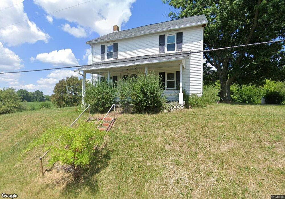
8570 Paris Ave Louisville, OH 44641
Estimated Value: $106,000 - $253,000
2
Beds
2
Baths
1,678
Sq Ft
$99/Sq Ft
Est. Value
About This Home
This home is located at 8570 Paris Ave, Louisville, OH 44641 and is currently estimated at $166,203, approximately $99 per square foot. 8570 Paris Ave is a home located in Stark County with nearby schools including Louisville High School.
Ownership History
Date
Name
Owned For
Owner Type
Purchase Details
Closed on
Jun 25, 2024
Sold by
Thewes Karol A
Bought by
David M Denlinger Revocable Trust and Denlinger
Current Estimated Value
Purchase Details
Closed on
Mar 27, 2024
Sold by
Thewes Anthoney C
Bought by
Thewes Anthoney C and Thews Karol A
Purchase Details
Closed on
Nov 3, 1999
Sold by
Boggins John V
Bought by
Thewes Anthony C
Create a Home Valuation Report for This Property
The Home Valuation Report is an in-depth analysis detailing your home's value as well as a comparison with similar homes in the area
Home Values in the Area
Average Home Value in this Area
Purchase History
| Date | Buyer | Sale Price | Title Company |
|---|---|---|---|
| David M Denlinger Revocable Trust | $92,000 | None Listed On Document | |
| Thewes Anthoney C | -- | None Listed On Document | |
| Thewes Anthony C | $44,000 | -- |
Source: Public Records
Tax History Compared to Growth
Tax History
| Year | Tax Paid | Tax Assessment Tax Assessment Total Assessment is a certain percentage of the fair market value that is determined by local assessors to be the total taxable value of land and additions on the property. | Land | Improvement |
|---|---|---|---|---|
| 2025 | -- | $56,570 | $22,720 | $33,850 |
| 2024 | -- | $46,870 | $23,910 | $22,960 |
| 2023 | $1,866 | $38,190 | $18,270 | $19,920 |
| 2022 | $1,872 | $38,190 | $18,270 | $19,920 |
| 2021 | $1,878 | $38,190 | $18,270 | $19,920 |
| 2020 | $1,487 | $31,930 | $15,650 | $16,280 |
| 2019 | $1,494 | $31,930 | $15,650 | $16,280 |
| 2018 | $1,489 | $31,930 | $15,650 | $16,280 |
| 2017 | $1,334 | $27,310 | $13,970 | $13,340 |
| 2016 | $1,153 | $24,090 | $13,970 | $10,120 |
| 2015 | $1,156 | $24,090 | $13,970 | $10,120 |
| 2014 | $1,151 | $22,200 | $12,850 | $9,350 |
| 2013 | $579 | $22,200 | $12,850 | $9,350 |
Source: Public Records
Map
Nearby Homes
- 7844 Morningstar Dr
- 6052 N Nickelplate St
- 5990 Meese Rd NE
- 5765 Maplegrove St
- 5495 Meese Rd NE
- 6285 California Ave
- 5474 Ravenna Ave
- 6079 Eastlawn St NE
- 316 E Reno Dr
- 3580 Brookridge Ave Lot 15
- 910 Crosswyck Cir
- 0 Glenbar St
- 6150 Pilot View Cir
- 524 Glenbar St
- 0 Brookridge Ave
- 614 Reno Dr
- 1170 Winding Ridge Ave
- 12200 Marlboro Ave NE
- 5700 Glena St
- 428 Honeycrisp Dr NE
- 8569 Paris Ave
- 8521 Paris Ave
- 8489 Paris Ave
- 8646 Paris Ave
- 8525 Paris Ave
- 8480 Paris Ave
- 8462 Paris Ave
- 8448 Paris Ave
- 8718 Paris Ave
- 8421 Paris Ave
- 8430 Paris Ave
- 8402 Paris Ave
- 8409 Paris Ave
- 8409 Paris Ave
- 8804 Paris Ave
- 8385 Paris Ave
- 8870 State St NE
- 8870 State St NE
- 8766 State St NE
- 8814 State St