Estimated Value: $747,000 - $920,000
6
Beds
5
Baths
4,142
Sq Ft
$201/Sq Ft
Est. Value
About This Home
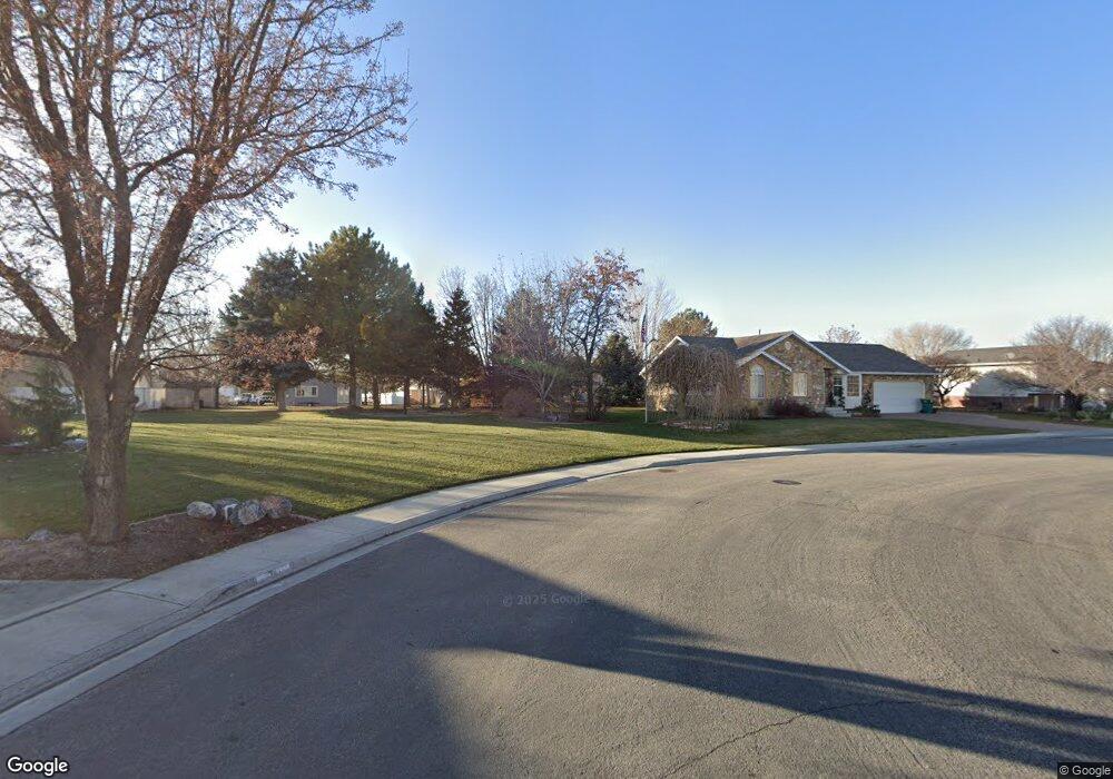
This home is located at 858 W Fox Borough Dr, Lehi, UT 84043 and is currently estimated at $832,768, approximately $201 per square foot. 858 W Fox Borough Dr is a home located in Utah County with nearby schools including Lehi Elementary School, Lehi Junior High School, and Lehi High School.
Ownership History
Date
Name
Owned For
Owner Type
Purchase Details
Closed on
Nov 23, 2020
Sold by
Mccoy David James and Mccoy Shauna Lee
Bought by
Lourido Nathan V
Current Estimated Value
Home Financials for this Owner
Home Financials are based on the most recent Mortgage that was taken out on this home.
Original Mortgage
$510,400
Outstanding Balance
$454,183
Interest Rate
2.8%
Mortgage Type
New Conventional
Estimated Equity
$378,585
Purchase Details
Closed on
Mar 27, 2001
Sold by
Foxborough Subdivision Llc
Bought by
Mccoy David James and Mccoy Shauna Lee
Home Financials for this Owner
Home Financials are based on the most recent Mortgage that was taken out on this home.
Original Mortgage
$220,000
Interest Rate
6.89%
Mortgage Type
Construction
Create a Home Valuation Report for This Property
The Home Valuation Report is an in-depth analysis detailing your home's value as well as a comparison with similar homes in the area
Home Values in the Area
Average Home Value in this Area
Purchase History
| Date | Buyer | Sale Price | Title Company |
|---|---|---|---|
| Lourido Nathan V | -- | Eagle Gate Ttl Ins Agcy Inc | |
| Mccoy David James | -- | -- |
Source: Public Records
Mortgage History
| Date | Status | Borrower | Loan Amount |
|---|---|---|---|
| Open | Lourido Nathan V | $510,400 | |
| Previous Owner | Mccoy David James | $220,000 |
Source: Public Records
Tax History Compared to Growth
Tax History
| Year | Tax Paid | Tax Assessment Tax Assessment Total Assessment is a certain percentage of the fair market value that is determined by local assessors to be the total taxable value of land and additions on the property. | Land | Improvement |
|---|---|---|---|---|
| 2025 | $3,162 | $428,395 | $215,200 | $563,700 |
| 2024 | $3,162 | $370,095 | $0 | $0 |
| 2023 | $2,843 | $361,240 | $0 | $0 |
| 2022 | $3,194 | $393,470 | $0 | $0 |
| 2021 | $2,928 | $545,200 | $124,500 | $420,700 |
| 2020 | $2,534 | $466,500 | $115,300 | $351,200 |
| 2019 | $2,337 | $447,300 | $115,300 | $332,000 |
| 2018 | $2,408 | $435,700 | $103,700 | $332,000 |
| 2017 | $2,357 | $226,655 | $0 | $0 |
| 2016 | $2,540 | $226,655 | $0 | $0 |
| 2015 | $2,627 | $222,530 | $0 | $0 |
| 2014 | $2,327 | $195,965 | $0 | $0 |
Source: Public Records
Map
Nearby Homes
- 902 W 1500 N
- 1301 N 900 W Unit 12
- 1817 W Bad Rock Cir
- 1094 W 1425 N
- 1610 N 1125 W
- 1011 W Mountain Way Unit 316
- 1249 W 1800 N
- 1332 W 1500 N
- 1272 W 1800 N
- 1132 Titan Dr
- 1755 N 250 W
- 1032 Titan Dr
- 1127 N 1500 W
- 1150 N 200 W Unit 6
- 1627 W Boxwood Dr Unit 110
- 1659 W Boxwood Dr Unit 109
- 996 N 200 W
- 443 W 820 N
- 497 W 2200 N
- 155 W State St Unit TRLR 3
- 858 W Fox Borough Dr
- 865 W 1500 N
- 1436 N Trinnaman Ln
- 1436 Trinnaman Ln
- 875 W 1500 N
- 855 W 1500 N
- 1438 Trinnaman Ln
- 1438 N Trinnaman Ln
- 831 W 1425 N
- 1476 Trinnaman Ln
- 1476 N Trinnaman Ln
- 815 W 1425 N
- 792 W 1425 N
- 1694 Trinnaman Ln
- 920 Trinnaman Ln
- 1 Trinnaman Ln
- 1475 Trinnaman Ln
- 845 W 1500 N
- 1445 Trinnaman Ln
- 805 W 1500 N