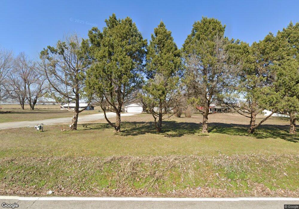
8588 Carrie Smith Rd Springdale, AR 72762
Estimated Value: $373,305 - $539,000
--
Bed
2
Baths
1,930
Sq Ft
$234/Sq Ft
Est. Value
About This Home
This home is located at 8588 Carrie Smith Rd, Springdale, AR 72762 and is currently estimated at $452,076, approximately $234 per square foot. 8588 Carrie Smith Rd is a home located in Benton County with nearby schools including Willis Shaw Elementary School, Hellstern Middle School, and Central Junior High School.
Ownership History
Date
Name
Owned For
Owner Type
Purchase Details
Closed on
Sep 14, 2022
Sold by
Dossett Earl and Dossett Irene
Bought by
Dossett Earl and Dossett Irene
Current Estimated Value
Purchase Details
Closed on
May 15, 2018
Sold by
Dossett Earl and Dossett Irene
Bought by
Dossett Earl and Dossett Ted
Purchase Details
Closed on
Jul 10, 2003
Bought by
Dossett, W 1 Ac
Purchase Details
Closed on
Jul 18, 2002
Bought by
Dossett Dossett T and Dossett 15Ac
Purchase Details
Closed on
Mar 19, 2001
Bought by
Dossett
Purchase Details
Closed on
Jan 11, 2001
Bought by
Fong and Fong 28Ac
Purchase Details
Closed on
Oct 23, 1991
Bought by
Dossett
Purchase Details
Closed on
Feb 6, 1990
Bought by
Scott
Purchase Details
Closed on
Jan 10, 1990
Bought by
Fong
Create a Home Valuation Report for This Property
The Home Valuation Report is an in-depth analysis detailing your home's value as well as a comparison with similar homes in the area
Home Values in the Area
Average Home Value in this Area
Purchase History
| Date | Buyer | Sale Price | Title Company |
|---|---|---|---|
| Dossett Earl | -- | -- | |
| Dossett Earl | -- | None Available | |
| Dossett, W 1 Ac | -- | -- | |
| Dossett Dossett T | $3,000 | -- | |
| Dossett | $2,000 | -- | |
| Fong | -- | -- | |
| Dossett | $30,000 | -- | |
| Scott | $20,000 | -- | |
| Fong | $54,000 | -- |
Source: Public Records
Tax History Compared to Growth
Tax History
| Year | Tax Paid | Tax Assessment Tax Assessment Total Assessment is a certain percentage of the fair market value that is determined by local assessors to be the total taxable value of land and additions on the property. | Land | Improvement |
|---|---|---|---|---|
| 2025 | $1,460 | $67,127 | $14,020 | $53,107 |
| 2024 | $1,493 | $67,127 | $14,020 | $53,107 |
| 2023 | $1,492 | $43,120 | $7,610 | $35,510 |
| 2022 | $1,120 | $43,120 | $7,610 | $35,510 |
| 2021 | $1,114 | $43,120 | $7,610 | $35,510 |
| 2020 | $1,117 | $30,620 | $5,200 | $25,420 |
| 2019 | $1,117 | $30,620 | $5,200 | $25,420 |
| 2018 | $1,142 | $30,620 | $5,200 | $25,420 |
| 2017 | $1,141 | $30,620 | $5,200 | $25,420 |
| 2016 | $1,141 | $30,620 | $5,200 | $25,420 |
| 2015 | $1,490 | $27,960 | $3,170 | $24,790 |
| 2014 | $1,140 | $27,060 | $3,170 | $23,890 |
Source: Public Records
Map
Nearby Homes
- 9149 Marchant Rd
- 813 Lancelot Dr
- 4022 Als Dr
- 3423 Roma Dr
- 3809 Bridgeton St
- 7889 Scenic Valley Ave
- 7887 Scenic Valley Ave
- 7833 Scenic Valley Ave
- 7811 Scenic Valley Ave
- 7842 Scenic Valley Ave
- 7376 Charlotte Ave
- 7478 Bellgrove Ave
- 4741 Hawk St
- 4859 Highway 112
- 4788 Hawk St
- 4726 Farmhouse St
- 4772 Farmhouse St
- 7307 Devonshire Ave
- 4751 Farmhouse St
- 3781 Baltic St
- 8588 Carrie Smith Rd
- 8636 Carrie Smith Rd
- 8532 Carrie Smith Rd
- 8551 Carrie Smith Rd
- 0 Grimsley Rd Unit 603189
- 0 Grimsley Rd Unit 632277
- 0 Grimsley Rd Unit 1108319
- 3818 Grimsley Rd
- 8718 Carrie Smith Rd
- 3870 Grimsley Rd
- 8793 Carrie Smith Rd
- 0 Carrie Smith Rd
- 8782 Carrie Smith Rd
- 3952 Grimsley Rd
- 8883 Carrie Smith Rd
- 8778 Greenbriar Estates Rd
- 8930 Carrie Smith Rd
- 8939 Carrie Smith Rd
- 0 N Grimsley Rd Unit 664746
- 0 N Grimsley Rd Unit 690223
