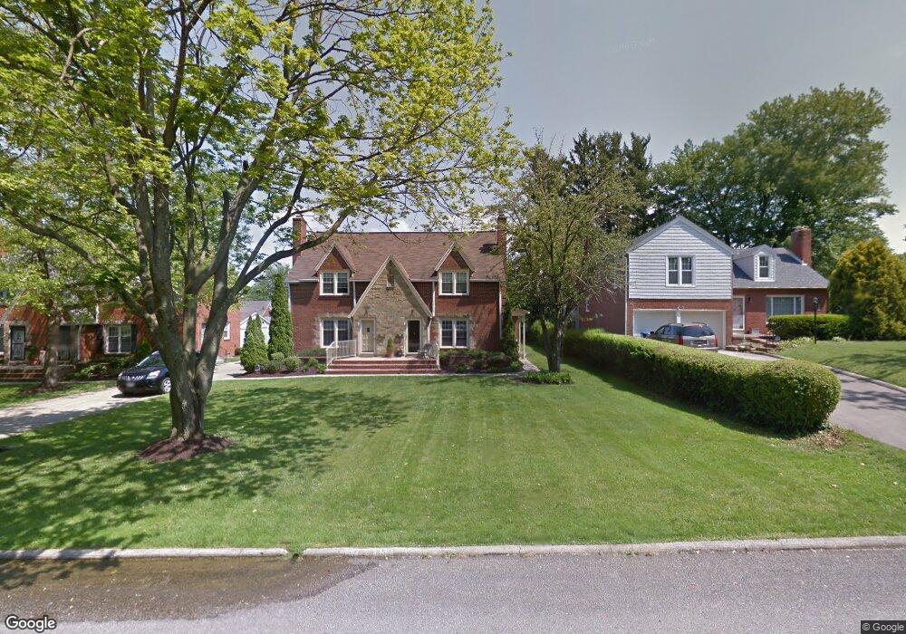
859 Andover Rd Unit 859 Mansfield, OH 44907
Estimated Value: $199,000 - $238,000
2
Beds
2
Baths
1,459
Sq Ft
$148/Sq Ft
Est. Value
About This Home
This home is located at 859 Andover Rd Unit 859, Mansfield, OH 44907 and is currently estimated at $216,000, approximately $148 per square foot. 859 Andover Rd Unit 859 is a home located in Richland County with nearby schools including Discovery School, Mansfield Christian School, and Mansfield Seventh-day Adventist School.
Ownership History
Date
Name
Owned For
Owner Type
Purchase Details
Closed on
Jun 13, 2023
Sold by
Brown Travis J and Brown Carrie R
Bought by
Banks Property Holdings Llc
Current Estimated Value
Home Financials for this Owner
Home Financials are based on the most recent Mortgage that was taken out on this home.
Original Mortgage
$350,000
Outstanding Balance
$342,386
Interest Rate
7.5%
Mortgage Type
New Conventional
Estimated Equity
-$126,386
Purchase Details
Closed on
Dec 30, 2010
Sold by
Chaz Properties Limited Liability Compan
Bought by
Kaufman Caroline M
Create a Home Valuation Report for This Property
The Home Valuation Report is an in-depth analysis detailing your home's value as well as a comparison with similar homes in the area
Home Values in the Area
Average Home Value in this Area
Purchase History
| Date | Buyer | Sale Price | Title Company |
|---|---|---|---|
| Banks Property Holdings Llc | $515,000 | Southern Title | |
| Kaufman Caroline M | $510,000 | None Available |
Source: Public Records
Mortgage History
| Date | Status | Borrower | Loan Amount |
|---|---|---|---|
| Open | Banks Property Holdings Llc | $350,000 |
Source: Public Records
Tax History Compared to Growth
Tax History
| Year | Tax Paid | Tax Assessment Tax Assessment Total Assessment is a certain percentage of the fair market value that is determined by local assessors to be the total taxable value of land and additions on the property. | Land | Improvement |
|---|---|---|---|---|
| 2024 | $2,291 | $47,860 | $4,250 | $43,610 |
| 2023 | $2,291 | $47,860 | $4,250 | $43,610 |
| 2022 | $2,062 | $36,100 | $3,800 | $32,300 |
| 2021 | $2,077 | $36,100 | $3,800 | $32,300 |
| 2020 | $2,124 | $36,100 | $3,800 | $32,300 |
| 2019 | $2,012 | $30,850 | $3,220 | $27,630 |
| 2018 | $1,985 | $30,850 | $3,220 | $27,630 |
| 2017 | $1,934 | $30,850 | $3,220 | $27,630 |
| 2016 | $1,935 | $29,970 | $3,120 | $26,850 |
| 2015 | $1,935 | $29,970 | $3,120 | $26,850 |
| 2014 | $1,824 | $29,970 | $3,120 | $26,850 |
| 2012 | $690 | $30,900 | $3,220 | $27,680 |
Source: Public Records
Map
Nearby Homes
- 0 George Ave
- 589 Andover Rd
- 421 Edgewood Rd
- 431 Overlook Rd
- 1009 Woodhill Rd
- 655 Woodhill Rd
- 501 Clifton Blvd
- 484 Beechwood Dr
- 654 Courtwright Blvd
- 476 Glendale Blvd
- 1125 Larchwood Rd
- 0 U S Highway 42
- 1163 Woodland Rd
- 220 W Cook Rd
- 1156 Yorkwood Rd
- 181 Chilton Ave
- 179 Chilton Ave
- 505 Wood St
- 0 Lexington Ave Unit 224009661
- 1179 Burkwood Rd
- 857 Andover Rd Unit 857
- 861 Andover Rd
- 855 Andover Rd Unit 855
- 853 Andover Rd Unit 853
- 867 Andover Rd
- 843 Andover Rd
- 796 Yale Dr
- 786 Yale Dr
- 802 Yale Dr
- 782 Yale Dr
- 808 Yale Dr
- 503 Stewart Ln
- 850 Andover Rd
- 812 Yale Dr
- 875 Andover Rd
- 866 Andover Rd
- 799 Yale Dr
- 465 Stewart Ln
- 809 Yale Dr
- 880 Andover Rd