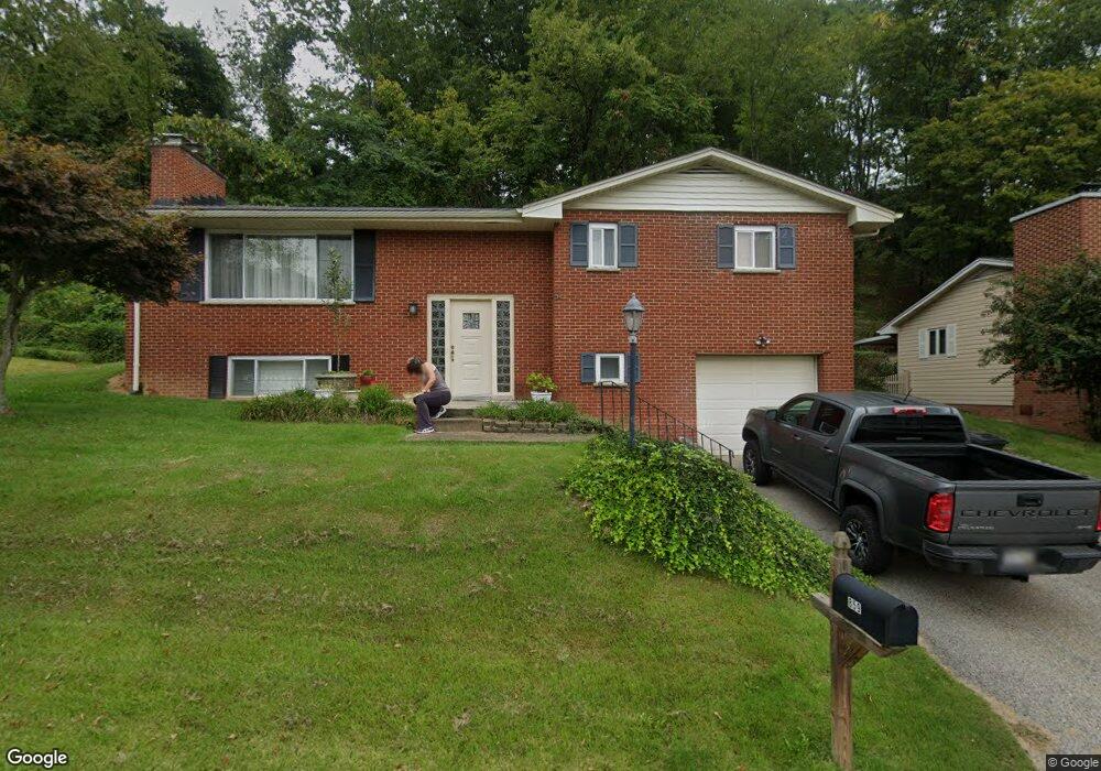
859 Carroll Rd Charleston, WV 25314
South Hills NeighborhoodEstimated Value: $251,122 - $275,000
3
Beds
3
Baths
2,148
Sq Ft
$124/Sq Ft
Est. Value
About This Home
This home is located at 859 Carroll Rd, Charleston, WV 25314 and is currently estimated at $265,281, approximately $123 per square foot. 859 Carroll Rd is a home located in Kanawha County with nearby schools including Overbrook Elementary School, John Adams Middle School, and George Washington High School.
Ownership History
Date
Name
Owned For
Owner Type
Purchase Details
Closed on
Jun 27, 2005
Sold by
Mobility Cendant
Bought by
Morris Christopher
Current Estimated Value
Purchase Details
Closed on
Sep 12, 2002
Sold by
Hatfield Richard
Bought by
Jazdzewski Brian
Home Financials for this Owner
Home Financials are based on the most recent Mortgage that was taken out on this home.
Original Mortgage
$147,156
Interest Rate
6.48%
Mortgage Type
Purchase Money Mortgage
Purchase Details
Closed on
Jul 22, 1999
Sold by
Newcomer Carl L
Bought by
Hatfield Richard W
Home Financials for this Owner
Home Financials are based on the most recent Mortgage that was taken out on this home.
Original Mortgage
$107,000
Interest Rate
7.65%
Mortgage Type
Purchase Money Mortgage
Create a Home Valuation Report for This Property
The Home Valuation Report is an in-depth analysis detailing your home's value as well as a comparison with similar homes in the area
Home Values in the Area
Average Home Value in this Area
Purchase History
| Date | Buyer | Sale Price | Title Company |
|---|---|---|---|
| Morris Christopher | $167,000 | -- | |
| Jazdzewski Brian | $154,900 | -- | |
| Hatfield Richard W | $150,000 | -- |
Source: Public Records
Mortgage History
| Date | Status | Borrower | Loan Amount |
|---|---|---|---|
| Previous Owner | Jazdzewski Brian | $147,156 | |
| Previous Owner | Hatfield Richard W | $107,000 |
Source: Public Records
Tax History Compared to Growth
Tax History
| Year | Tax Paid | Tax Assessment Tax Assessment Total Assessment is a certain percentage of the fair market value that is determined by local assessors to be the total taxable value of land and additions on the property. | Land | Improvement |
|---|---|---|---|---|
| 2025 | $1,660 | $103,140 | $25,080 | $78,060 |
| 2024 | $1,660 | $103,140 | $25,080 | $78,060 |
| 2023 | $1,596 | $99,180 | $25,080 | $74,100 |
| 2022 | $1,596 | $99,180 | $25,080 | $74,100 |
| 2021 | $1,493 | $93,180 | $25,080 | $68,100 |
| 2020 | $1,495 | $94,140 | $25,080 | $69,060 |
| 2019 | $1,486 | $94,140 | $25,080 | $69,060 |
| 2018 | $1,358 | $95,100 | $25,080 | $70,020 |
| 2017 | $1,349 | $95,100 | $25,080 | $70,020 |
| 2016 | $1,355 | $96,060 | $25,080 | $70,980 |
| 2015 | $1,347 | $96,300 | $25,080 | $71,220 |
| 2014 | $1,323 | $96,240 | $25,080 | $71,160 |
Source: Public Records
Map
Nearby Homes
- 805 Basil Rd
- 263 Oakwood Rd
- 1539 Ravinia Rd
- 266 Oakwood Rd
- 1540 Ravinia Rd
- 1504 Ravinia Rd
- 315 Viola Rd
- 836 Walters Rd
- 10 Observatory Rd
- 1501 Knob Rd
- 1570 Smith Rd
- 1203 Oakmont Rd
- 1230 Stone Rd
- 128 McGovran Rd
- 1520 Knob Rd
- 1206 Ashwood Rd
- 1538 Clark Rd
- 1416 Ravinia Rd
- 1603 Colby Rd
- 1227 1 2 Bridge Rd
- 857 Carroll Rd
- 861 Carroll Rd
- 855 Carroll Rd
- 858 Carroll Rd
- 860 Carroll Rd
- 846 Alta Rd
- 856 Carroll Rd
- 863 Carroll Rd
- 853 Carroll Rd
- 854 Carroll Rd
- 846 Beaumont Rd
- 862 Carroll Rd
- 844 Beaumont Rd
- 842 Beaumont Rd
- 865 Carroll Rd
- 848 Alta Rd Unit ROAD8
- 838 Beaumont Rd
- 848 Beaumont Rd
- 851 Carroll Rd
- 852 Carroll Rd