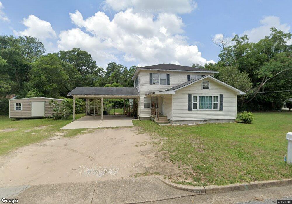
859 Kuffskie Ln Mobile, AL 36618
Beau Terra NeighborhoodEstimated Value: $190,000 - $252,000
4
Beds
3
Baths
2,184
Sq Ft
$105/Sq Ft
Est. Value
About This Home
This home is located at 859 Kuffskie Ln, Mobile, AL 36618 and is currently estimated at $229,953, approximately $105 per square foot. 859 Kuffskie Ln is a home located in Mobile County with nearby schools including Forest Hill Elementary School, CL Scarborough Middle School, and Mattie T Blount High School.
Ownership History
Date
Name
Owned For
Owner Type
Purchase Details
Closed on
Feb 12, 2019
Sold by
Us Bank Trust Na
Bought by
Reed Tameka
Current Estimated Value
Purchase Details
Closed on
Oct 5, 2017
Sold by
Wood Samuel L and Wood Carolyn R
Bought by
U S Bank Trust Na
Purchase Details
Closed on
Jun 30, 2006
Sold by
Gaines Floyd W and Gaines Amelia F
Bought by
Wood Samuel L and Wood Carolyn R
Home Financials for this Owner
Home Financials are based on the most recent Mortgage that was taken out on this home.
Original Mortgage
$90,100
Interest Rate
9.83%
Mortgage Type
Unknown
Create a Home Valuation Report for This Property
The Home Valuation Report is an in-depth analysis detailing your home's value as well as a comparison with similar homes in the area
Home Values in the Area
Average Home Value in this Area
Purchase History
| Date | Buyer | Sale Price | Title Company |
|---|---|---|---|
| Reed Tameka | $58,500 | None Available | |
| U S Bank Trust Na | $114,428 | None Available | |
| Wood Samuel L | -- | None Available |
Source: Public Records
Mortgage History
| Date | Status | Borrower | Loan Amount |
|---|---|---|---|
| Previous Owner | Wood Samuel L | $90,100 |
Source: Public Records
Tax History Compared to Growth
Tax History
| Year | Tax Paid | Tax Assessment Tax Assessment Total Assessment is a certain percentage of the fair market value that is determined by local assessors to be the total taxable value of land and additions on the property. | Land | Improvement |
|---|---|---|---|---|
| 2024 | -- | $16,910 | $2,500 | $14,410 |
| 2023 | $0 | $13,410 | $2,500 | $10,910 |
| 2022 | $0 | $13,250 | $2,500 | $10,750 |
| 2021 | $0 | $13,250 | $2,500 | $10,750 |
| 2020 | $58 | $13,260 | $2,500 | $10,760 |
| 2019 | $1,692 | $26,640 | $0 | $0 |
| 2018 | $0 | $12,720 | $0 | $0 |
| 2017 | $0 | $12,460 | $0 | $0 |
| 2016 | -- | $13,960 | $0 | $0 |
| 2013 | -- | $13,180 | $0 | $0 |
Source: Public Records
Map
Nearby Homes
- 1325 Carre Dr W
- 4409 Moffett Rd
- 1553 Phillips Ln
- 1617 Phillips Ln
- 4409 Eastview Dr
- 1557 Phillips Ln
- 1417 Pringle Dr
- 1758 La Pine Dr
- 1510 Northview Dr
- 1204 Forest Dell Rd
- 1800 La Pine Dr
- 4636 Saint Charles Ct
- 1113 Carre Dr W
- 4054 Pringle Dr
- 1413 Pine Grove Ave
- 1809 Harris Rd
- 1116 Bristol Ct
- 1166 Harvard Dr
- 1257 Belle Wood Dr W
- 4108 Chambord Ln
- 859 Kuffskie Ln
- 1515 Kuffskie Ln
- 855 Kuffskie Ln
- 4213 Buckingham Ave
- 1519 Kuffskie Ln
- 4218 Chesterfield Dr S
- 4209 Buckingham Ave
- 853 Kuffskie Ln
- 4212 Buckingham Ave
- 4216 Chesterfield Dr S
- 863 Kuffskie Ln
- 4205 Buckingham Ave
- 4208 Buckingham Ave
- 4300 Moffett Rd
- 1505 Tarreyton Dr
- 4213 Parliament Ave
- 1513 Chesterfield Dr E
- 4204 Buckingham Ave
- 4320 Moffett Rd
- 4310 Moffett Rd